Just a little map I drew based on my towpath amenities routing fun, click to check it out…
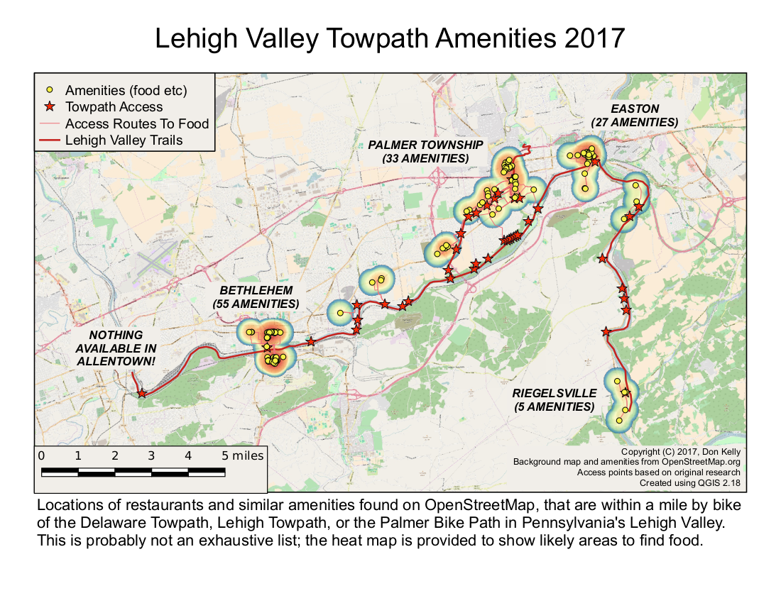
This is a map I made using the QGIS cartography module from my latest results; it took me probably about 20 minutes to lay it out (though the work to generate the results took a bit longer than that). Basically, I figured out the other day how to make a virtual layer, which let me do an inner join on the amenities with respect to the routing data, so now I don’t have any amenities shown except the ones that can be reached by bike. From there I added the heatmap, then made this layout. Pretty nifty, eh?
One thing caught my eye though: I was looking at my amenities, and noticed I had no hotels, which would be an important amenity to any serious bicycle tourist on the towpath. (In my toy problem, a reasonably strong rider could probably ride all the trails I show and be back before dark, but suppose the D&L is completed, from near Bristol to Mountaintop: multi-day trips could become common if there were places to stay.) My input data is incomplete, I must get more bicycle-tourist amenities, which should include both places to stay (hotels and motels, campsites, bed-and-breakfast places) and useful shops, such as supermarkets and, most importantly, bike shops.
Shops and hotels were not caught by my original Open Streetmap data collection, because I only downloaded features containing the key “amenity=whatever”, then selected food-related items within that data set, and these other amenities are not labeled as “amenities” in the OSM database — if I want motels and hotels, I’ll have to search under the “tourism” key, and for food markets I’ll have to do a search for “shop=grocery|supermarket|whatever”. (It may also be a a good idea to use different distance criteria, like any bike shop within five miles if it’s a mechanical emergency say, or hotels within two.)
The map is good enough for now though, as a proof of concept.
