We spent a big chunk of the last week preparing, cleaning etc, and on Saturday we had a Labor Day BBQ with Anne’s family: siblings and their kids (and their kids), Ben, Anne’s mom, and even her Uncle Joe. We fired up the oven and made pizza, had burgers and hot dogs, and corn on the cob and all kinds of summer salads. All in all a perfect way to end the summer.
Sunday was recovery day: Ben had stayed over, and he and we cleaned the yard, and the kitchen, and made a nice (huge) breakfast. We hung out until mid afternoon, when we drove him home to Philly and checked out his new apartment. (We took Kelly Drive, which meant we drove right past one of the locations I’ve been studying recently, where there was a river crossing on the Schuylkill at the end of what is now Ferry Street, part of the native path between Philly and Harrisburg.) When we got home we visited with our neighbors Matt and Diet, and Matt’s dad who was in town for a few days.
Yesterday was a CAT group ride down Cherry Valley, sort of the “second half” of our Blue Mountain ride the week before. It’s also one of the Road Scholar routes, so I invited my boss and co-ride-leader Andrea along, and some people from the D&L were there as well — one person at least, and some of her friends — it was a pretty nice crowd. We rode from outside Wind Gap to lunch at the Apple Pie Store in Delaware Water Gap, then retraced our steps back to the cars. Not a bad ride, about 26 miles in all, and we finished just before the rain started…
It’s been raining ever since, a nice mild soaking rain, something we really need right now. Today I’m just hanging out, doing some more post-party straightening and getting ready for cello duets with my friend Donna.
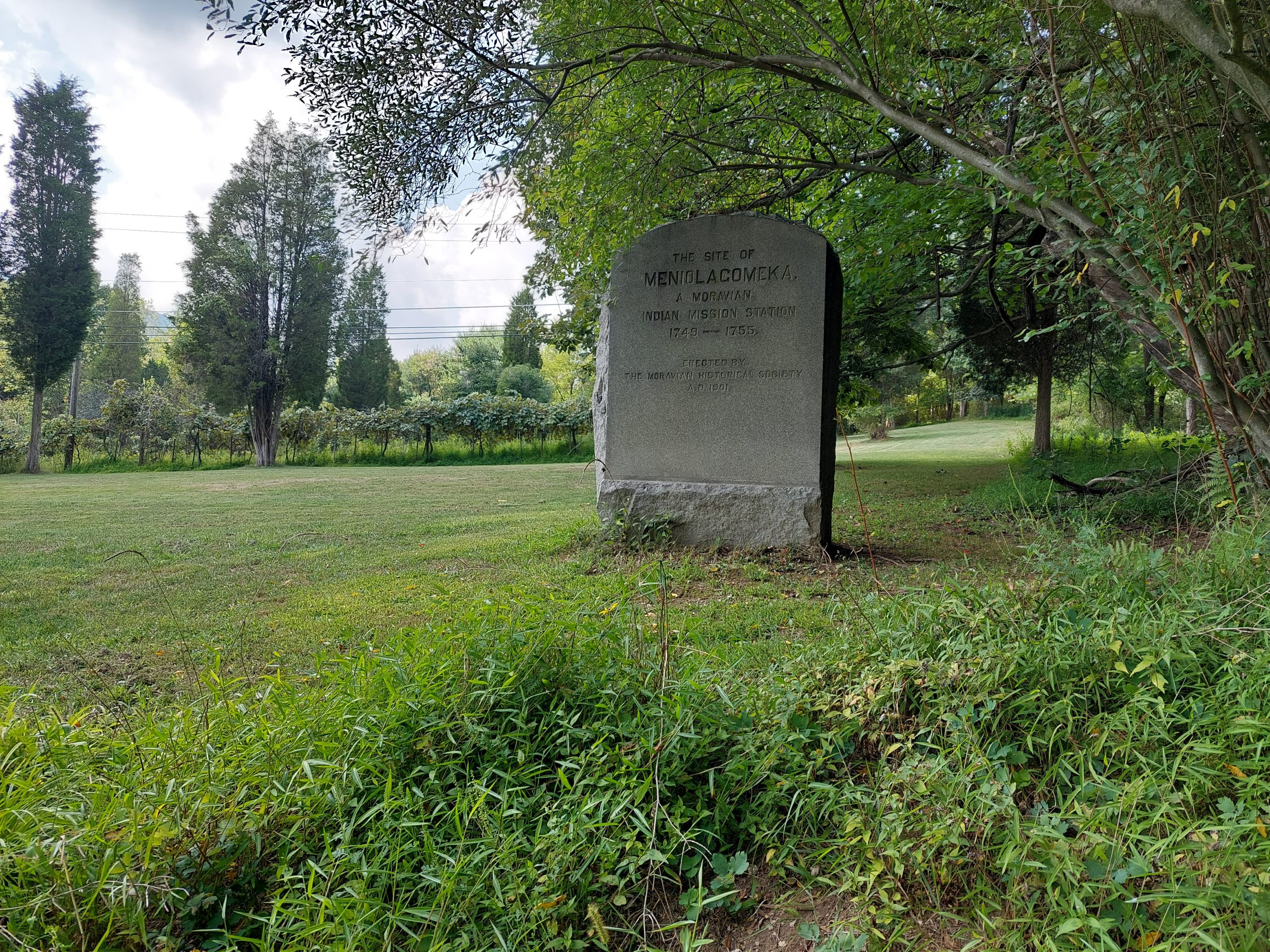
Meniolagomeka (“fat land in the midst of scarcity”) was a small Lenape village near what is now Kunkletown, on the banks of the Aquashikola Creek just north of Blue Mountain at Smith’s Gap. The Moravians had converted many in the village, and eventually founded a mission station there, but some time after the Walking Purchase the natives were evicted by the colonial authorities, and the Moravians relocated them to Gnadenhuetten (Lehighton). The actual location was pretty much forgotten for a century, until the Moravian Historical Society rediscovered it and put up this memorial marker.
The village is not far off the route of one of the more iconic local bike rides — among my crowd anyway; it’s part of the old Gap Gallop century ride, crossing Blue Mountain at Little Gap and returning via Wind Gap a dozen or so miles further down the ridge — but I had no idea anything like this was here until recently. After the week of kitchen disasters we just had, Anne and I both needed a big ride, so even though the Blue Mountain route doesn’t really follow many native paths, and the Meniolagomeka site does not figure prominently in my Native Paths project, I thought it would be neat to do the ride, and make an effort to find the old memorial stone.
So that was the ride we did on Friday, with our friend Dwight H.
Our ride took us up Township Line Road, through Bath and Moore Township, and out to Danielsville via the little roads that run south of the mountain. Blue Mountain Drive was being repaved and was down to one lane the whole way to the top, but the construction guys gave us some traffic assistance (and an audience) for the climb. We regrouped at the top, then bombed down the hill, past the ski resort and made the right onto Smith Gap Road.
The memorial is on a road called Chestnut Ridge Road, a turn off Smith Gap Road (and pretty much at Smith Gap). We turned off our route, spent some time admiring Aquashikola Creek, and then rode a few hundred yards up the hill and found the stone — it was at the edge of a field, on what looked like private property but close to and easily visible from the road. We stopped, took some pictures and paid our respects, and then continued on our way. (We heard thunder so we weren’t sticking around.)
The rest of the ride was pretty uneventful, though we did get caught in a storm cell (a little cold rain actually felt good), and we also stopped at the “Snoopy Barn,” where Dwight took a few selfies. All told, we got in about 67 miles in just over seven hours. (I took about a mile off the beginning and end of the ride on my map, to preserve some privacy.)
Just a few things that have come and gone in the past week:
I finished the final book in the “Expanse” series, Leviathian Falls. I was pretty sure I knew the ending just from the title (and I was mostly right), but I still had a great time reading it. There’s plenty that can still be written in the universe of “The Expanse,” but the writers made a real point of bringing the book series to a definitive conclusion — there is no “the end …or is it?” for this one. No spoilers!
I finished Phase One of my native paths project: all the path descriptions, all the start and end points, and all the road routes approximating the paths are in the database. (There are a few more paths listed in appendices in the Indian Paths book, but they are part of colonial history. I may expand the project to add them at some other time, but they’re not really part of what I’m doing right now.) This all happened more quickly than I was expecting, so I’ve been caught a bit flat-footed when it comes to Phase Two. I am now looking at raster storage for the map photographs, and studying the first route in the book, to start adding its foot path.
Our Alberta trip is really over now, I just posted my last post about our trip.
Our fridge is up and running, and the parts are now here to get the ice maker fixed. The kitchen is (mostly) clean and back to normal, though we’re cleaning some of our other cabinets in an excess of anti-wheat-moth caution.
Today is a cleaning day (again). I’ll probably get in a long ride tomorrow.
This is the thirteenth (and last) in a series of posts about our bicycling trip from Jasper to Canmore, via the Icefields and Bow Valley Parkways, through Jasper and Banff National Parks in Alberta, Canada. The full series can be found here.
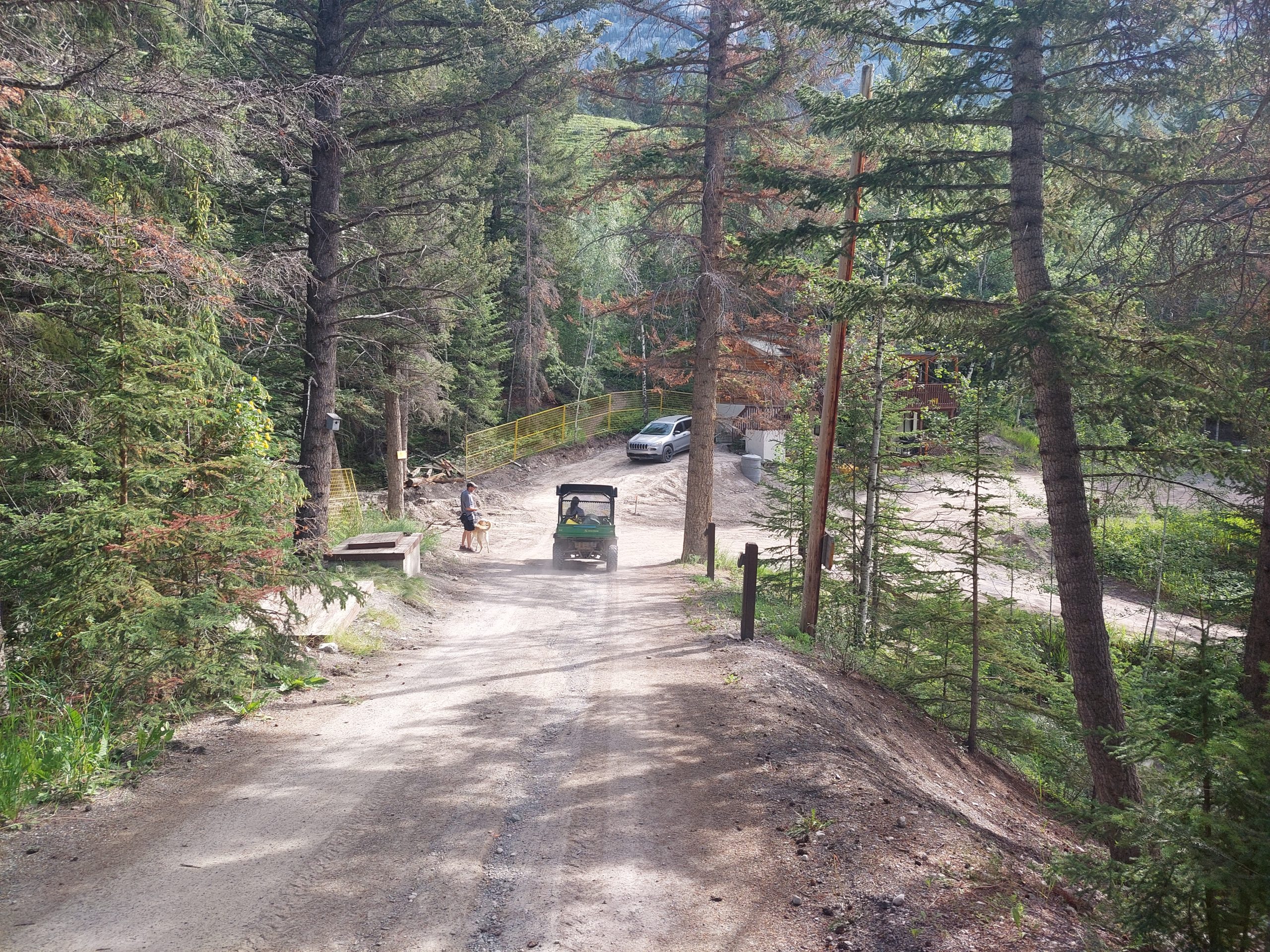
We stayed at the hostel again for our last night in Canmore. By this time I felt like an old hand, a hostel regular… In the morning we packed up and, since the driveway was under construction (thus inaccessible to taxis), we got a lift down the hill in the little hostel vehicle, or at least our bags did.
Our Luggage Goes Down The Hill
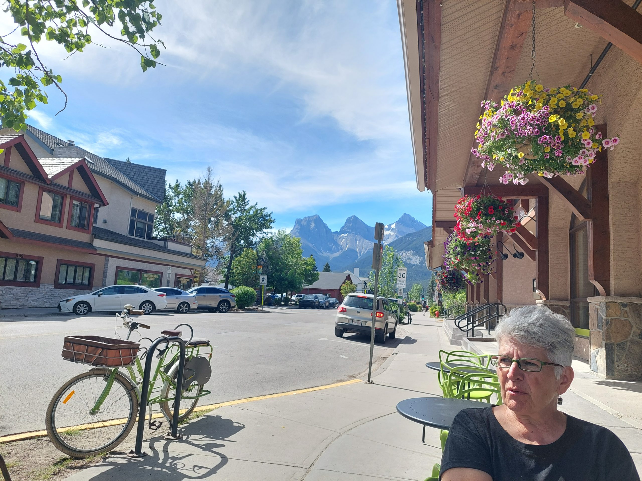
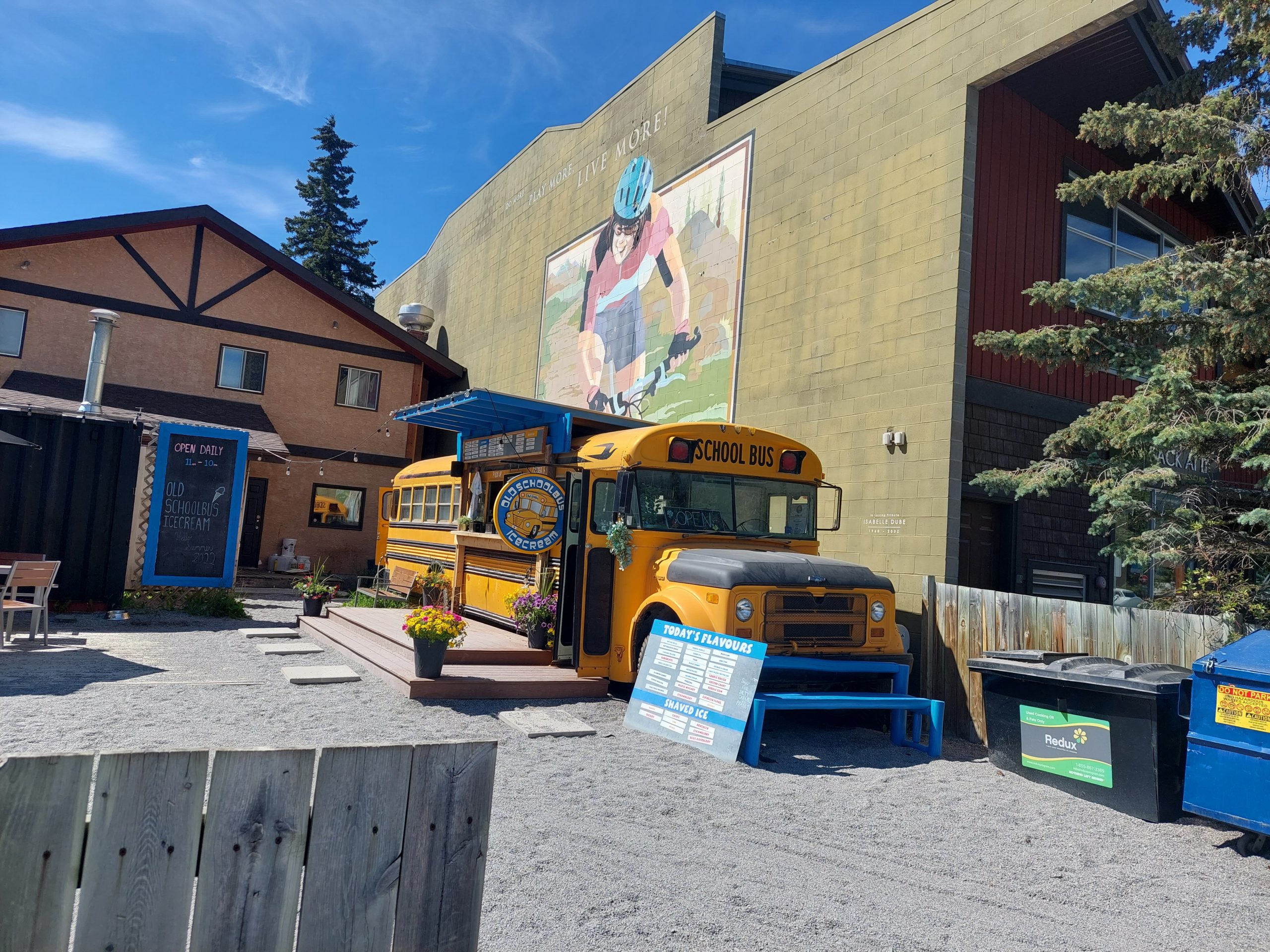
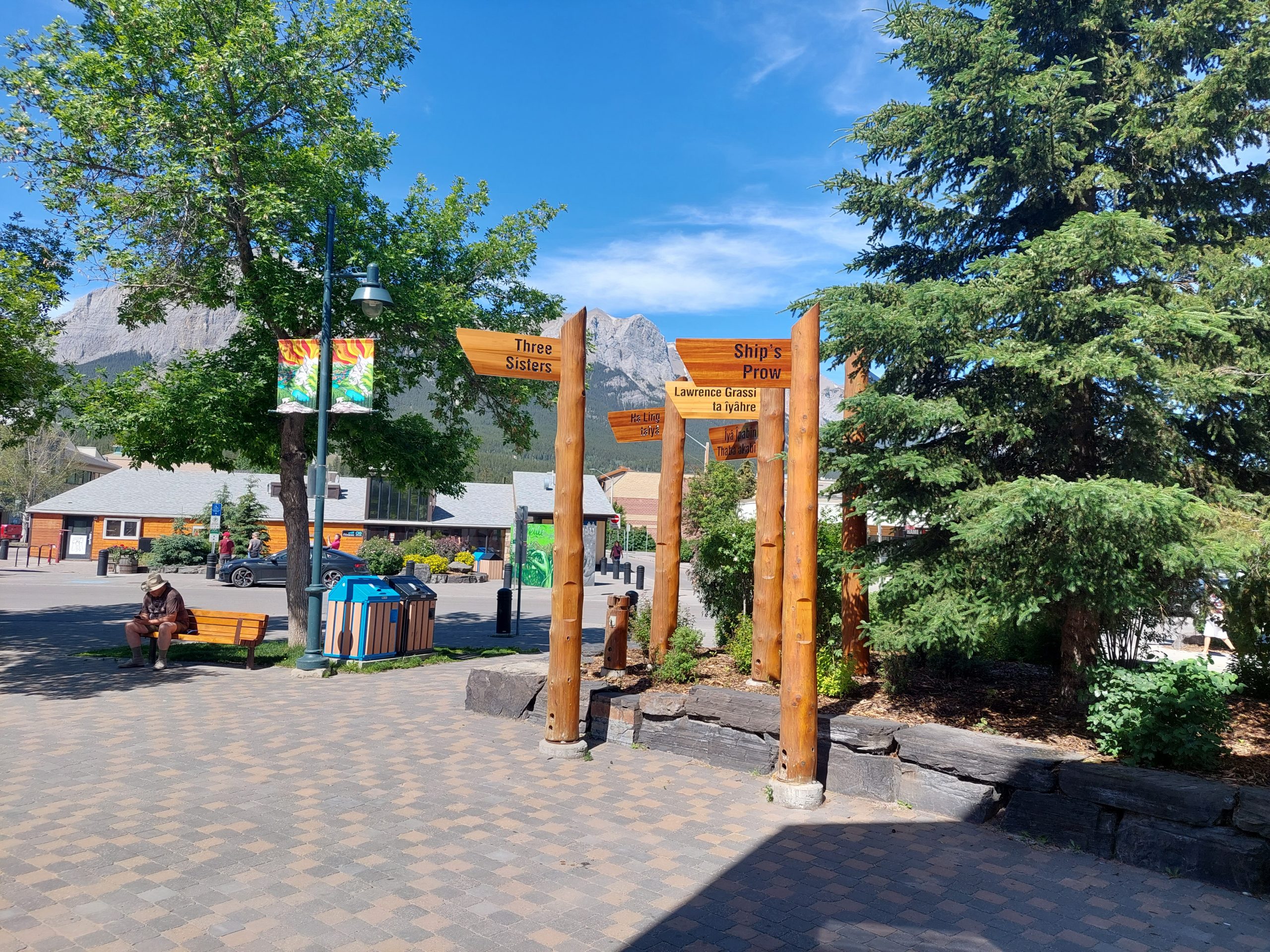
At the bottom of the hill we found that no taxis were available anyway, but we got a lift from yet another kind stranger with a pickup truck. Our benefactor dropped us off at the bike shop, where our bikes had been boxed and where they let us stash our bags for a few hours while we waited for the shuttle. We got one last walk around town before we left.
Three Sisters And AnneThe Ice Cream BusCanmore DowntownNon-Glacial Stream
The bike store owner got us to the shuttle stop, the shuttle got us to the Calgary Airport, and the hotel shuttle (barely) got us to the hotel — barely, because their big vehicle was in for service, and we could hardly fit with all our stuff into the minivan they showed up with.
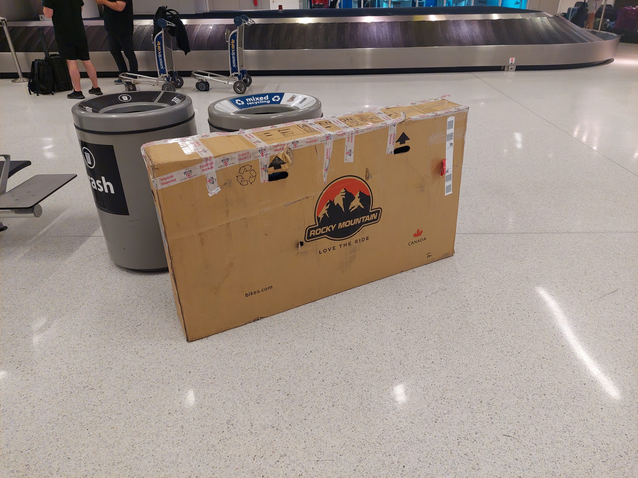
The hotel was busy, because everything was busy with the Calgary Stampede in town (it’s the biggest rodeo in North America), but even so, it was an airport hotel in the middle of nowhere, and there wasn’t much going on. A short walk to a nearby brewpub, and an early night, and an early morning flight for me (Anne’s flight would be the following day). Once again, the flight had some difficulties and delays, but the bike and I both made it to JFK in one piece.
Bike Back On The Ground
Julie picked me up from the airport, and let me know about the cell phone lot where she’d waited for my flight to arrive. This came in handy the next day, when I drove to JFK and picked Anne up…
…and then we were home. We took a few days to rebuild the bikes, clean and stow our gear, and get rid of those bike boxes, but now it’s in the past. All in all, this was one of the best trips we’ve ever done, “ten out of ten, would do again,” in a heartbeat. I really enjoyed reminiscing, I hope you all enjoyed following along!
This is the twelfth in a series of posts about our bicycling trip from Jasper to Canmore, via the Icefields and Bow Valley Parkways, through Jasper and Banff National Parks in Alberta, Canada. The full series can be found here.
Friday: A Goodbye To Julie
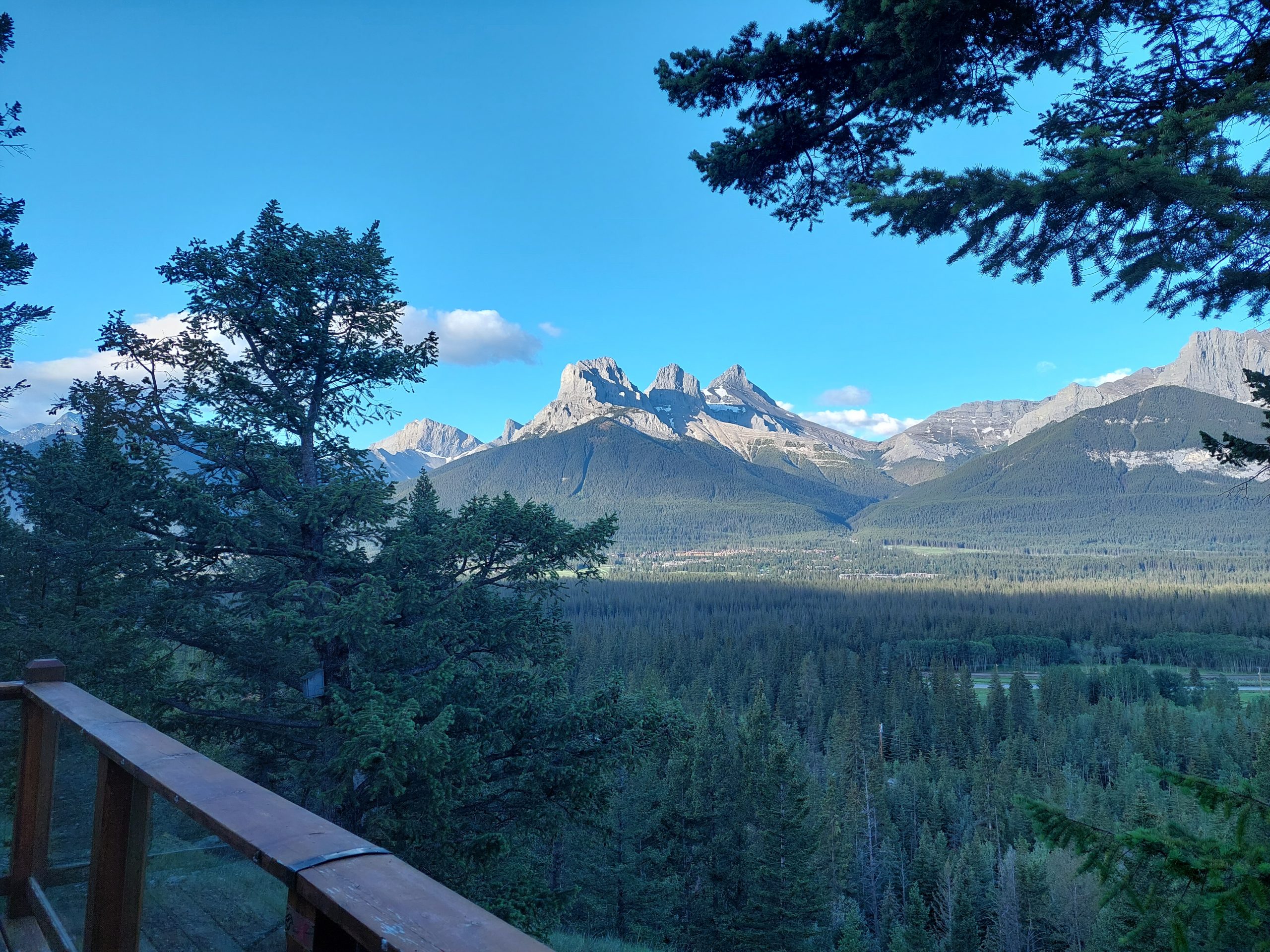
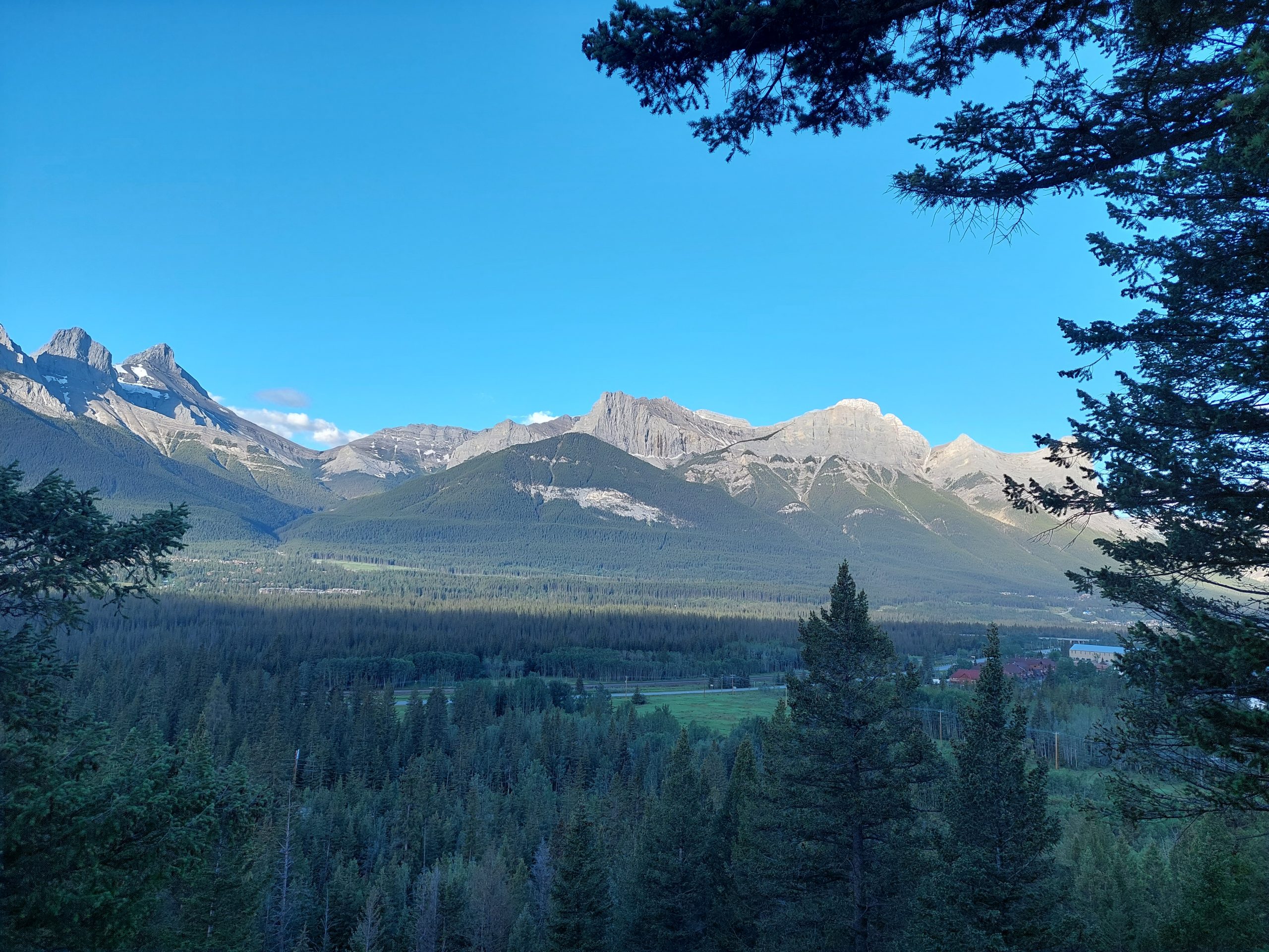
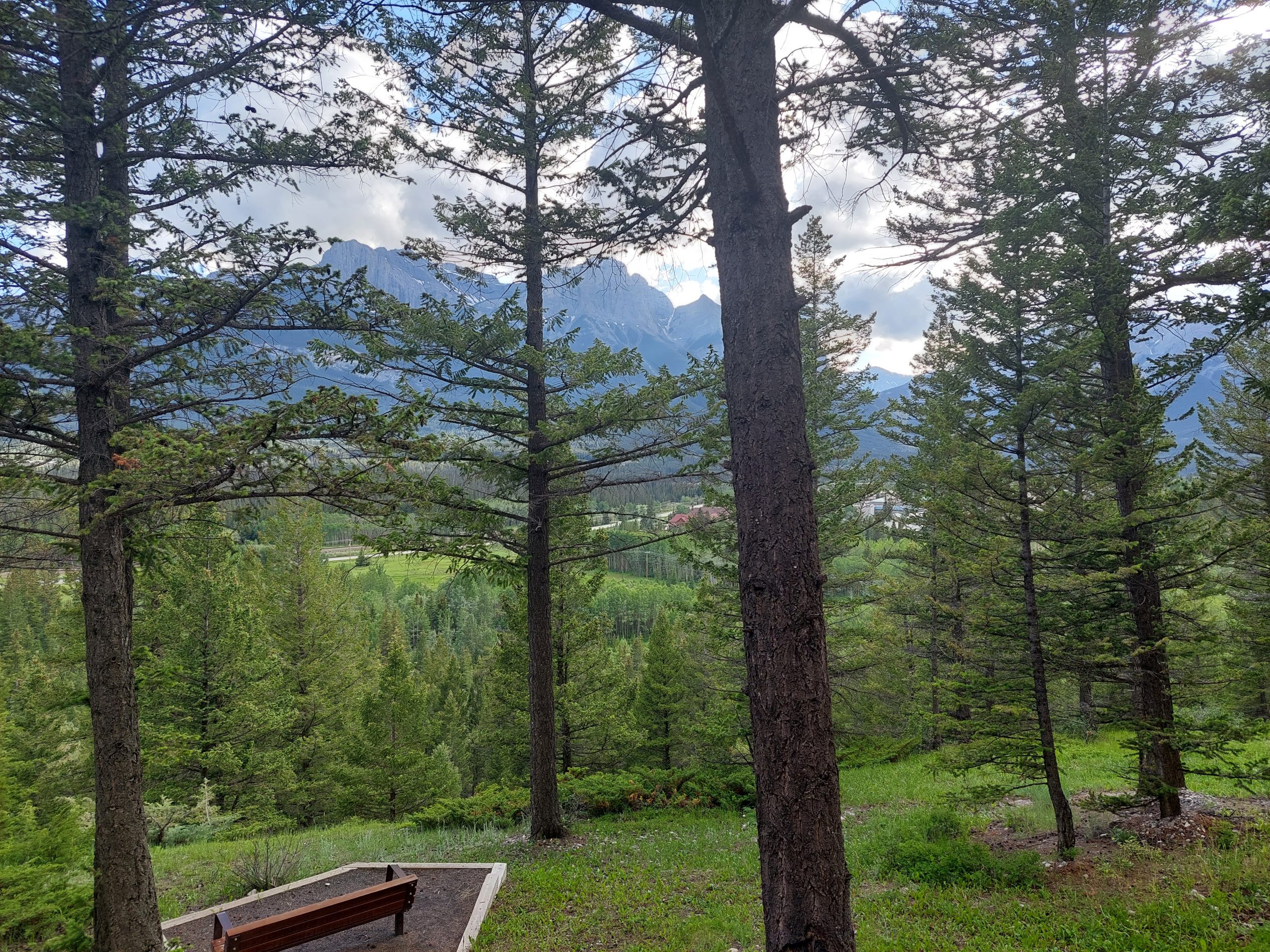
Canmore was the end of the line for our bike tour. Anne and I had plans to stay a few days in town, but Julie would be heading home. We all stayed that first/last night at the Alpine Club hostel, which was beautiful, and which we (Anne and I) would return to later in the week. Some photos I took while I was drinking my morning coffee:
The Three SistersThe View From The Porch
That first photo is a shot of the iconic Three Sisters, and I’m pretty sure that’s Mount Rundle on the right in the second shot.
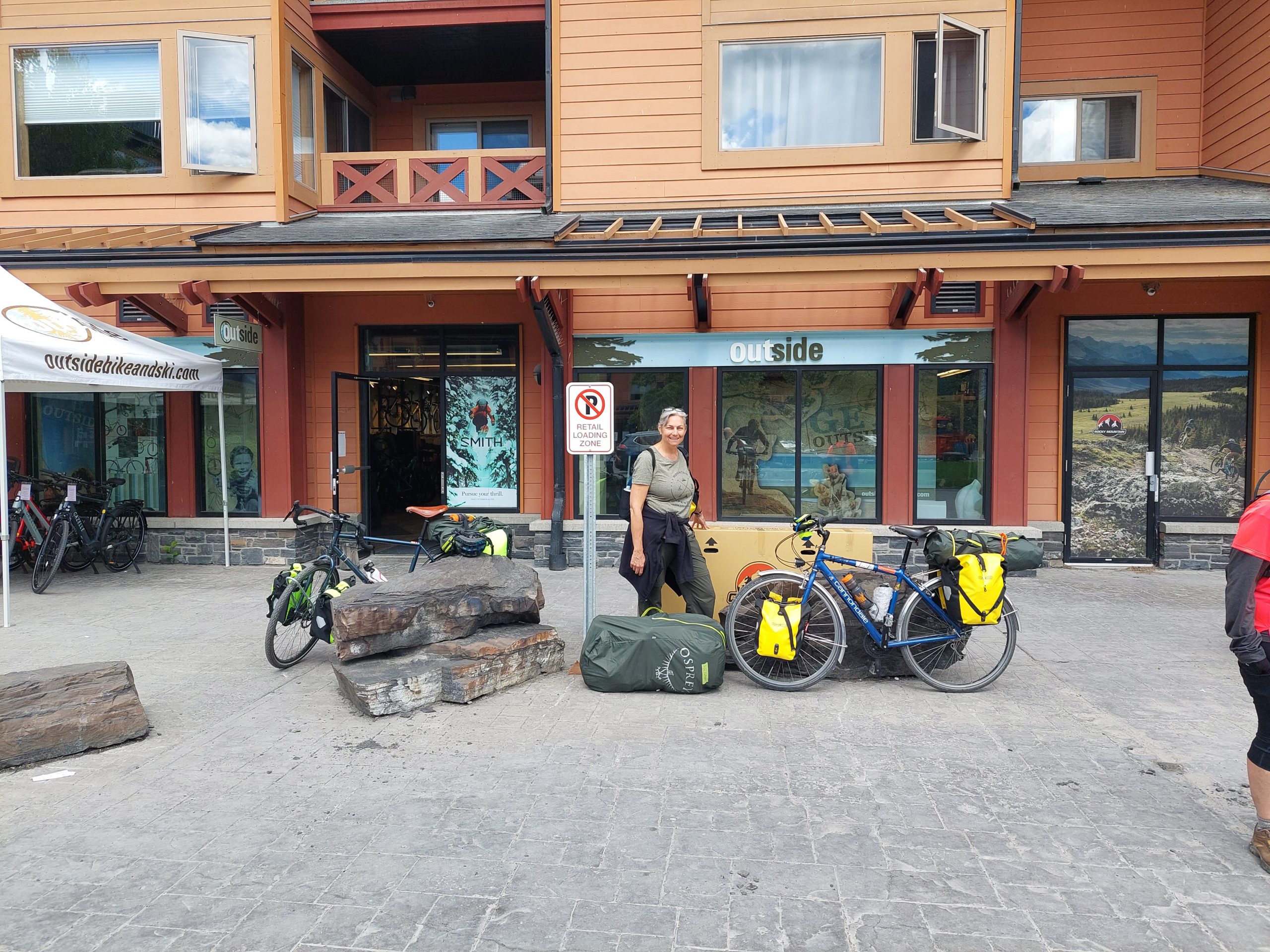
Unfortunately, this was the end of our travel fellowship — Julie would be taking the shuttle from Canmore to Calgary, where she would catch her flight back home. Here she is with her bike boxed up and her bag packed, waiting for her ride to the shuttle pickup:
Goodbye Julie
Julie had to make her way (with all her stuff) from the bike shop to the shuttle pickup a mile away, but luckily Lyle (our Warm Showers host) had a pickup truck and offered to give her a lift, even though they weren’t expecting to have to host us until around 5:00. This was our first contact with Lyle, and the first but not the last time we got to experience his decency and hospitality.
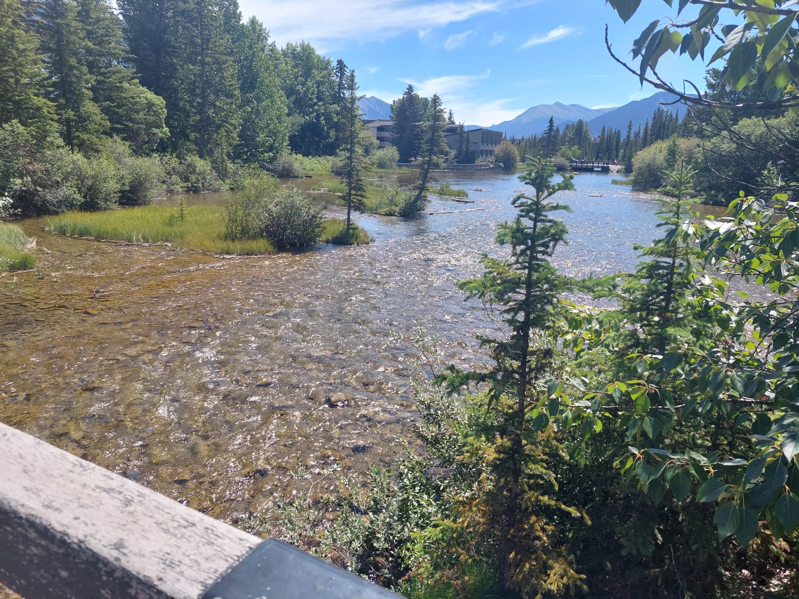
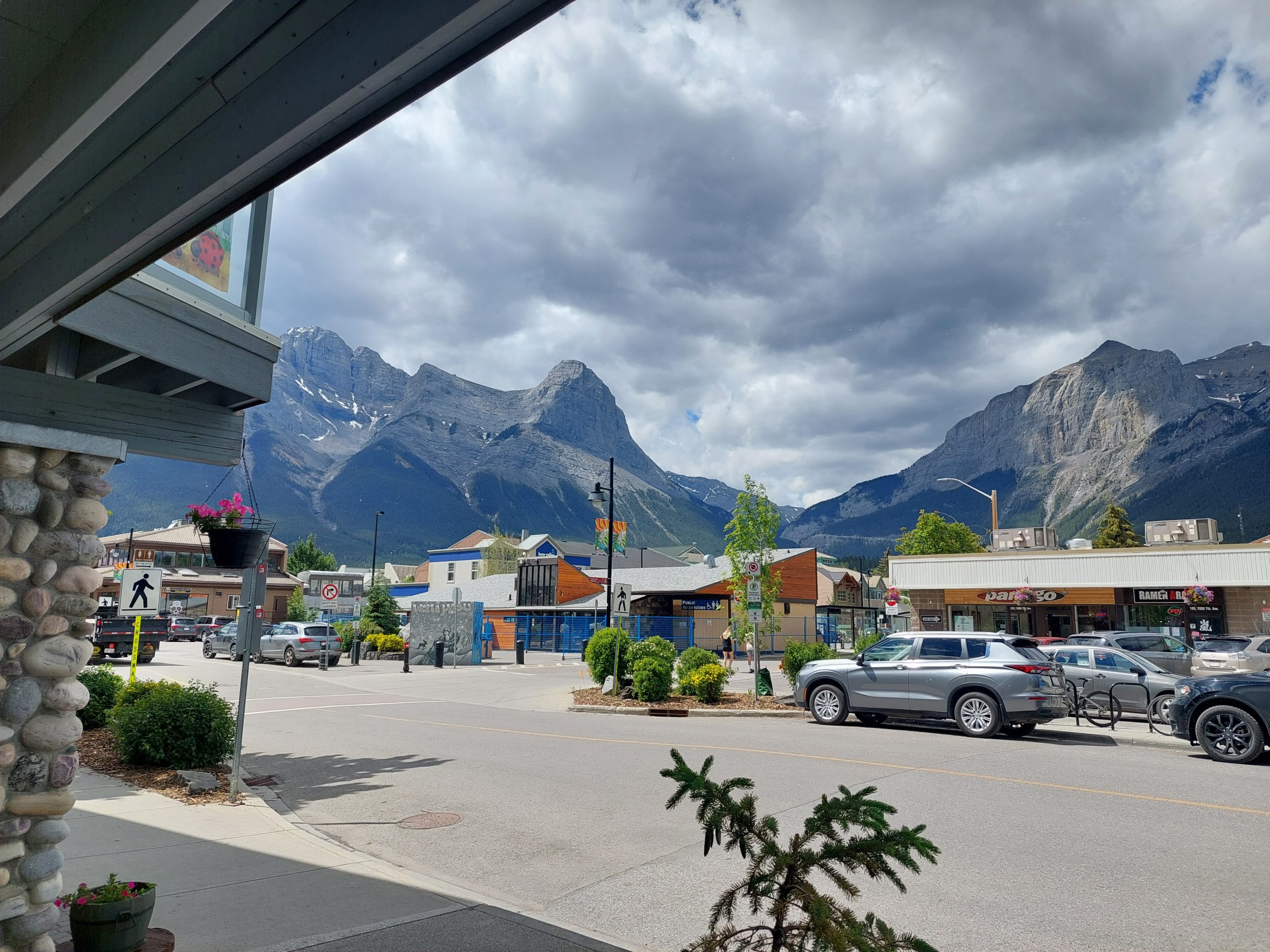
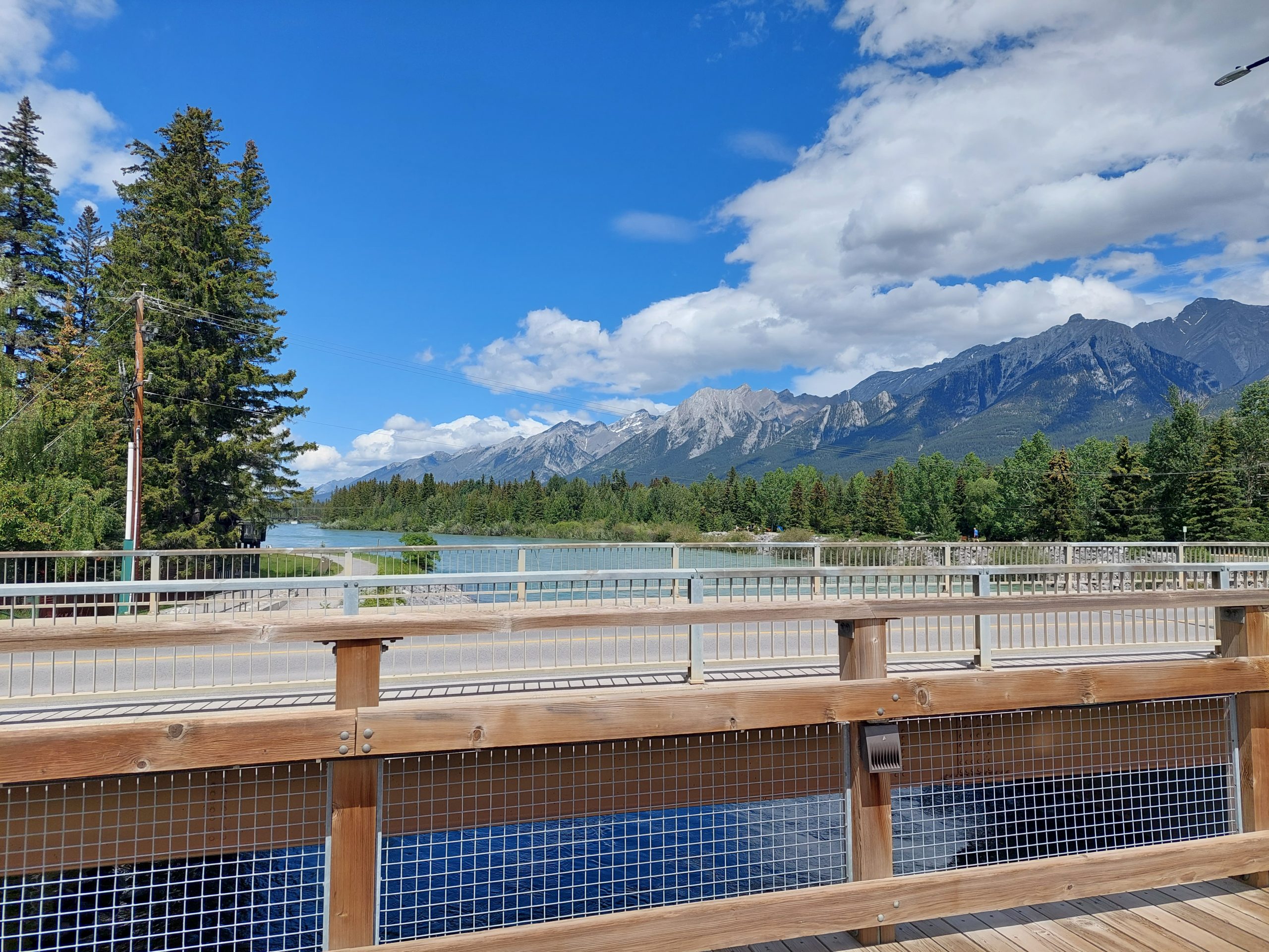
We would be staying for the next several days in Lyle and Kirsten’s home. Our plan was to arrive sometime early evening so we wouldn’t be in their hair all day, and so Anne and I did some more shopping and explored the town.
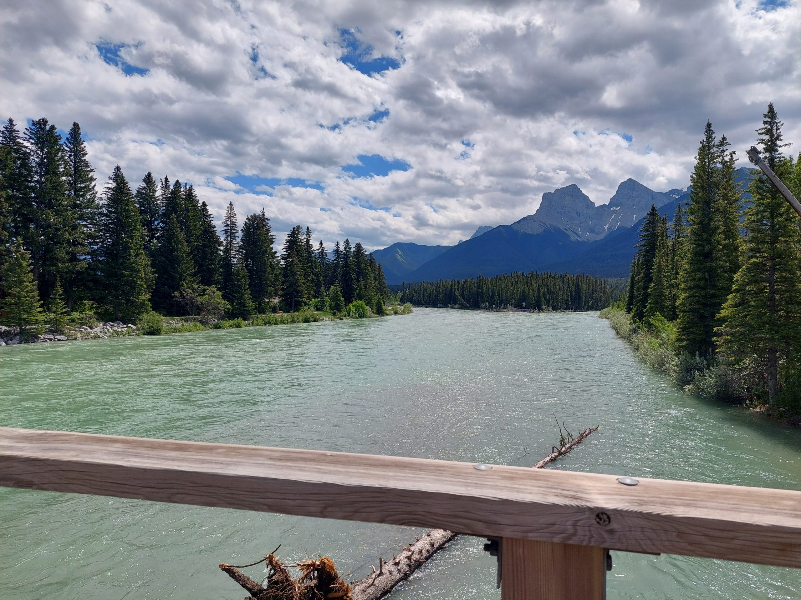
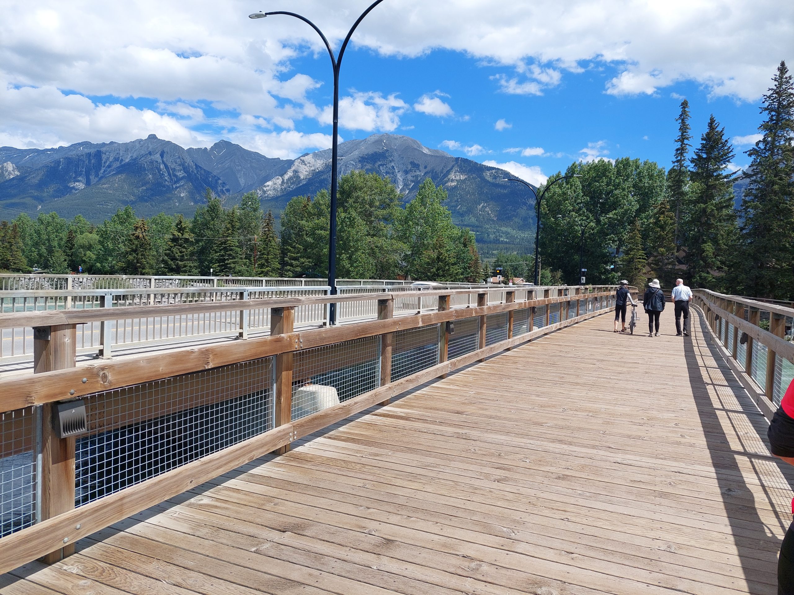
Mountains From TownBow River Looking NorthBow River Looking SouthPedestrian Bridge
We arrived at their home just around dinnertime, and found that they gave us their entire upstairs to use — it was almost a suite, complete with an incredible shower in the bathroom, almost like a cross between a rainforest and a steam bath. They made an incredible dinner, and we all hung out and got acquainted, chatting and comparing notes about biking and other sports, family, and former jobs (we were all retired). They were a very interesting couple. Lyle had been an engineer, but I think he played the game at a higher level than I did, and he’d had postings all over the world. They’d lived in Scotland, Germany, and Vietnam as well as Calgary. He was also a car enthusiast, and something of a gadgeteer, especially when it came to cooking: espresso machine, grill and smoker, sous vide cooker…
Saturday: The Hike
We woke up on Saturday, looking for something to do for the day, and our hosts suggested a hike. They had one particular hike in mind, one they liked but the trailhead was not nearby, so they offered use of their car to get there — their Porsche SUV. (They really did treat us like royalty.) Driving a Porsche sounds like fun, but I was terrified of damaging it, and the road to the trailhead turned out to be a twisty, unpaved mountain road, complete with mountain goats wandering around and licking up salt from the road…
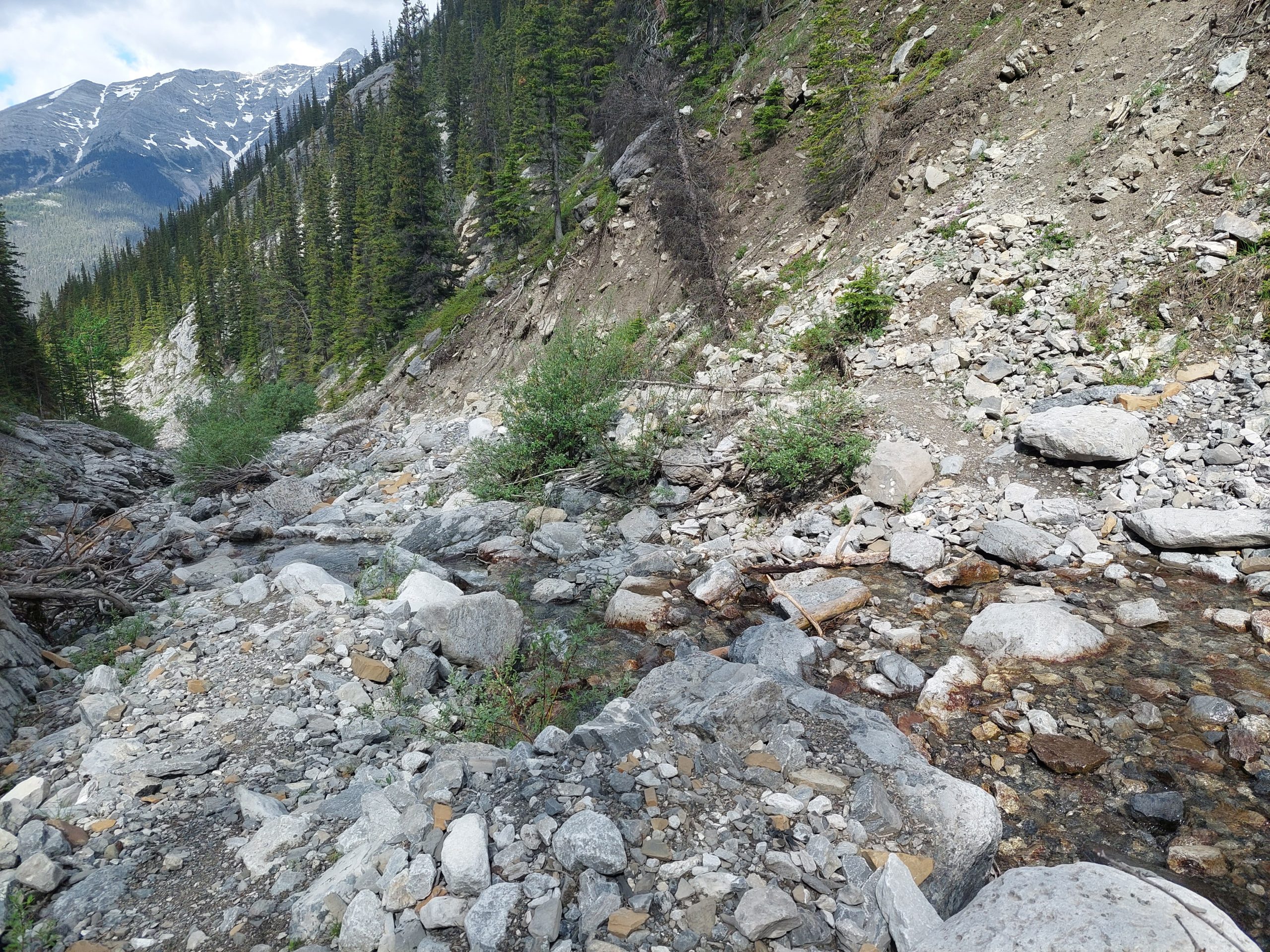
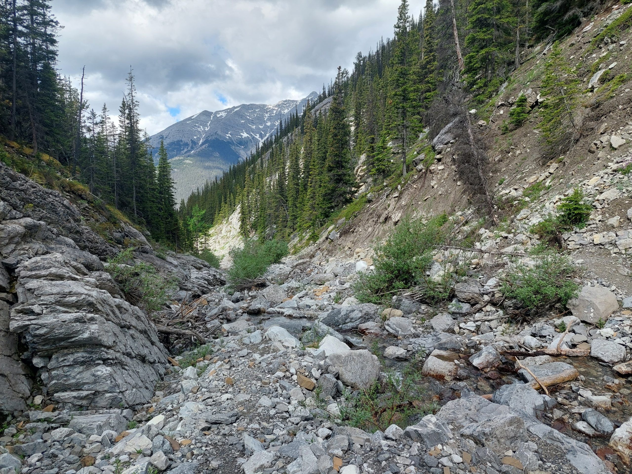
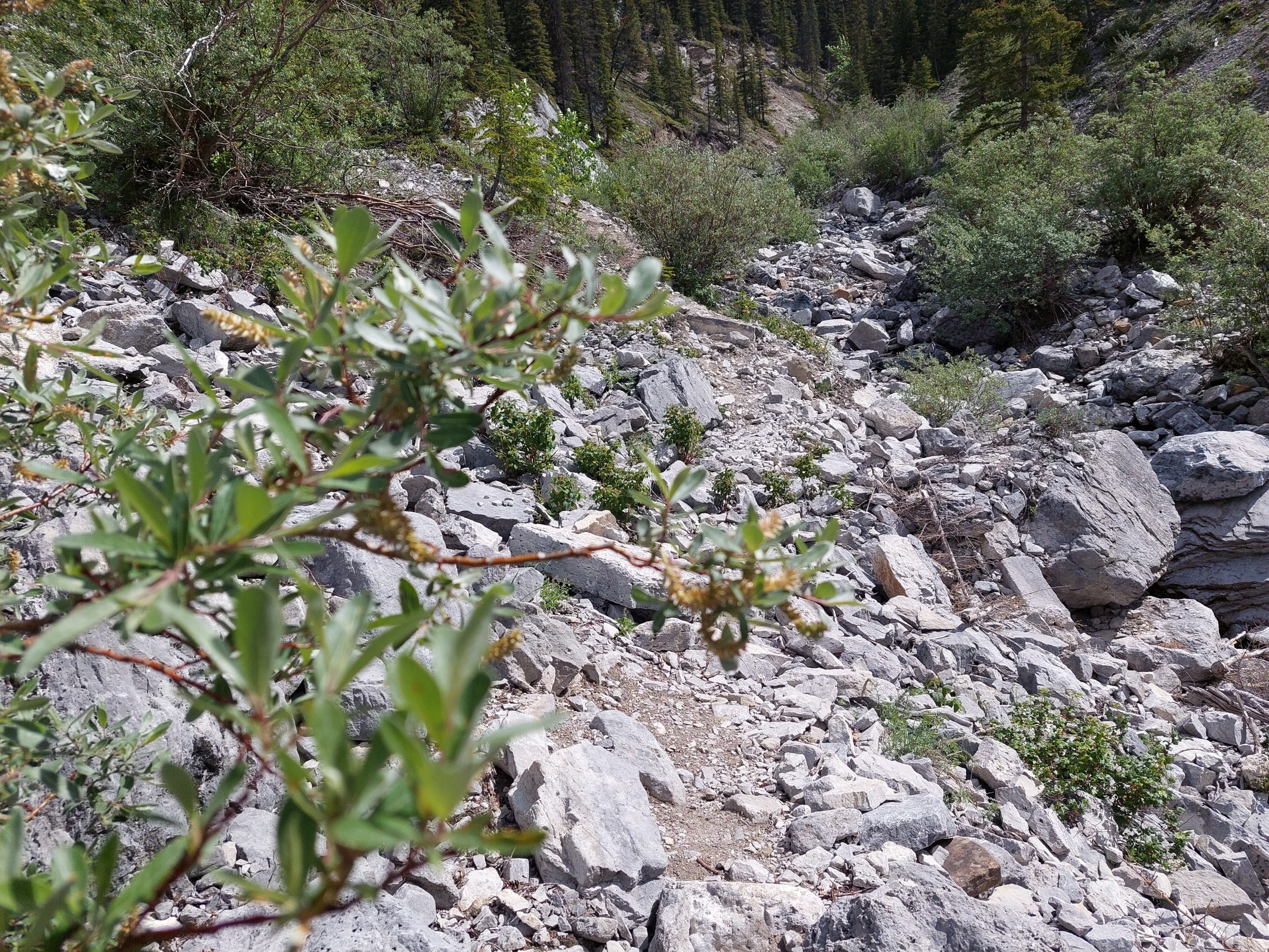
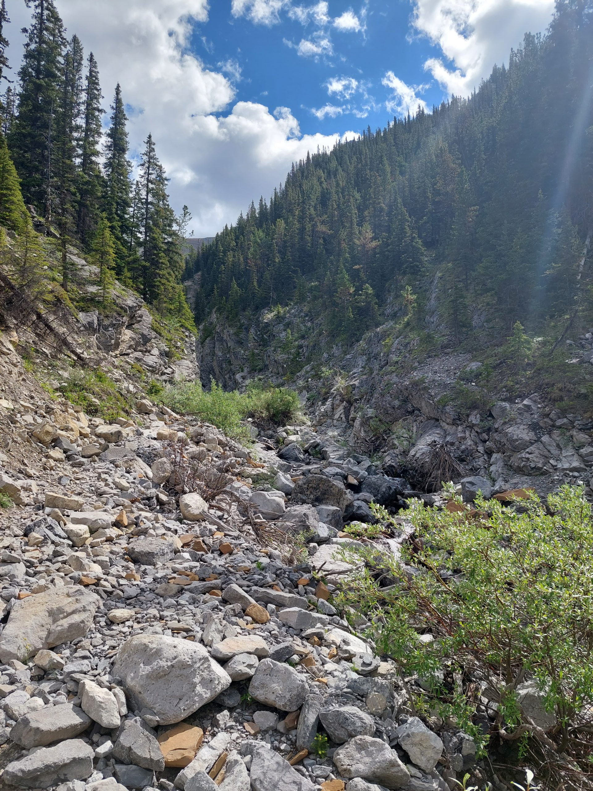
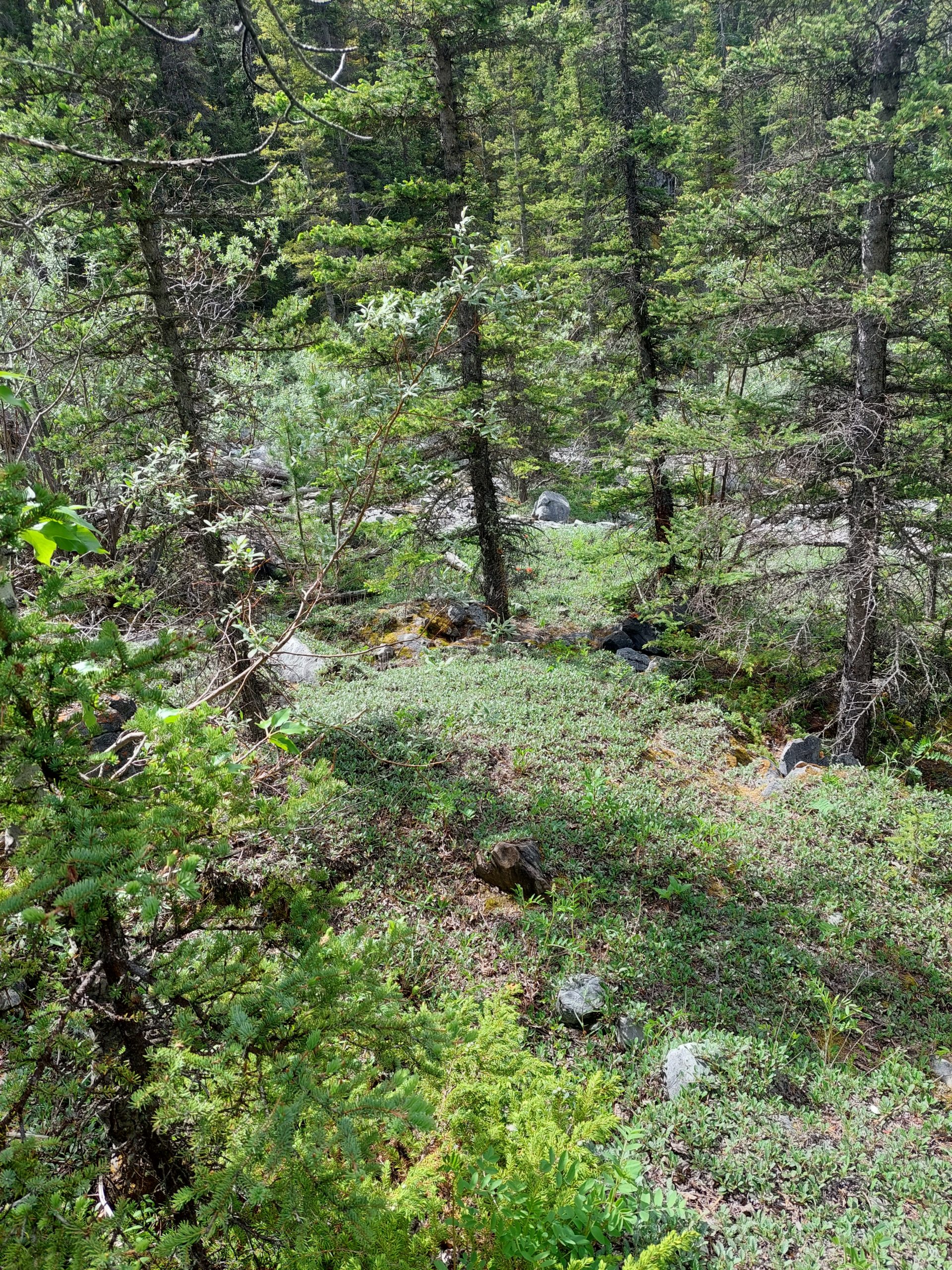
Well we made it to the trailhead without incident and started up the hill, though we weren’t 100% sure we were on the trail a lot of the time. I didn’t have my GPS and we had no topo map; all we had to show is the way was a guidebook page on my phone that I’d photographed earlier. The trail, or what we supposed was the trail, was more rugged than we expected, so we turned around before reaching the top. Oh well, but what we did of the hike was well worth it.
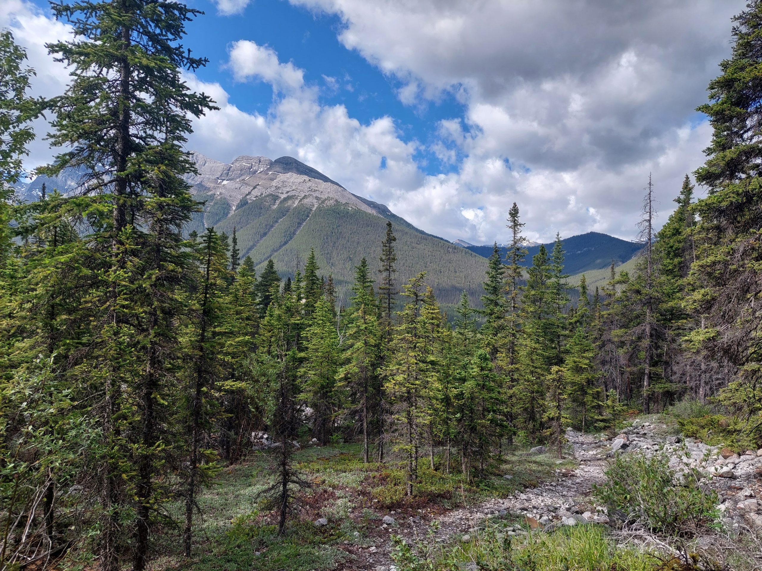
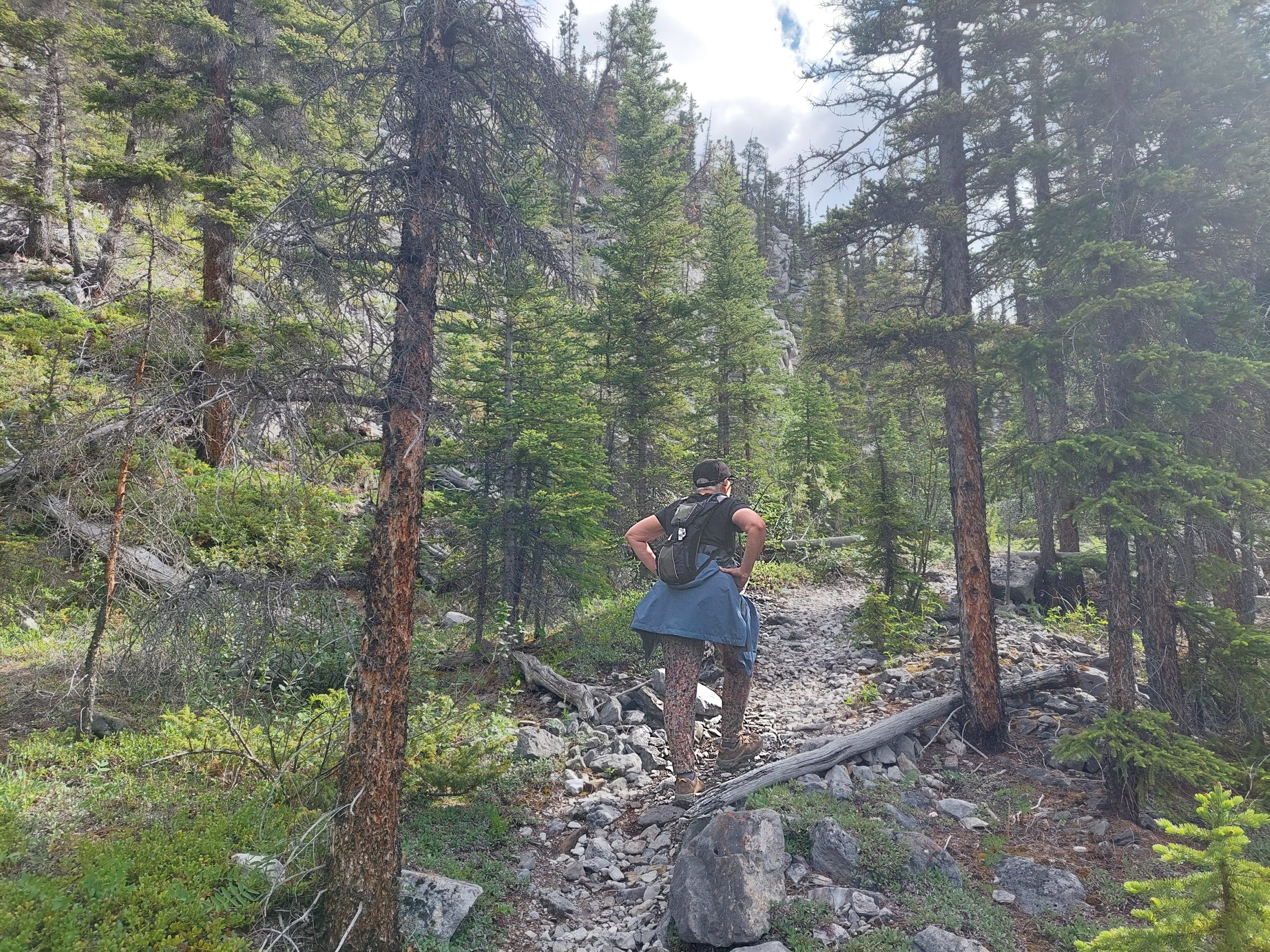
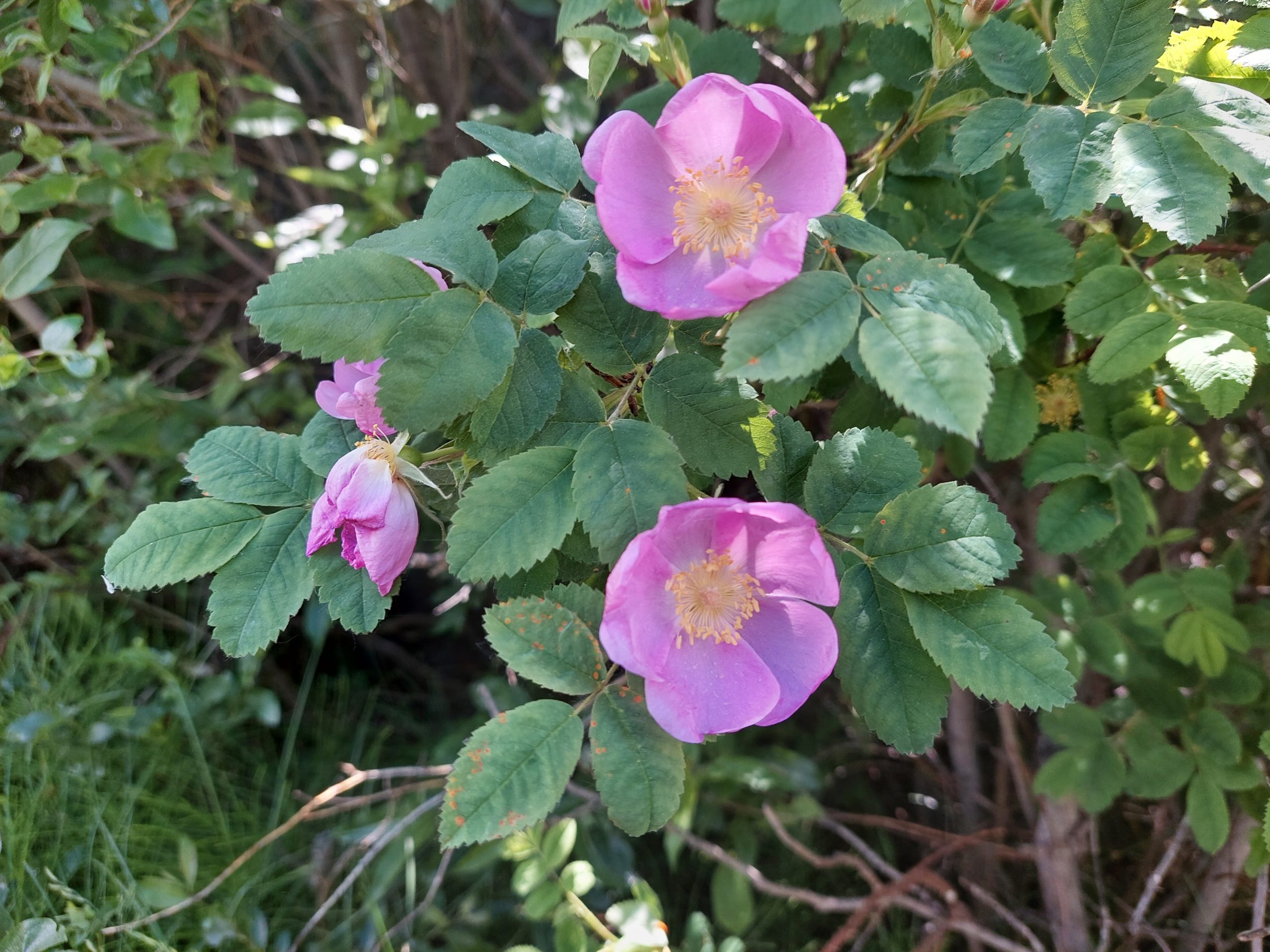
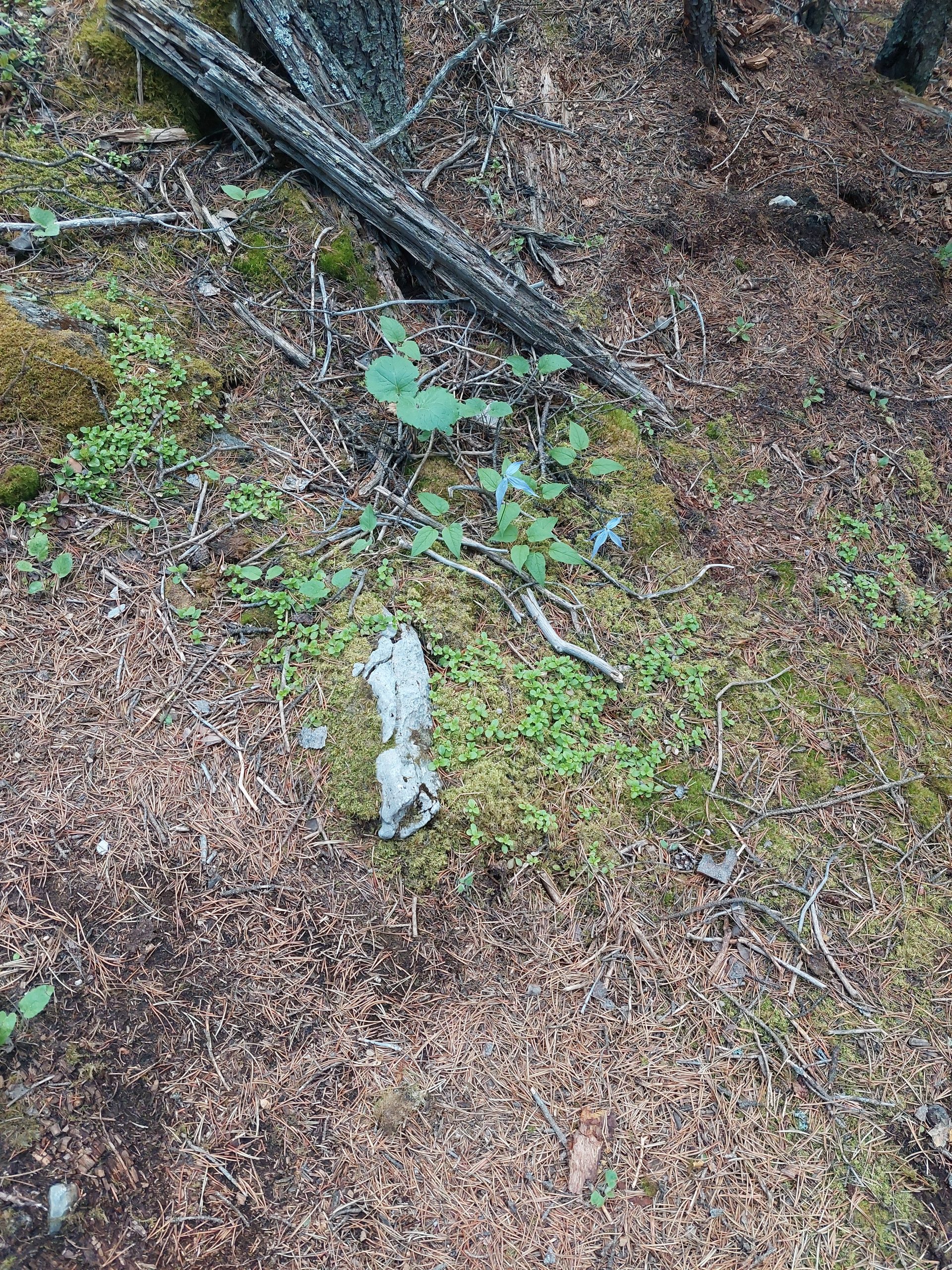
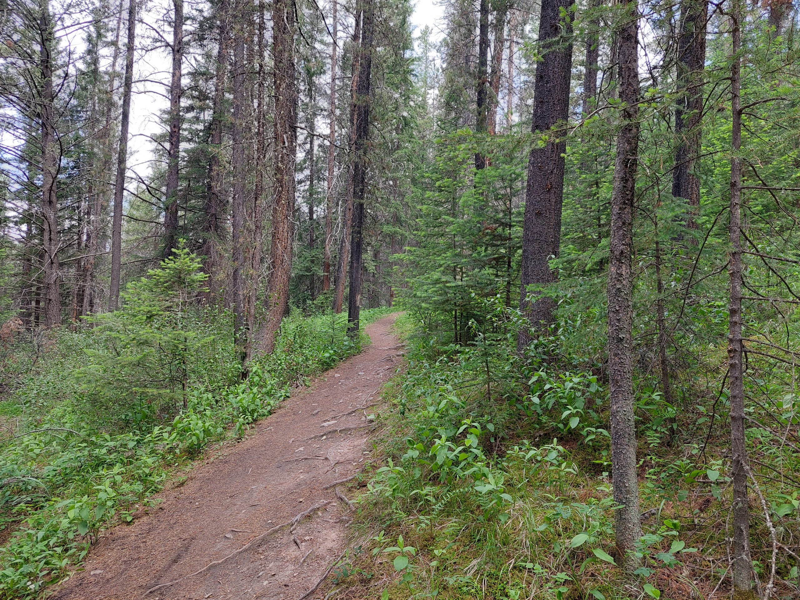
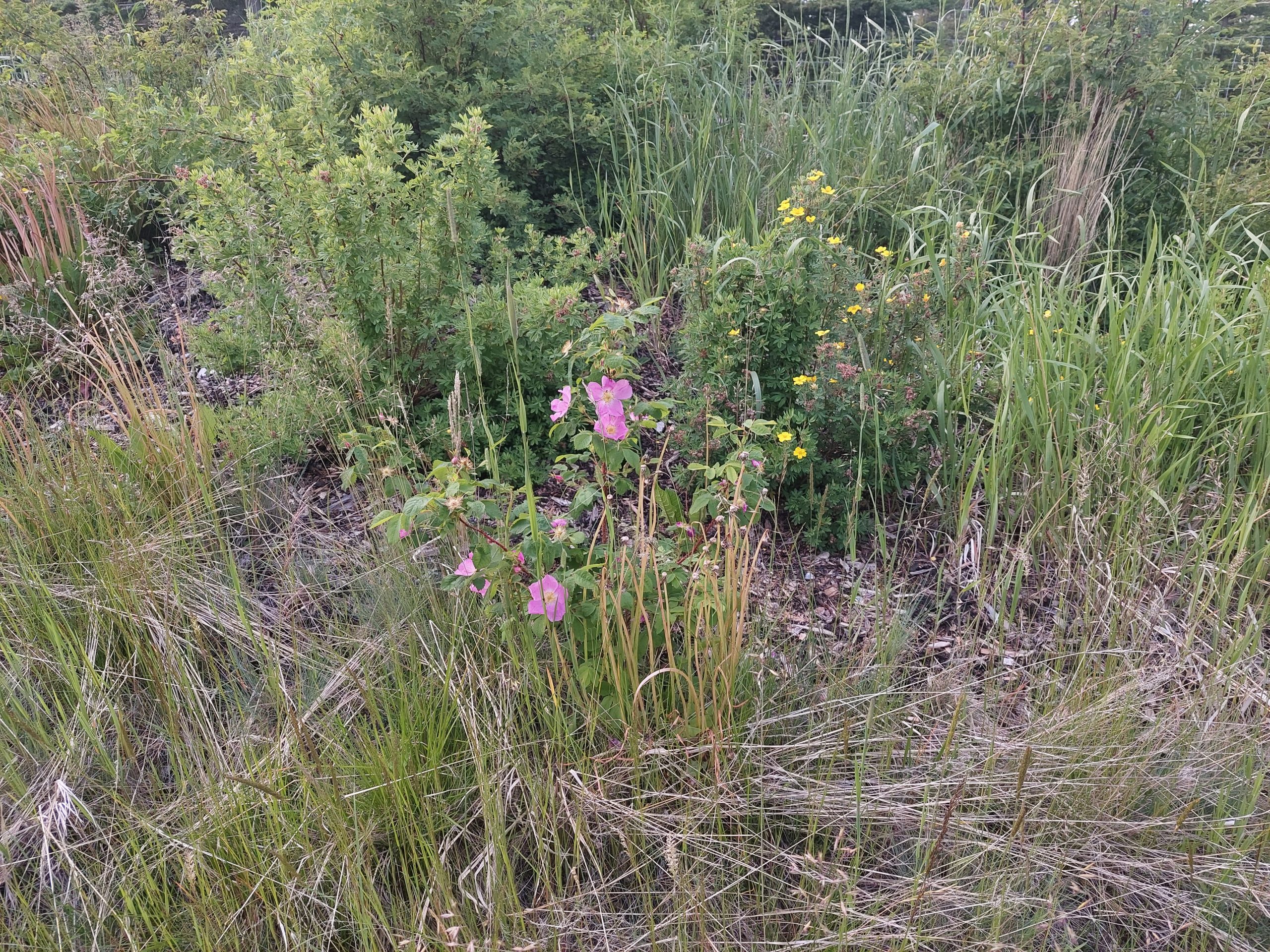
For those following along at home, the trail we attempted was the Three Sisters Pass Trail. Some photos:
TrailheadAnne On The TrailWhere We Came FromLooking DownhillThe TrailRose Of SharonPlant LifeLooking UpMaybe The Trail
Two Rides (Sunday and Monday)
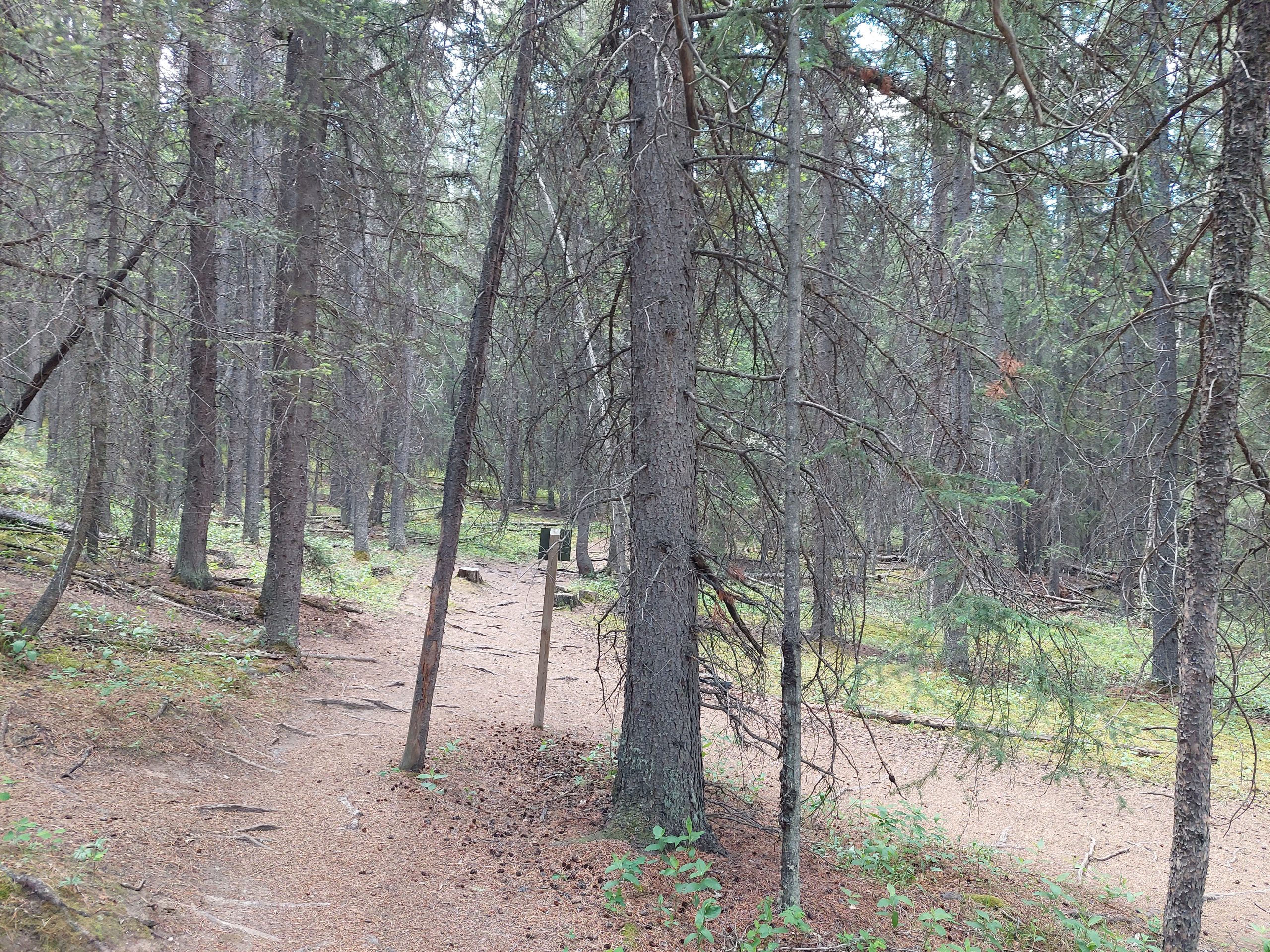
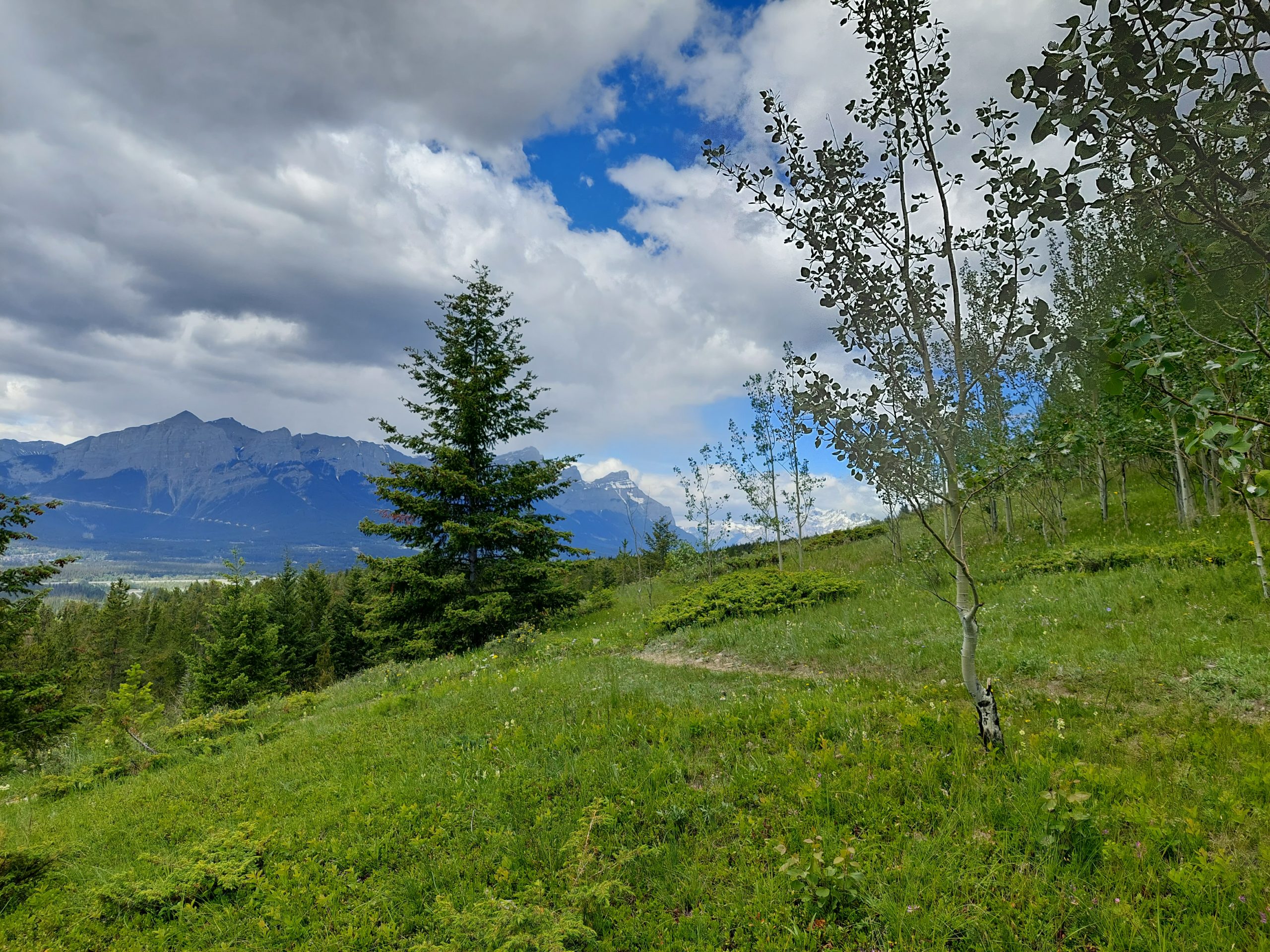
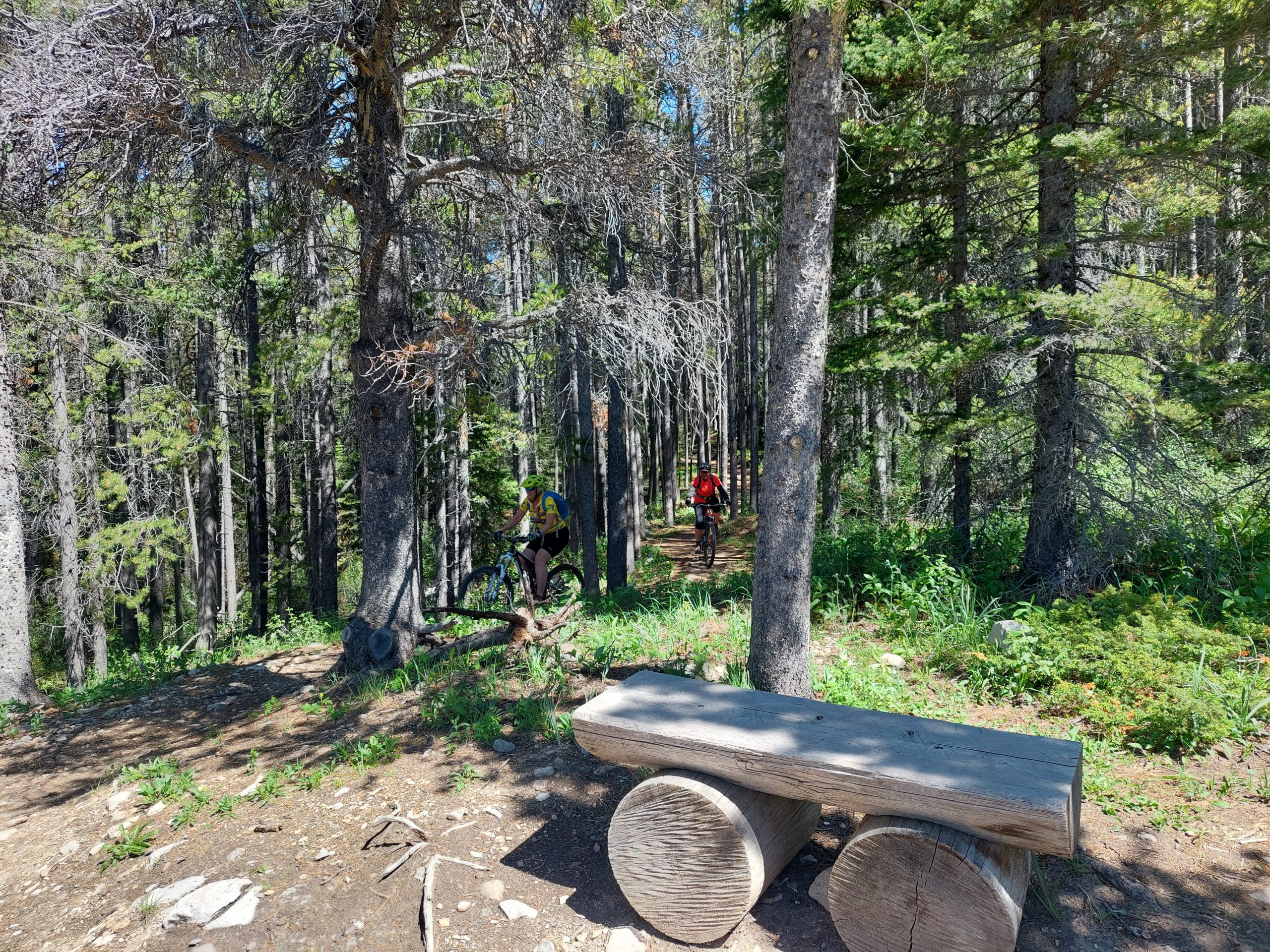
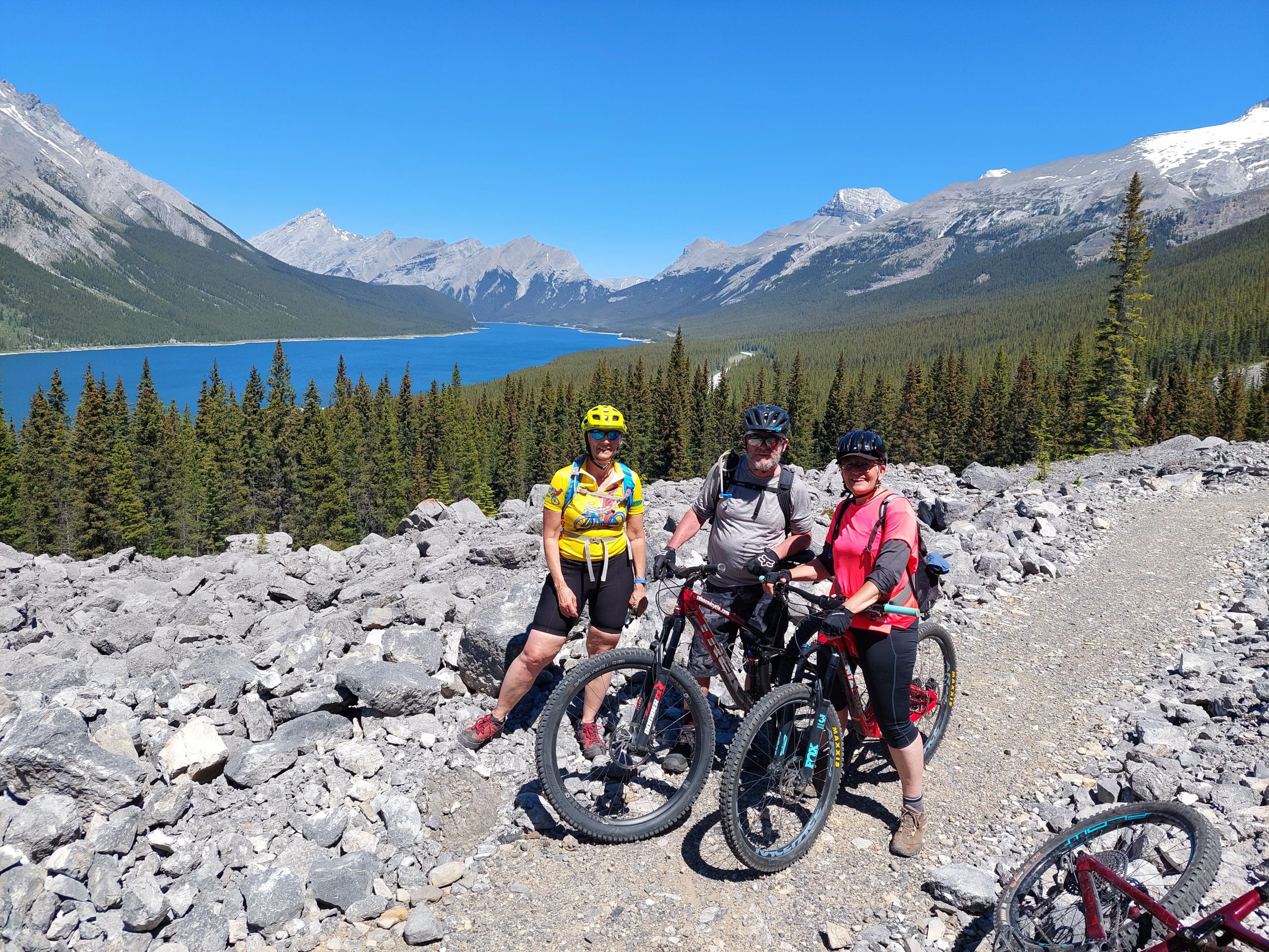
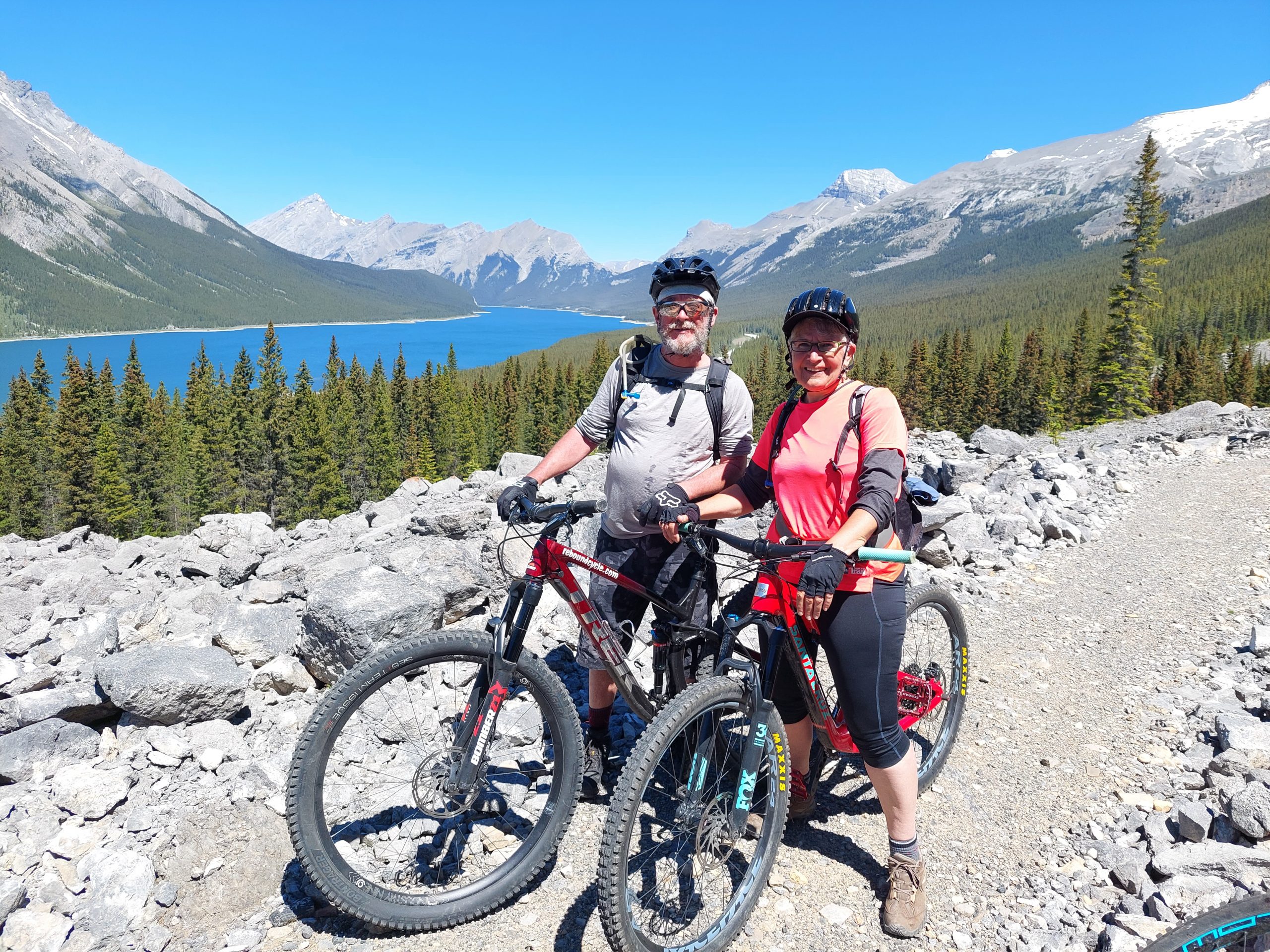
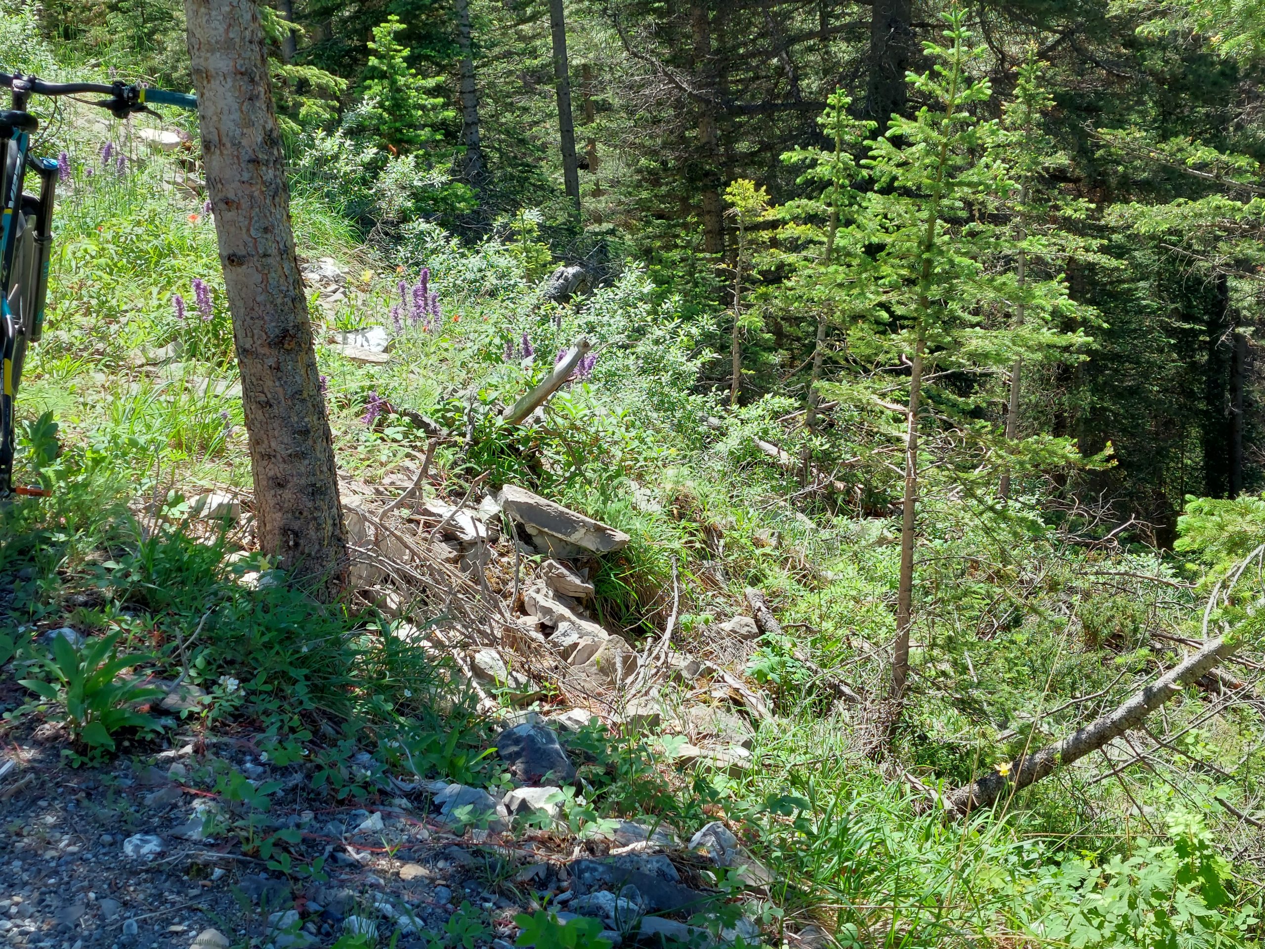
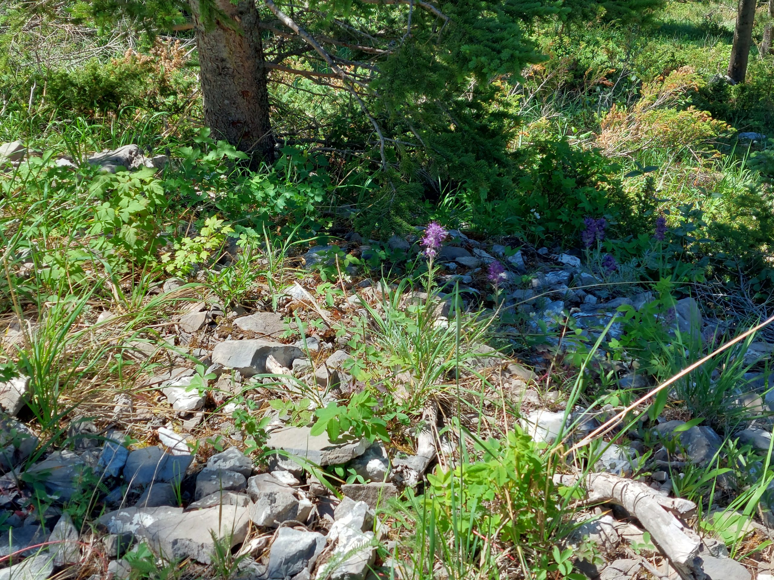
Anne and I had rented high end, full suspension mountain bikes in town, and once again our hosts hooked us up, this time showing us around the excellent riding near Canmore. The first day we rode from town, and did some trails called Horseshoe and G8, if I heard Lyle correctly.
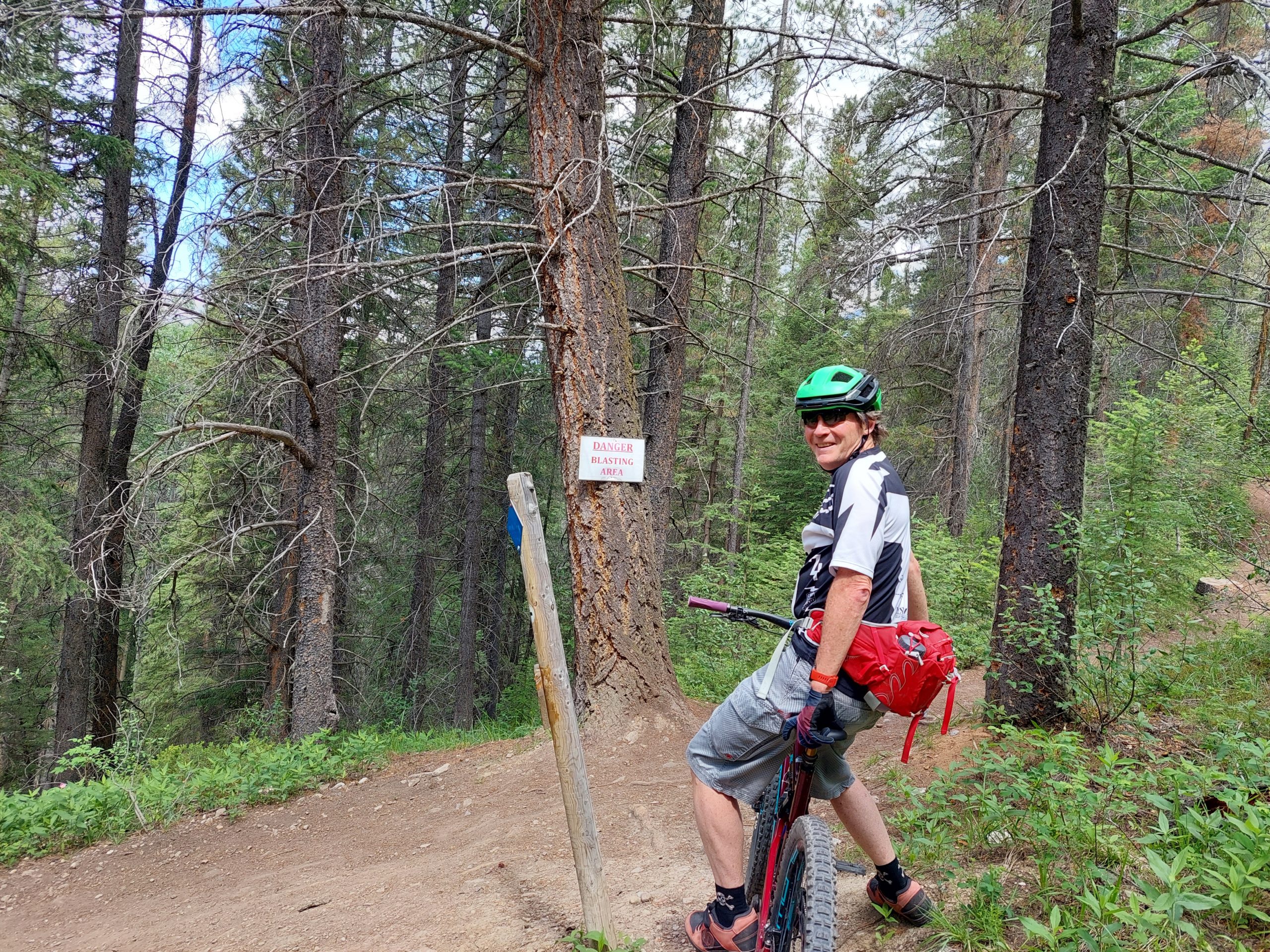
Anne had mechanical difficulties with her seatpost and went back to the rental place, and Kirsten was dealing with some wrist issues and had to bail, so for a good chunk it was just me and Lyle. We had a lot of fun, but it was all I could do to hold on to the pace — he was fast.
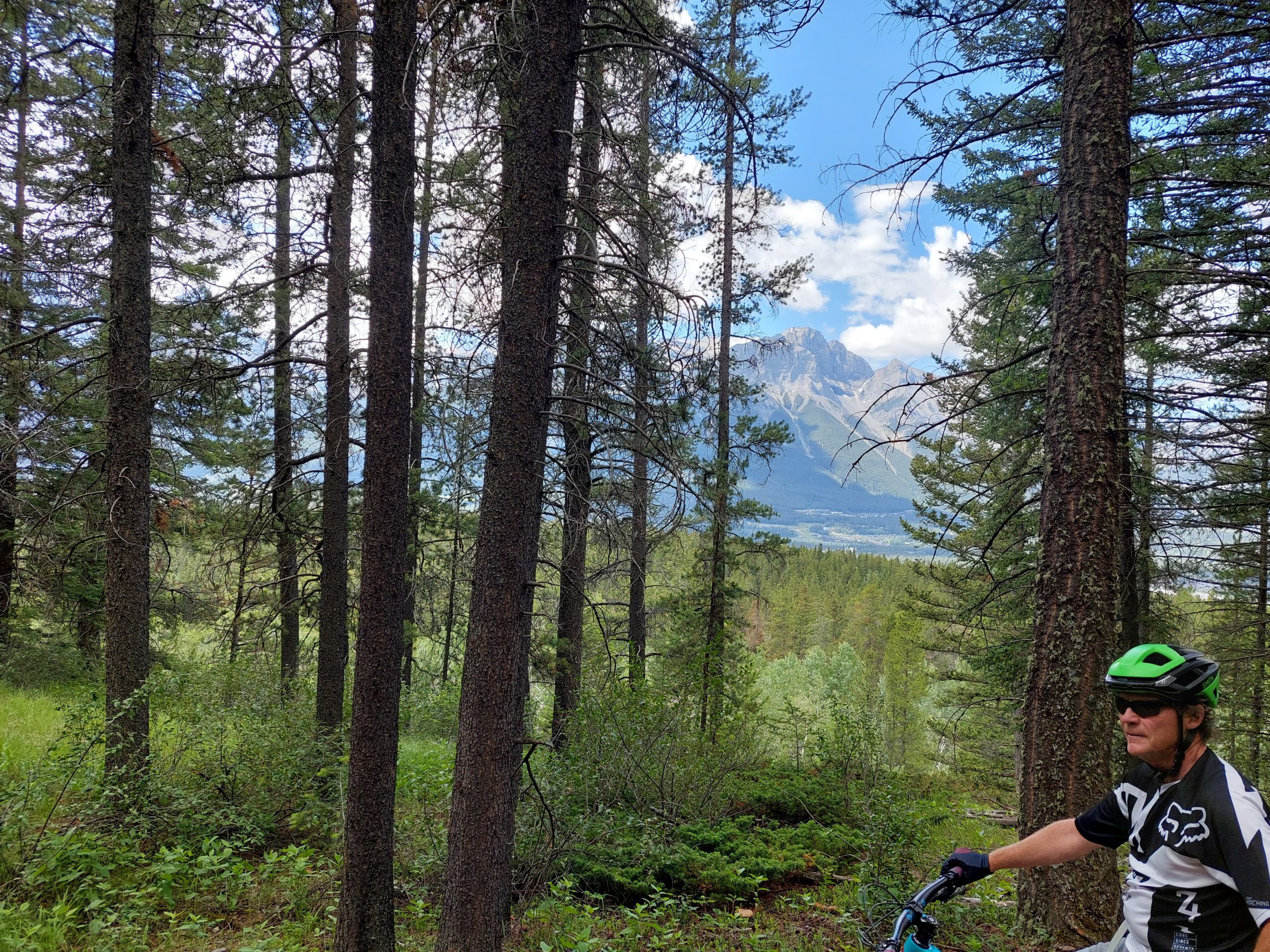
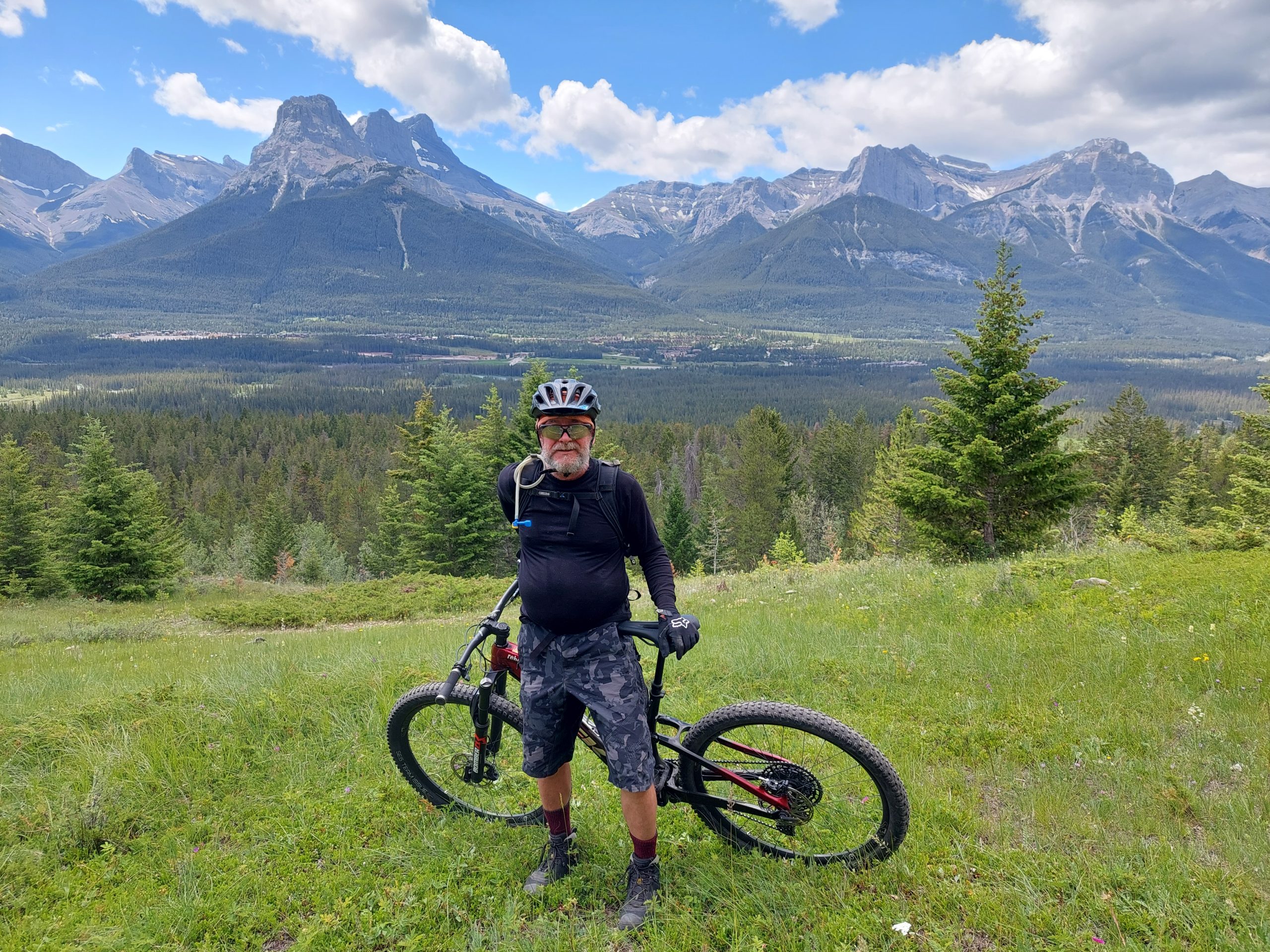
Canmore SingletrackCanmore TrailsBlasting ZoneLyleThe Sound Of MusicAlpine Meadow
Eventually we looped around, and Anne caught up with us, and we rode a bit more before her cursed rental bike had more troubles. At that point we just rode down the hill to a microbrewery where we met Kirsten. We hung out there for quite a while, and it was cool to see the place fill up with mountain bikers as time went on.
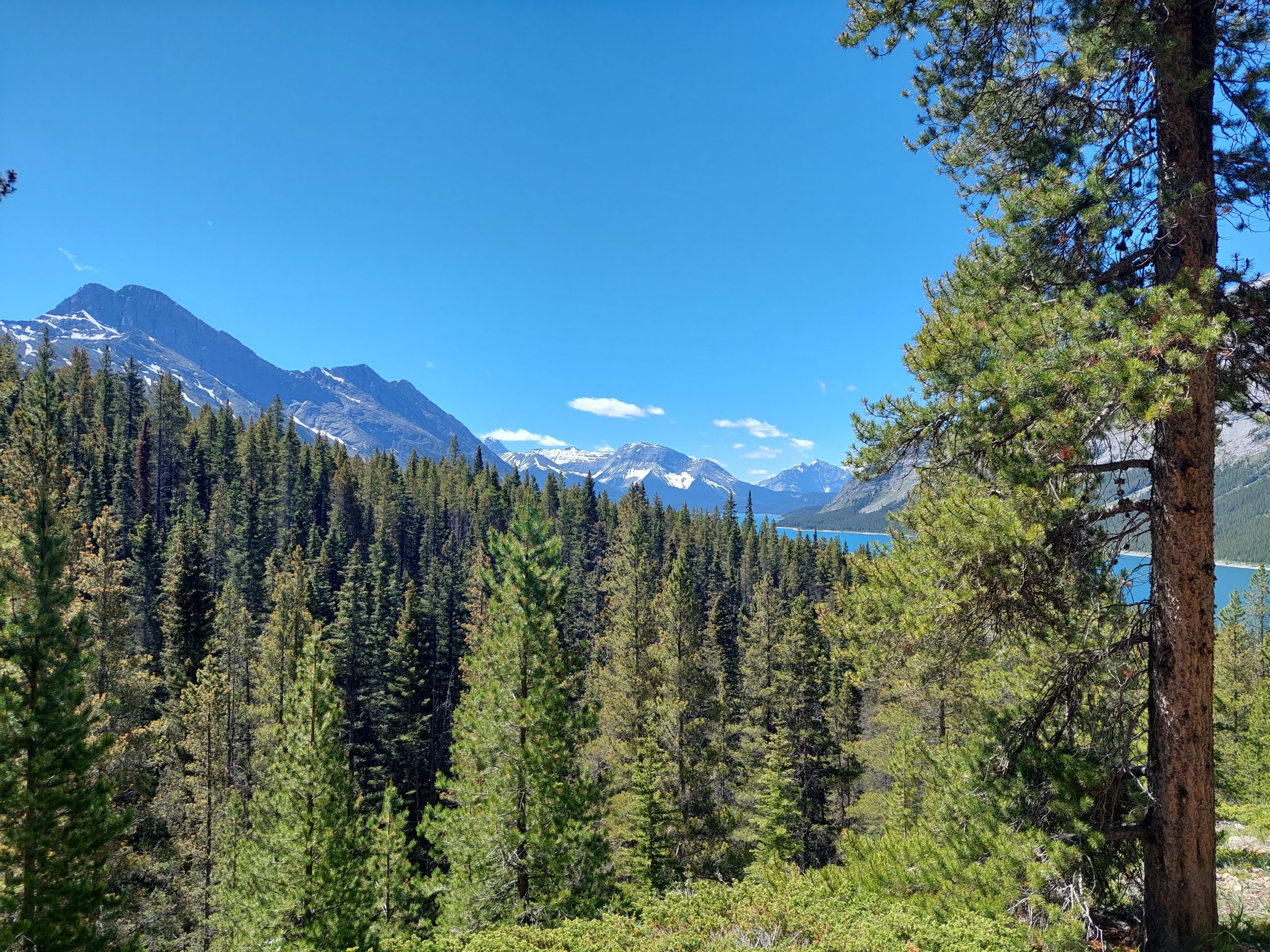
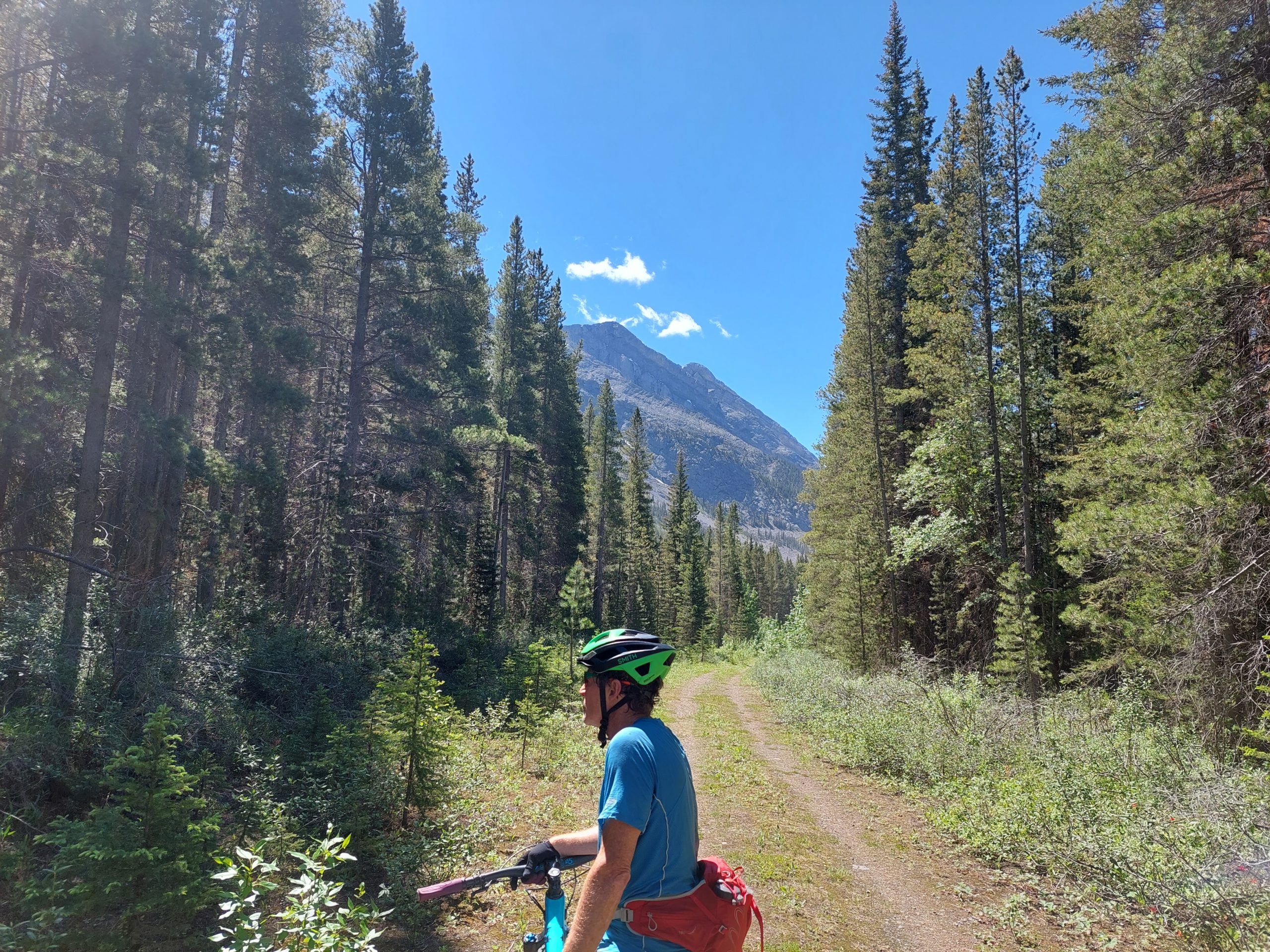
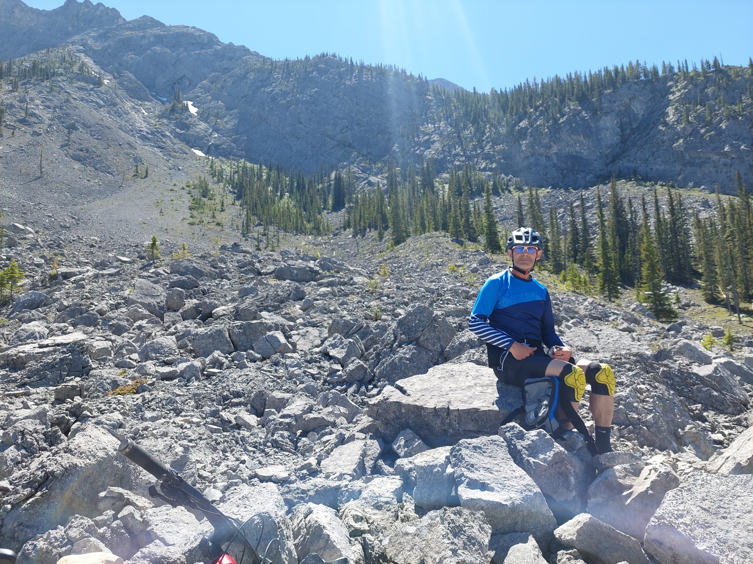
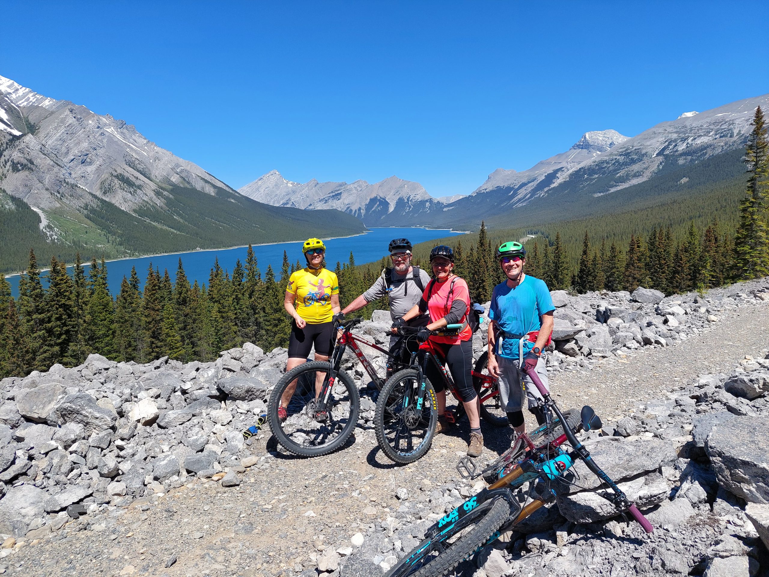
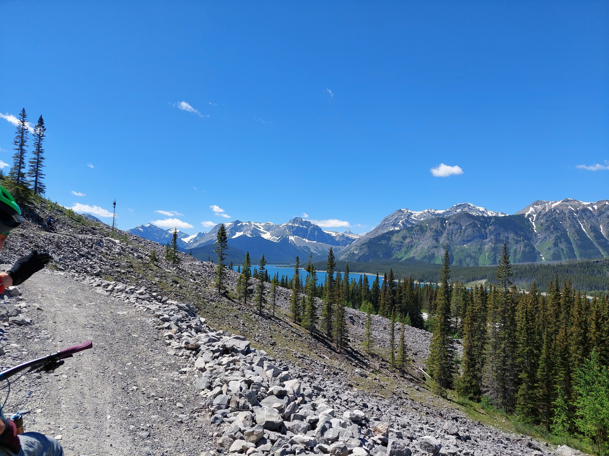
Our second ride took us back out to where we hiked, and we did a point-to-point ride, complete with shuttles, on a section of the High Rocky Trail. We were joined by Lyle’s friend Dave, another strong rider, who also loaned Anne his wife’s bike.
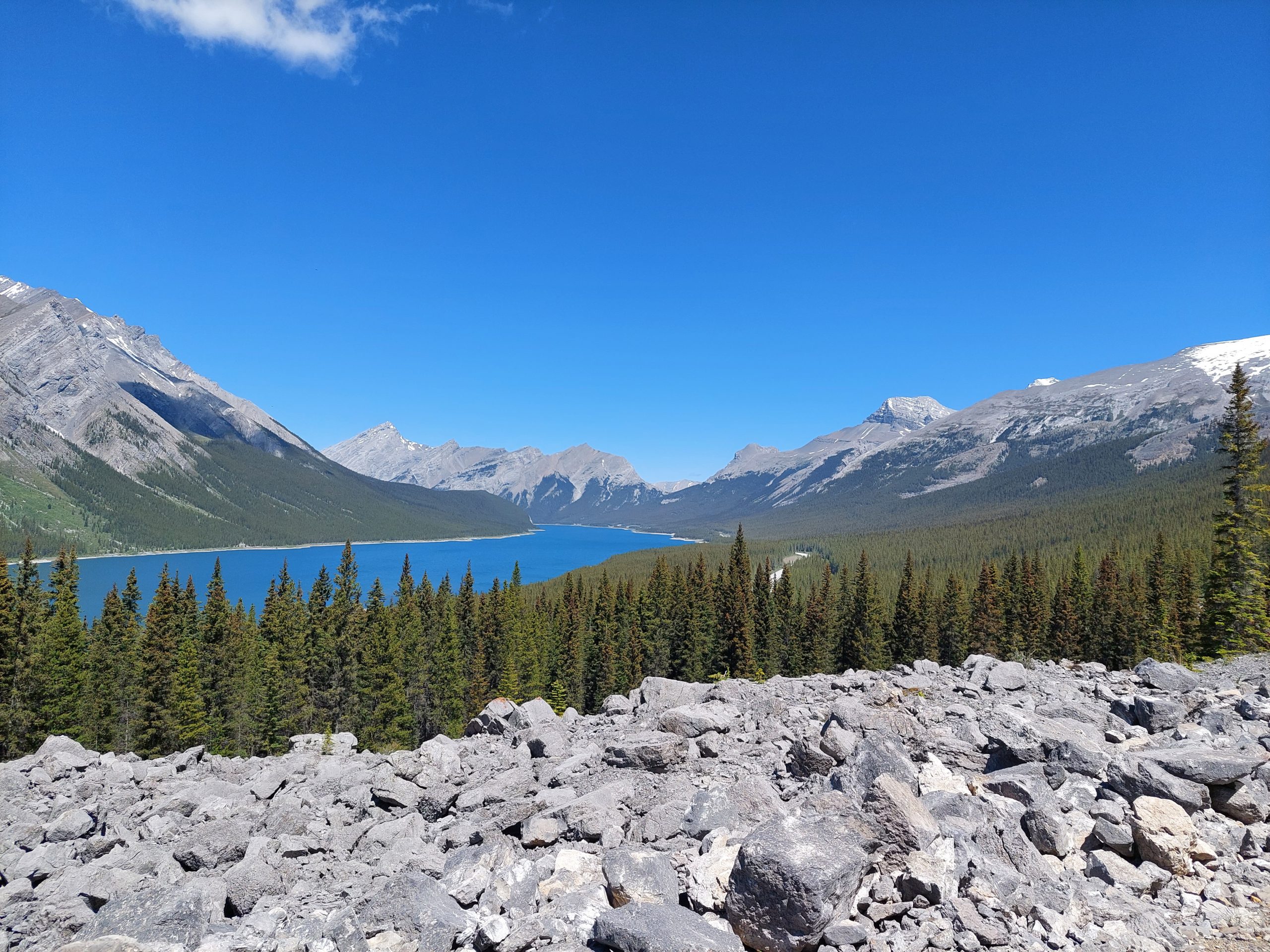
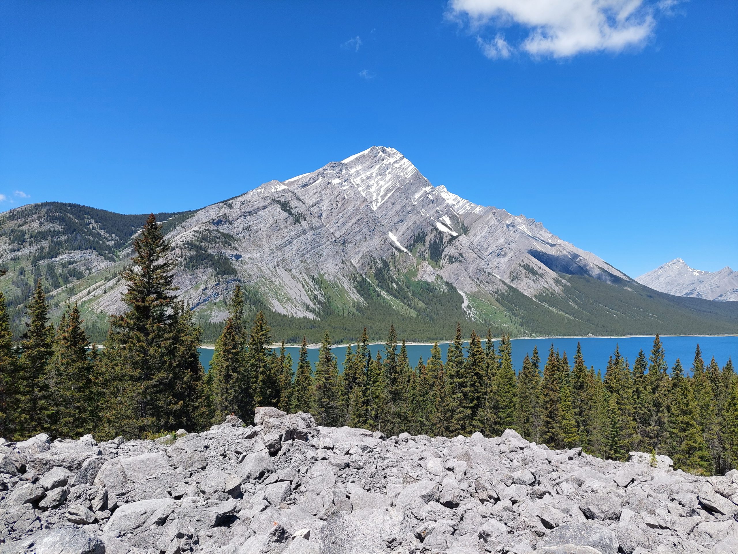
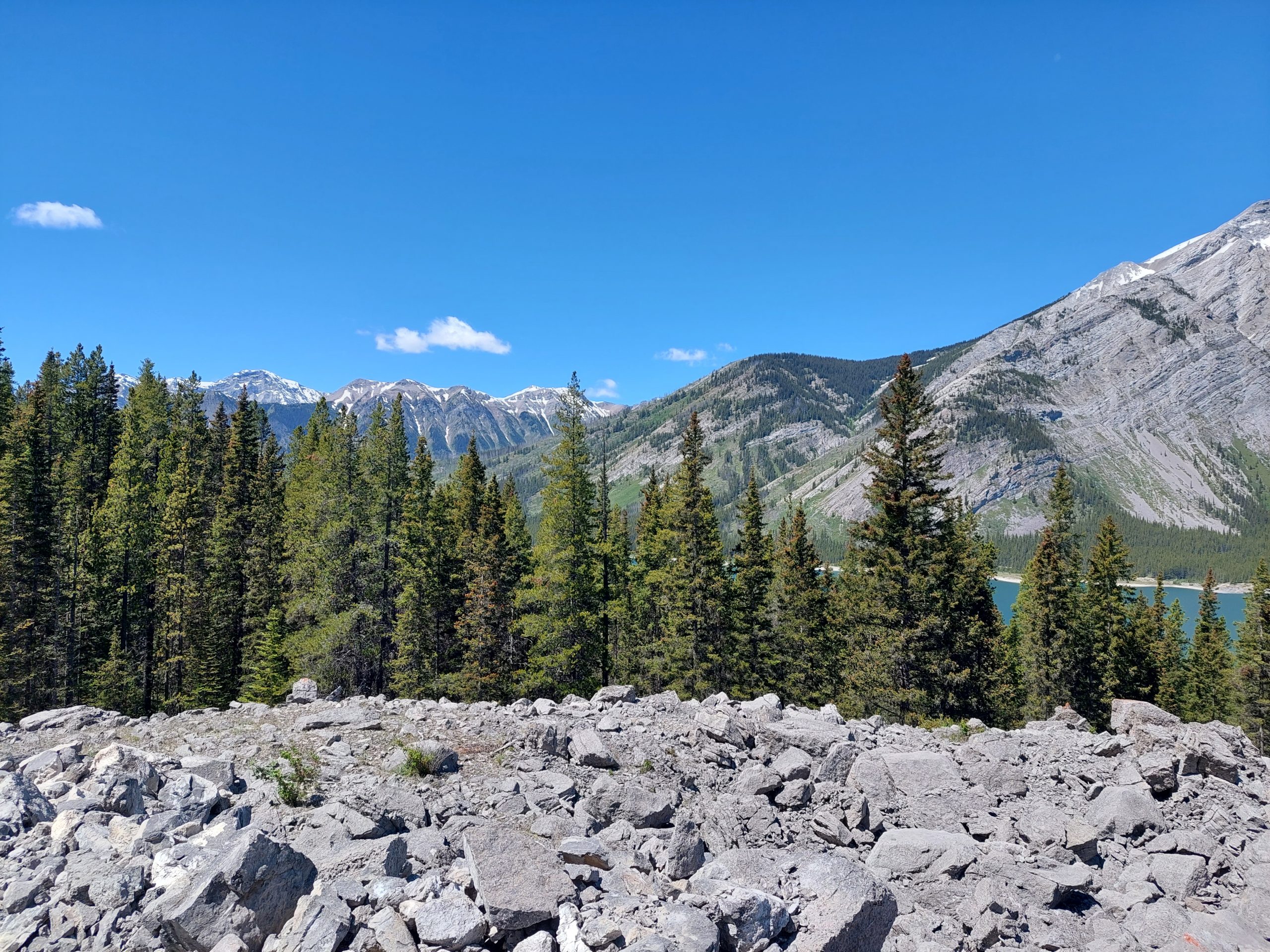
This was a great ride on some twisty, rolling singletrack, very different terrain and soil from back home but still reminiscent of places like Raystown. (Lyle told me that the trails had been made by machine, which would be a lot like Raystown). Dave was, if anything, even faster, and we all had a merry chase up and down the trail, occasionally yodeling and shouting to warn the bears off. This trail sort of paralleled the dirt road, which was next to a long thin lake, and every so often we came to a clearing with incredible views.
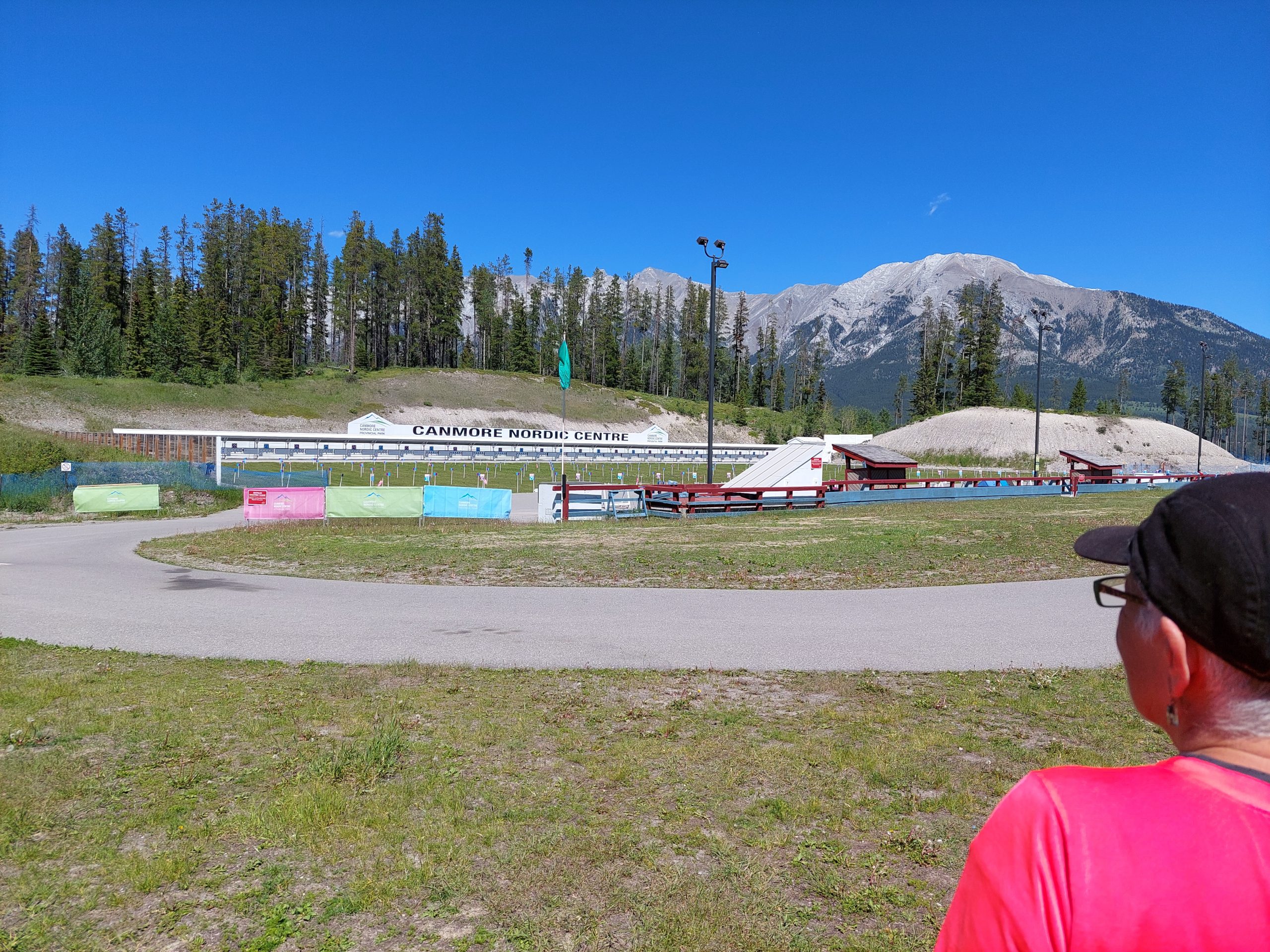
Spray LakeKirsten and AnneLyle On TrailSprat Lake And ScreeLake And MountainHigh Rocky SceneDaveKirsten, Me and AnneAnne and MeKirsten, Me, Anne and LyleMount Assiniboine In The DistanceTrailside VegetationTrailside FlowerCanmore Nordic Center
On the way back to town we stopped at the Canmore Nordic Centre, where Lyle and Kirsten showed us around. The Nordic Centre is a provincial park in its own right, with mountain bike trails all through the woods, but it’s also their Olympic-level winter sports arena, the one that was built for Calgary ’88. (Lyle and Kirsten, and their kids, are all very athletic, and Lyle is an official in the Canadian national governing body for biathlon, a sort of mix of XC-skiing and shooting.) You could tell they really loved their town, with its bike trails and all its awesome facilities and amenities, and it was a pleasure to have them show it all to us.
We came back to town and cleaned up, and then we all went out for pizza. This was our goodbye dinner with our hosts: we would be relocating back to the hostel for our last night in town. Moving on was a little sad, and they even offered to let us stay that one last night but we’d taken up enough of their time and hospitality, and we knew they had to get back to living their own lives.
Our vacation wasn’t quite over, but it was starting to wind down.
Our refrigerator’s ice maker started acting up the other day. No biggie, the ice cubes were not formed right, just throw them in the sink and start over… Well, it must have failed for real Saturday night, because we woke up to the freezer door completely frozen in place. We had a ride to do so we left everything as it was until we got back.
We still couldn’t open it Sunday afternoon, so we unplugged the fridge in hopes that it would thaw out — nothing. Yesterday morning we woke up early and with our loins girded to deal with the ice problem (it was still frozen shut), only to discover we also had a wheat moth infestation in one of our kitchen cabinets — worms everywhere. Aargh!
So, we spent all day yesterday cleaning: we ran to the store and got cleaning supplies and new cabinet liners (and also flashlights and a new cooler because ours all seem to be missing), then we dealt with the fridge by freezing some food in the big basement freezer, saving what what we could in the cooler, and throwing out a whole lot of old food. We got the fridge mostly empty, and left it open to help thaw the freezer door.
At the same time, we took out all the containers in the cabinet — mostly jars of grains and dried beans, in supposedly moth-proof jars — emptied and cleaned them, and scrubbed/disinfected the cabinets before putting the few non-infested things back. That’s basically all we did yesterday.
The freezer door was still stuck this morning, but the repair guy came and was able to open it, and sure enough, the entire bottom was a solid block of ice. We cleaned out the freezer, and the tech determined that we need a new ice-maker valve, which is now on order; as soon as the ice has melted enough to be removed we can plug the fridge back in and use it (we can live without the ice maker for a while). I’ve been removing chunks of of ice and mopping the kitchen floor all day.
When we’re done we will have at least cleaned out one cabinet, and seriously cleaned the fridge and the kitchen floor. Good thing we’re getting this behind us — we are having a picnic this weekend, and it’s not like we have nothing else to do to get ready…
So I have about a dozen left of the native paths to add to my database, in this first pass through Indian Paths of Pennsylvania (that book I’m following/analyzing/whatever). This is the pass where I go through the book from beginning to end, adding the basic info for each path to the database, adding the info about the start points and destinations, and generating the routes described in each chapter’s “For the Motorist” section.
There are a few big pieces left to this project, which I think I can do all together in a second pass through the book:
I need to document the relationships between the paths, as described for each path in the book (which is what required me to go through the book one first time: to get all the paths documented, before trying to map the relationships).
I need to generate the actual footpath routes. This will probably be the most difficult and labor intensive task in the whole project, and I expect it will likely involve digitizing all the (low quality) maps in the book; it may also require trying to find primary sources, old deeds and land grants etc, and even after all that I expect I’ll have to live with a great deal of ambiguity in the routes.
I’m not sure if I want to do this yet, but as I go through the book I may document any points of interest (landmarks, native towns that aren’t trail endpoints) that I haven’t already included.
I’ve been thinking about the first part for a while, and have set up a separate bridge table in the database to capture these relationships; the table is set up with links to a subject path (the one that’s doing the referring) and an object path (the one getting referenced), and a link to another table with the list of possible relationships between them: intersections, alternate routes and spurs; aliases and alternate names; concurrencies (ie where the path shares some section of trail with another path); and the ever-popular “for more information see also.” I can add more relationships as I see the need.
For the second task, I think I’ll want to use the maps in the book, even if it’s just to trace over. That means scanning the maps in some way without damaging the book (I may just photograph them with my phone), then georeferencing them and saving the result somewhere. I suspect I’ll end up with a pretty big set of raster data, and now need to consider how to do to organize it. Rasters are not something I have much experience with, so there will likely be a learning curve involved — I think I may put them in the database in some way.
In terms of original research, my plan at the start was to use Indian Paths of Pennsylvania as my sole source — my project would be the book translated into GIS form — but I’ve already used other sources (e.g., Wikipedia, town websites) to flesh out histories and descriptions, and I think I’m seeing the book now as a condensation of other info, even if it’s just the author’s research files; the info in the book may have been “condensed,” oversimplified, to the point of vagueness, more exact versions of the trail descriptions exist somewhere. I really don’t want to get into actual archival research for this though, and it may just end up that if I dig really deep, I’ll only find that all the primary information is pretty vague too…
Finally, that third task has me a bit stuck: I’d originally planned to only record the endpoints of the paths (as given in the book), and even called my points table “termini.” Now I’m looking to enter things like landmarks, known trail junctions — there are several places called “the parting of the ways” — towns that aren’t actually endpoints, and all sorts of other points of interest. I painted myself into a corner with that “termini” name, and even if it wouldn’t be too much of a stretch to stick these other points in the termini table, I may add a separate “points of interest” table, or at least add a column to the termini table to designate non-endpoints. (Maybe I’m overthinking this, I could easily find the endpoints and non-endpoints within a mixed table, just by using simple searches.)
This kind of gets to what I want my native paths data to eventually look like. Many of these landmarks and points of interest are likely to be nodes in a trail network (just like the endpoints), so I am back to thinking they should all be part of the same table. I also expect that I’ll have trail segments from node to node, and my final paths will be lists of trail segments from start point to end point, so my final product will not look much like what I’m building now.
I woke up this morning with a hankering for some bagels, so I went downtown to Johnny’s for breakfast — I just got back. Anne’s out of town visiting Emmi, and I’ve been living the bachelor life again…
Yesterday I rode with Doug & Lori at Nockamixon, which was bone dry but a lot of fun. They were on the tandem, and we got in a really pleasant ride, brisk but not too brisk, if you know what I mean.
Friday night I walked through Musikfest and over to Southside, and got myself a burger and a beer at F&A Grog House. Like most non-Musikfest places right now, it was a bit quiet. (Anne and I got dinner at Brick last weekend, just yards from the festivities, and it was dead — the owner/bartender said it’s like that every year, and they’ve taken to closing for vacation for at least part of the Musikfest week. Go figure, it was ten times more pleasant in there than the scene just outside.)
Thursday I got up at 2:00 AM and drove Anne & Lorraine to the airport, so when I came home I went back to bed, and slept in a bit. I got in some yard work, housework, yadda yadda…
Today is probably more yard work and house work, and I’ll probably get in a shopping run. I just finished the 8th (of 9) in the Expanse series, and I think I’ll go get the final one while I’m out.
This is the eleventh in a series of posts about our bicycling trip from Jasper to Canmore, via the Icefields and Bow Valley Parkways, through Jasper and Banff National Parks in Alberta, Canada. The full series can be found here.
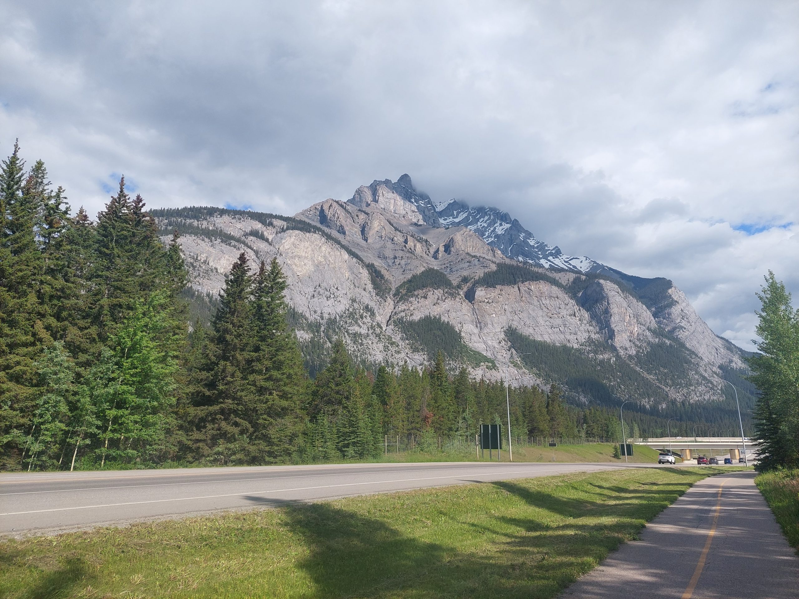
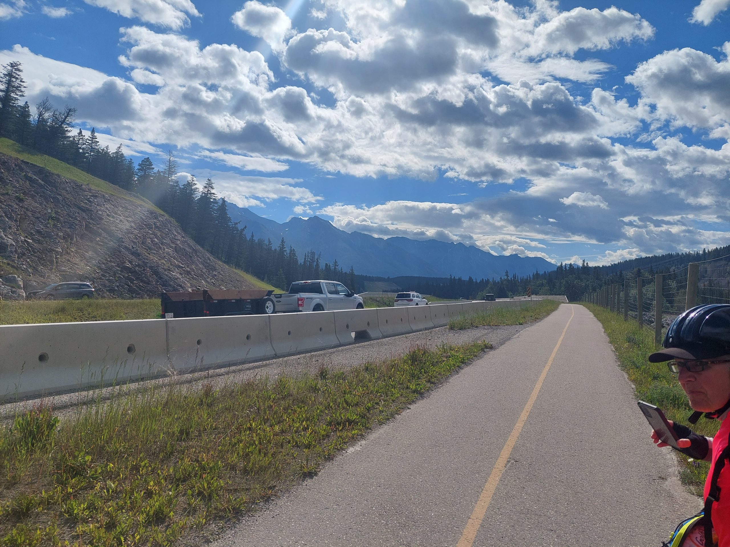
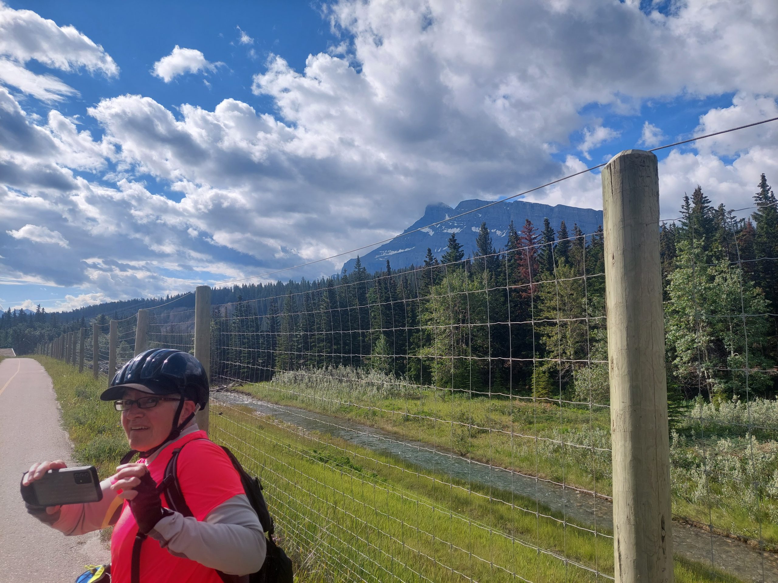
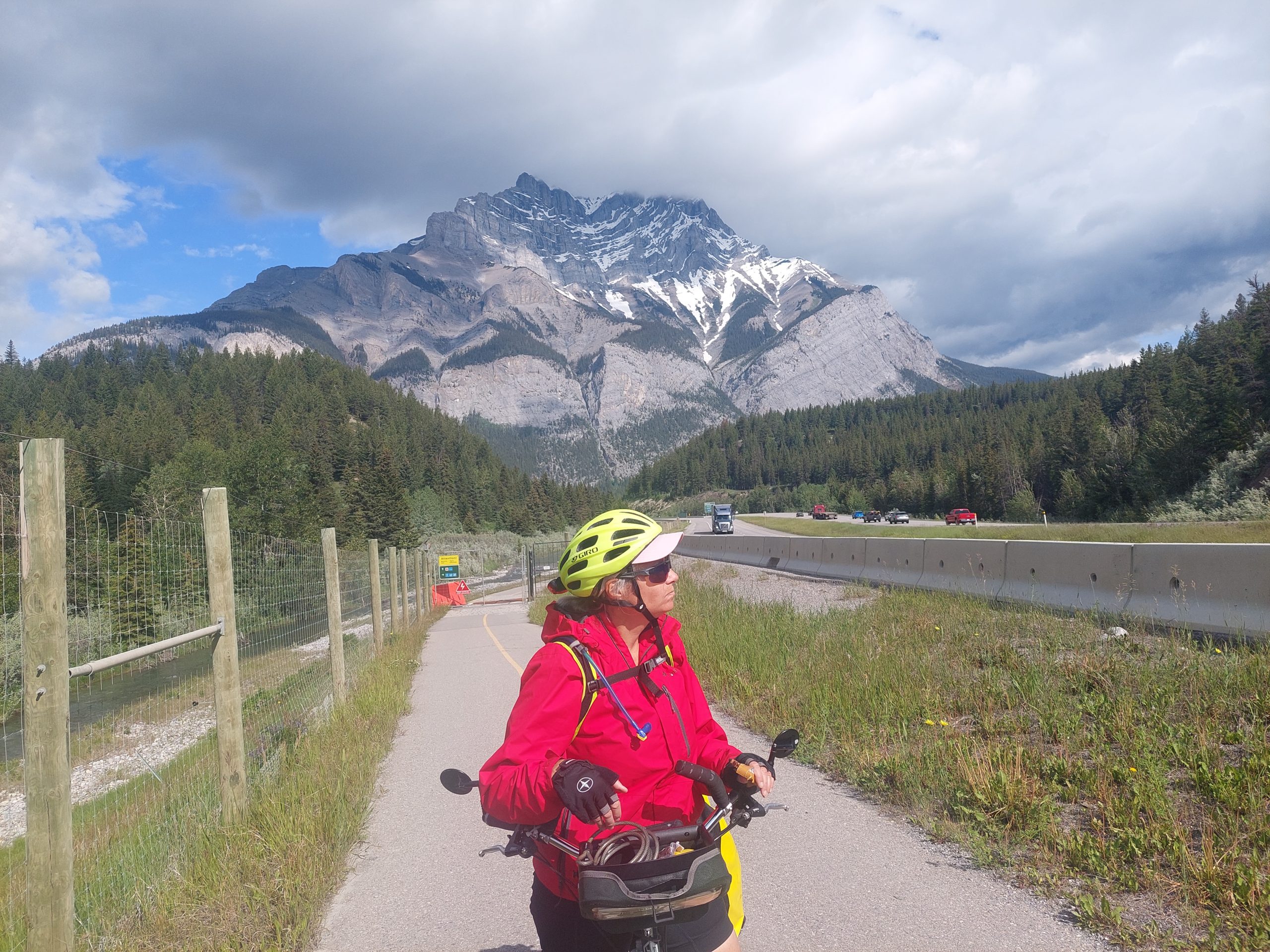
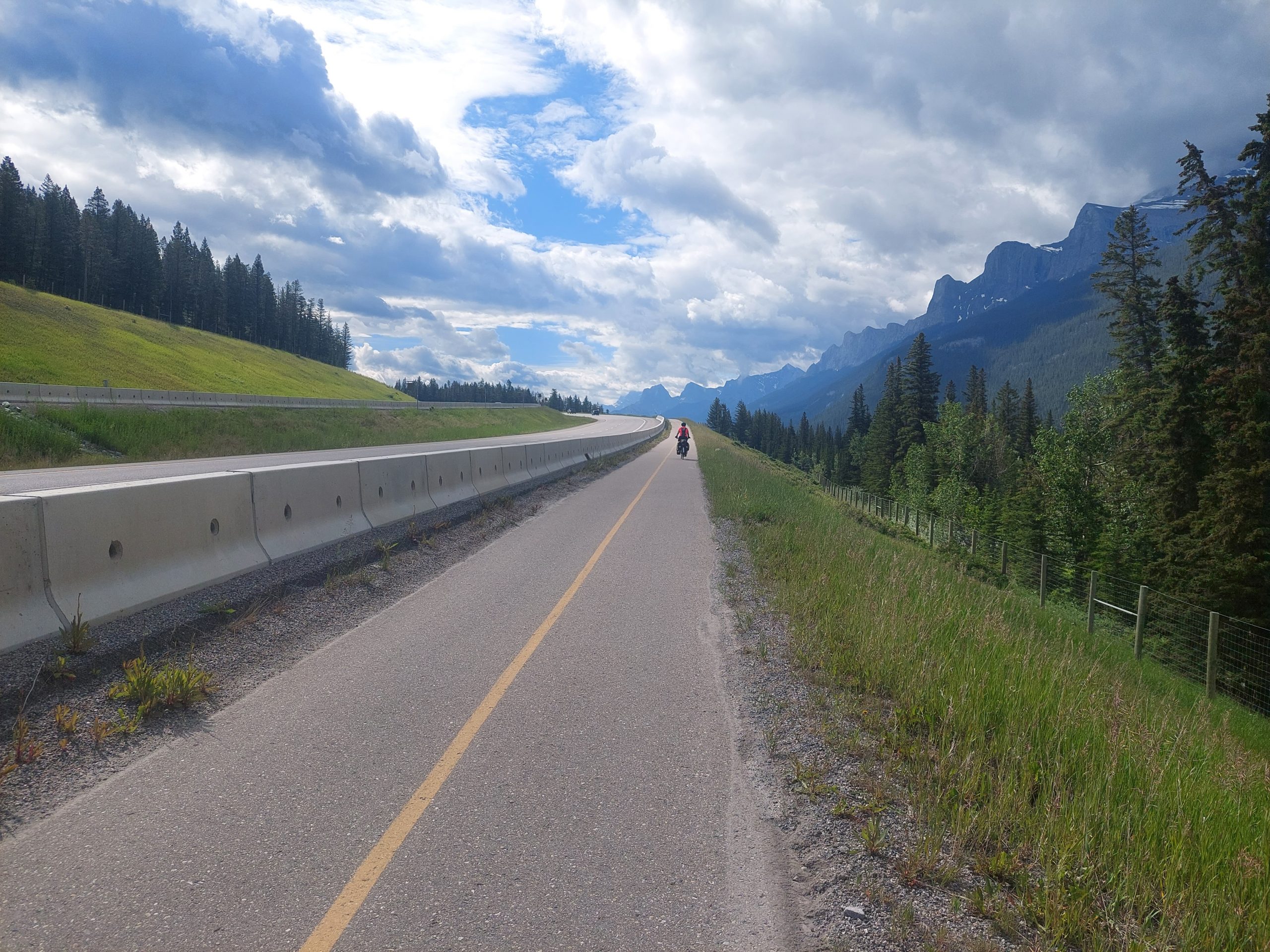
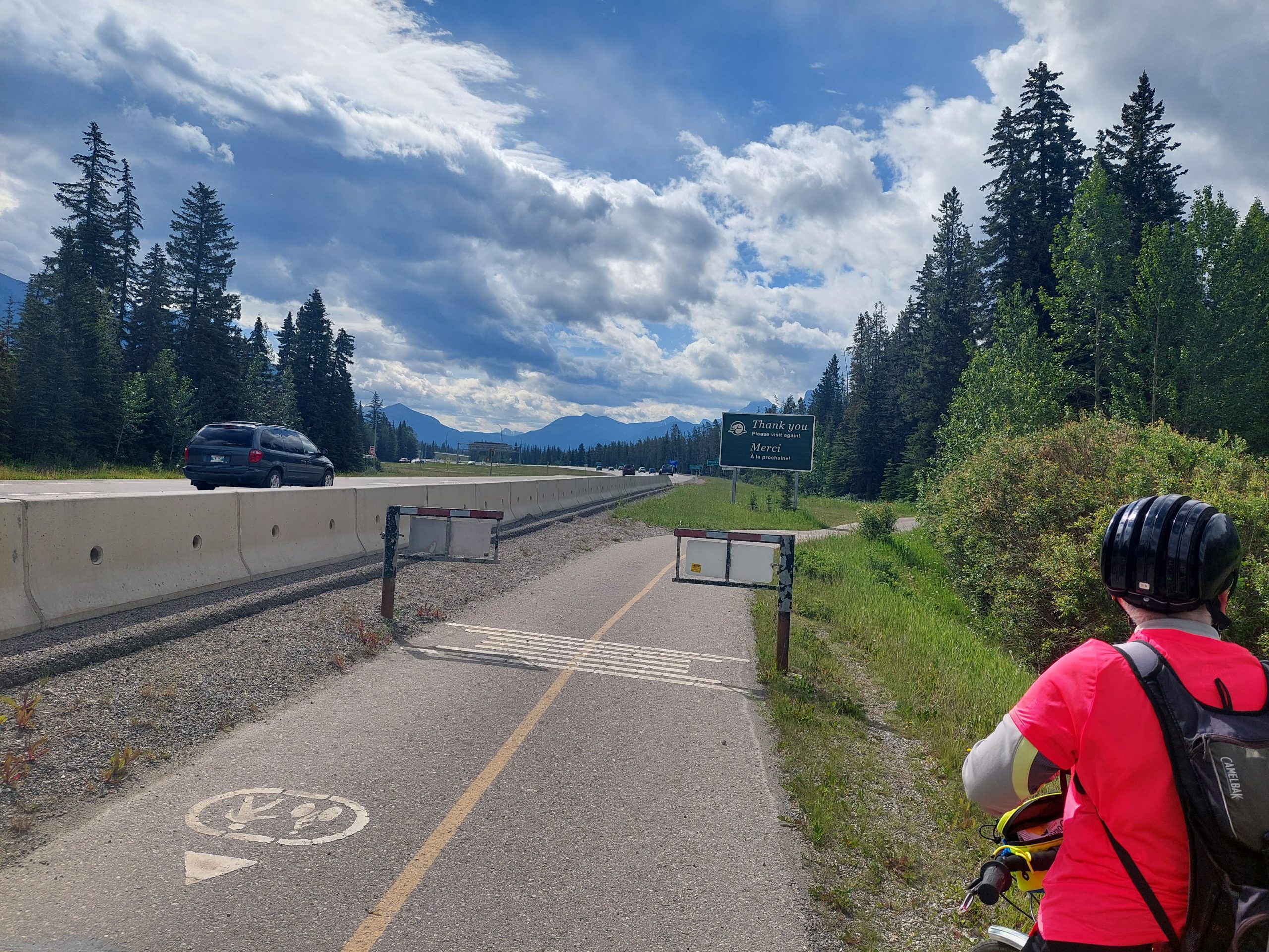
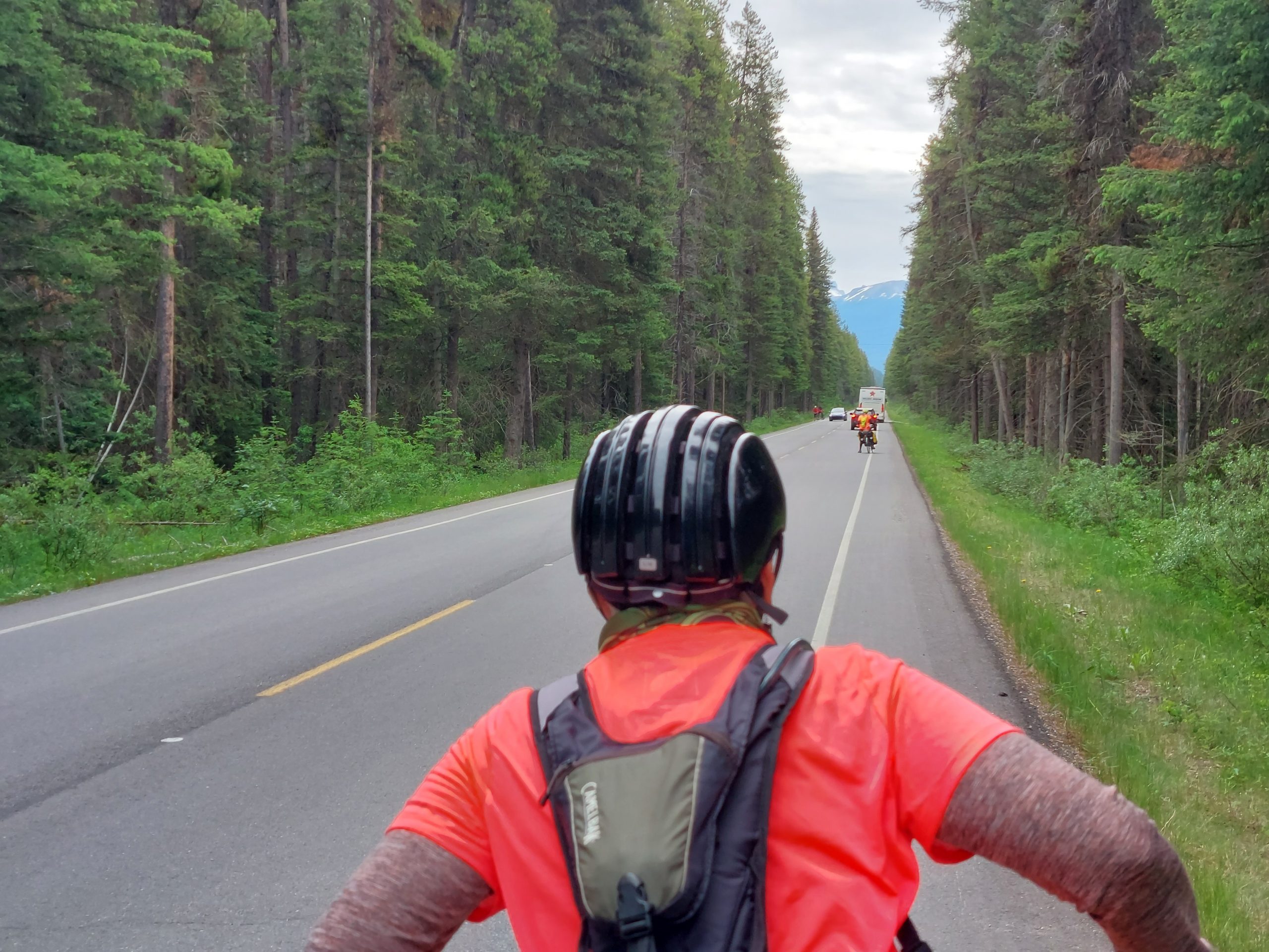
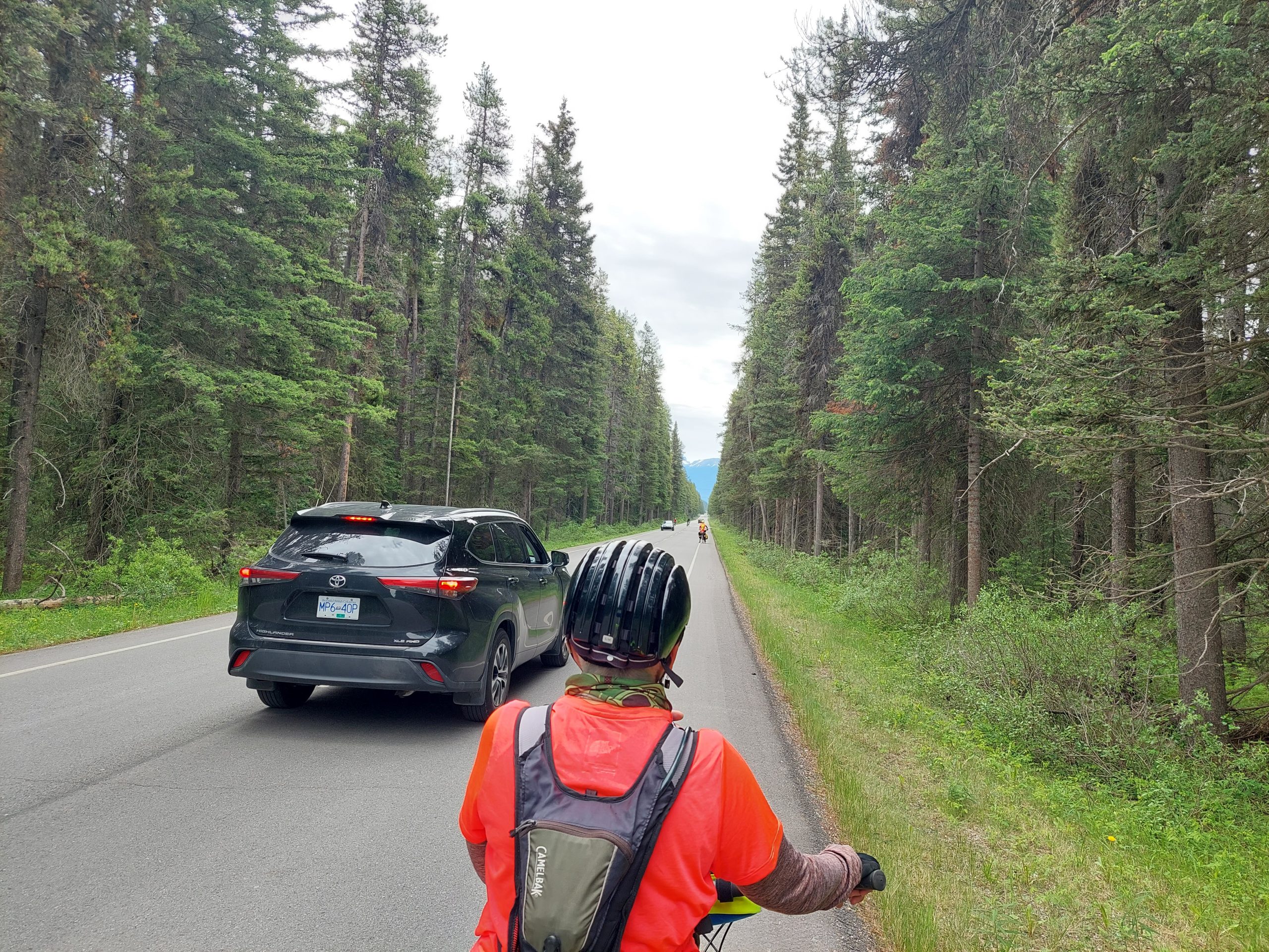
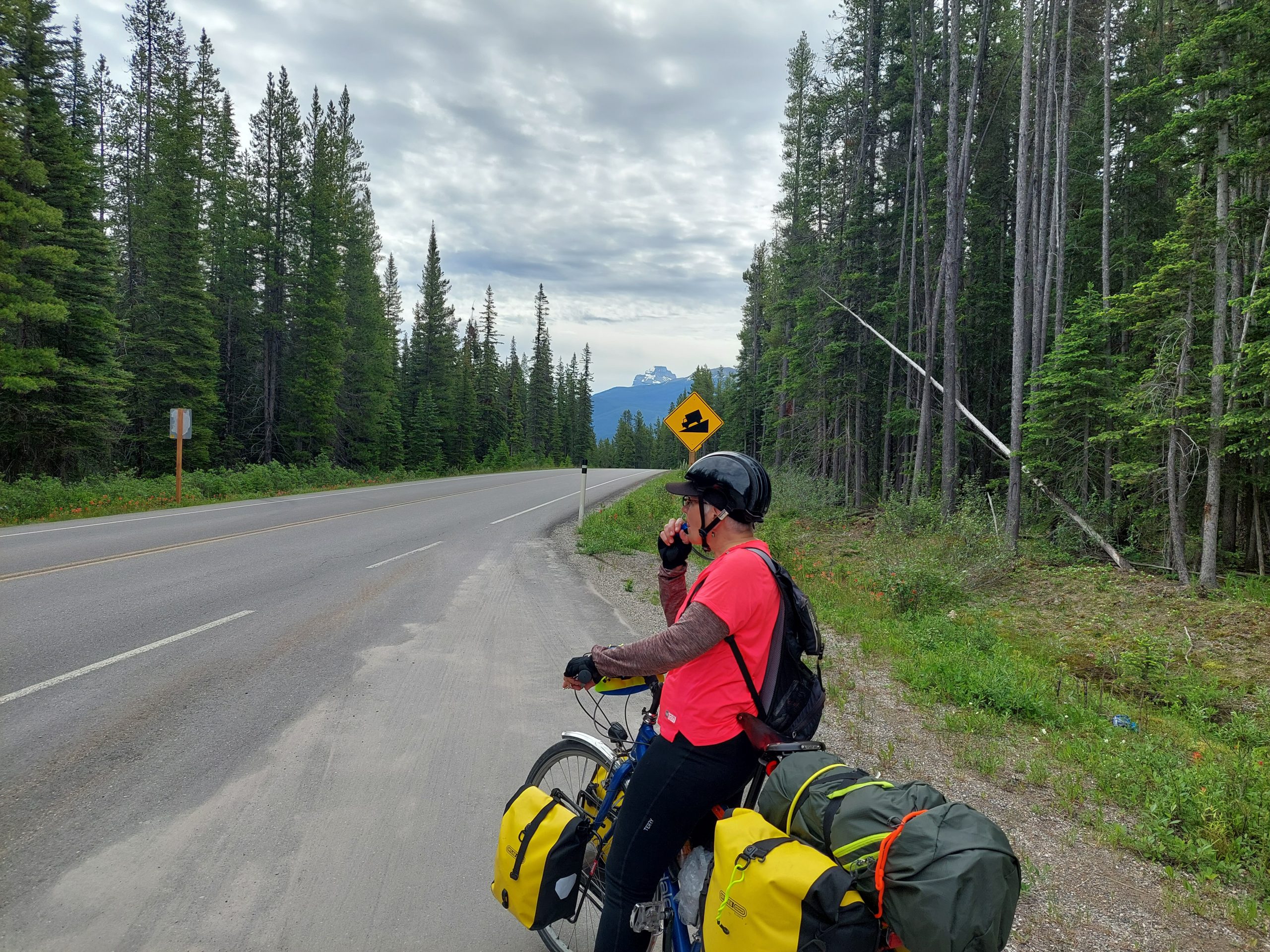
This was the day we left the parks and the parkways behind, and our final ride day together. We traveled down the Banff Heritage Trail, a bike path alongside the Trans-Canada Highway between the towns of Banff and Canmore…
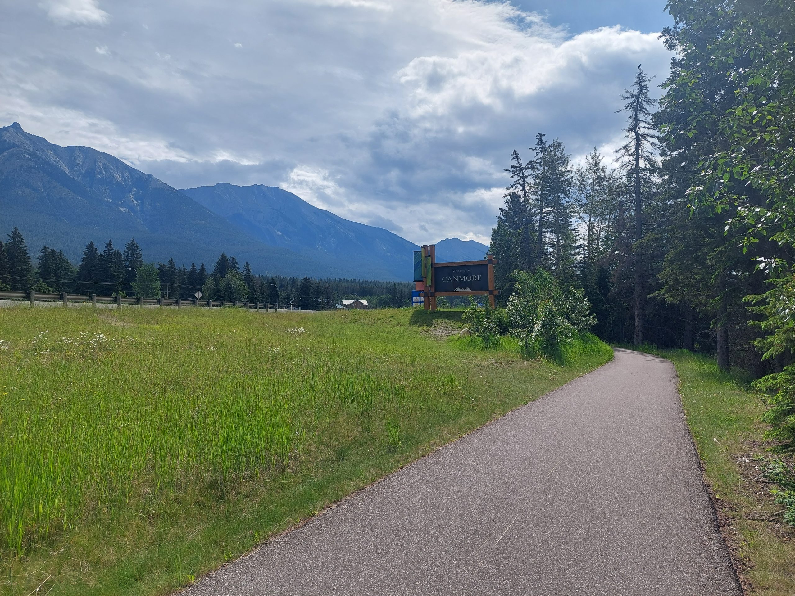
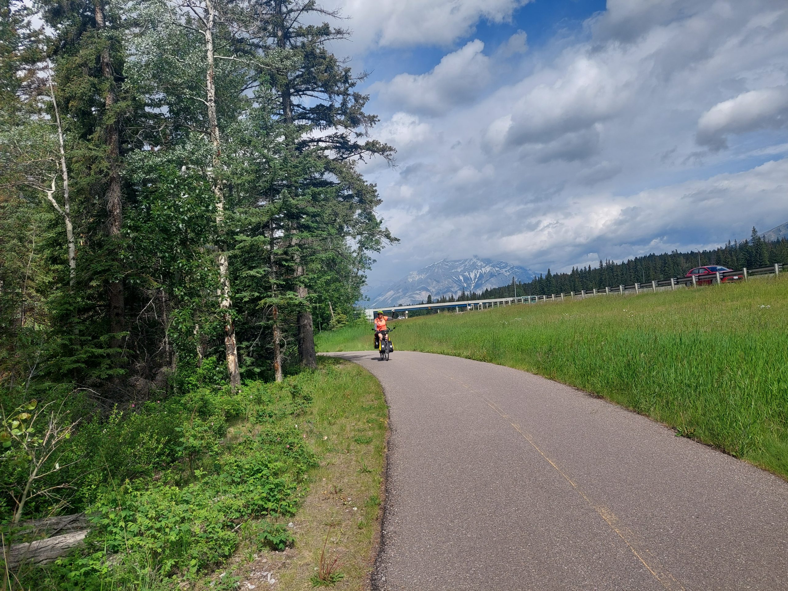
The bike path was pretty mellow, just a roll down the hill to the next town, and the vibe was a lot like any local rail-trail, with plenty of people doing what looked like their regular exercise and recreational, out-and-back rides. We were back in the real world, except that we were still surrounded by mountains and beautiful scenery, and wildlife was still a thing — Anne even saw a gray wolf at one point. Luckily it was on the other side of the Trans-Canada Highway’s wildlife protection fence, until we went a bit further and passed through a gate, back into the hungry wilderness… But it was a short ride for all that, and before we knew it we reached our final destination.
Canmore
Canmore had been a coal mining town until 1979 when the mines closed, and reconfigured itself for outdoor sports just in time to be a part of the 1982 Winter Olympics in Calgary — and that’s what put it on the map. It’s a beautiful town, just outside the national park and a tourist destination in its own right — mountain biking in summer, XC skiing in winter — but more charming and less crowded than the towns of Banff and Lake Louise. There was a considerable residential area, and a “real town” shopping district with supermarkets, hardware stores and so on, besides the more touristy “restaurant row,” which was closed to auto traffic and full of outdoor dining, souvenir stands and bike shops. Julie had an appointment at one of them (Outside Bikes) to drop her bike off for packing, and while we were there we got a recommendation for lunch/dinner at their go-to, a brewpub just around the corner. House-smoked brisket sandwiches and cold brews — delicious! After lunch we made our way to the Alpine Club Hostel, our lodging for the night. That was pretty much all she wrote for me, though I think Anne and Julie stayed up a bit later.
Anyway, here are some shots from the day’s ride, and one photo I took from the porch of our hostel:
Leaving BanffSouthboundPhoto OpJulieAnne Rides OnEnd Of The LineWelcome To Canmore!Julie At The Finish LineHostel Porch View
This is the eleventh in a series of posts about our bicycling trip from Jasper to Canmore, via the Icefields and Bow Valley Parkways, through Jasper and Banff National Parks in Alberta, Canada. The full series can be found here.
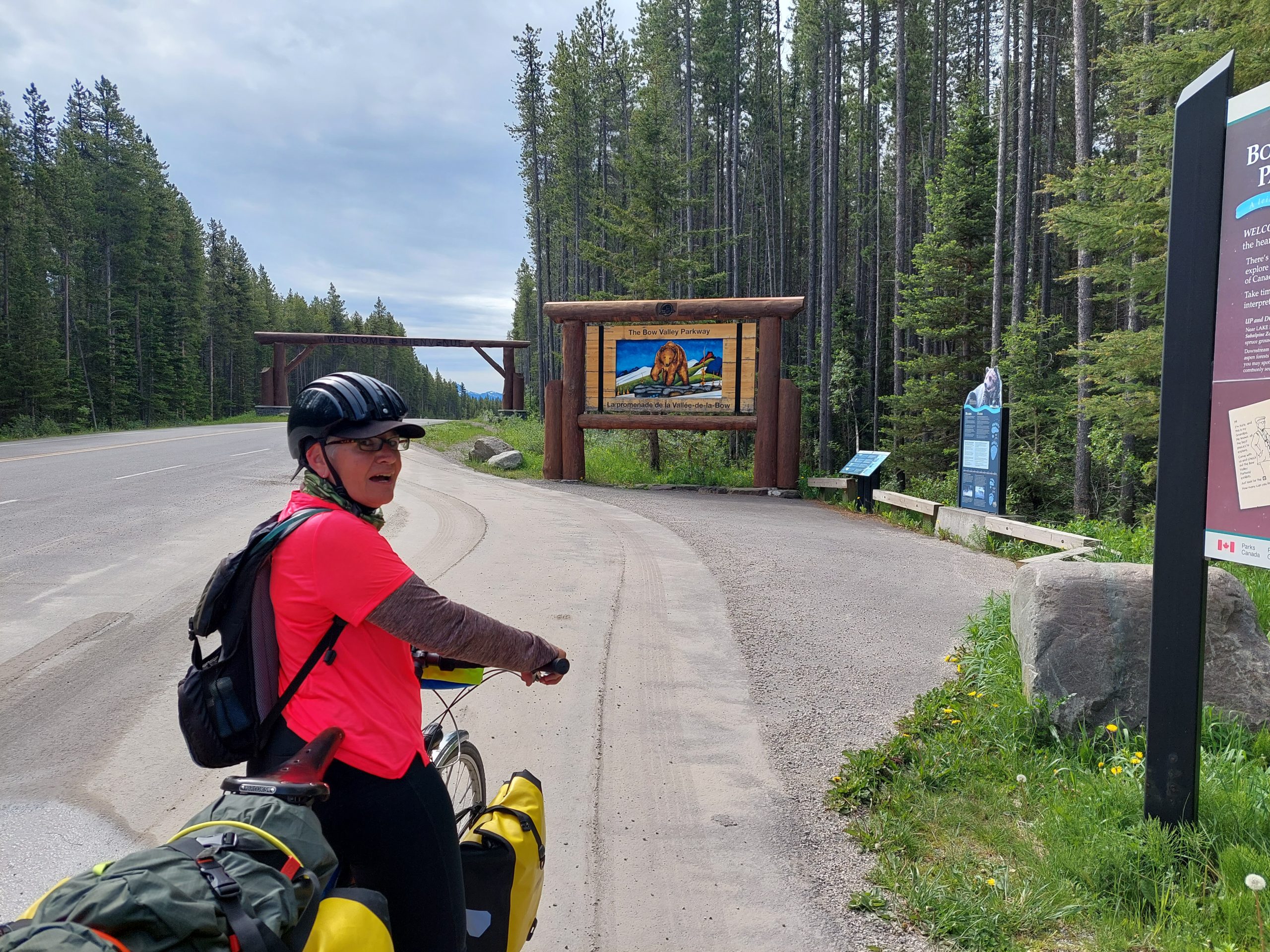
This would be our longest ride day. We would go just about 40 miles (luckily, they were easy miles) on the Bow Valley Parkway, from the hostel in Lake Louise to our campsite just outside Banff.
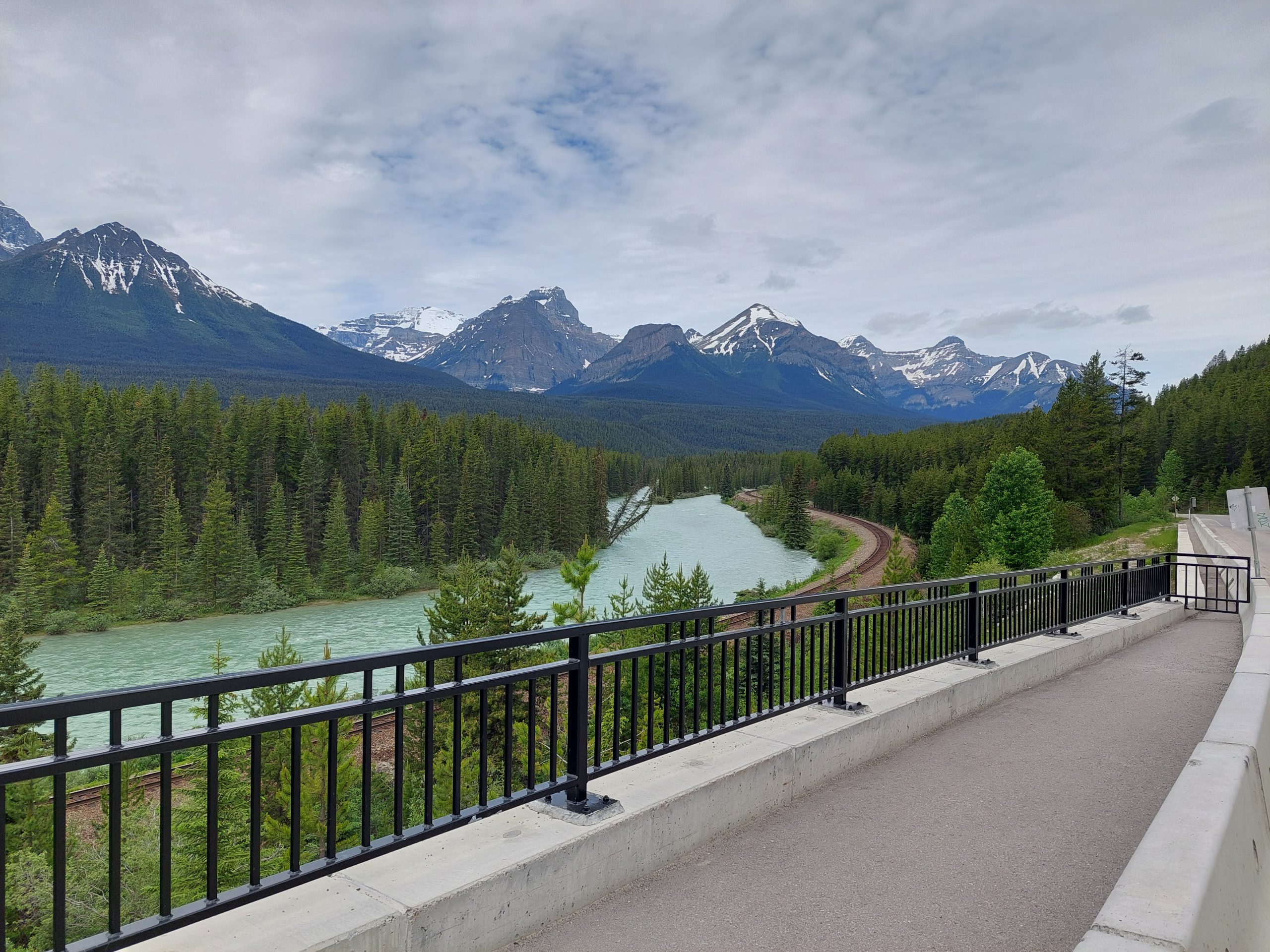
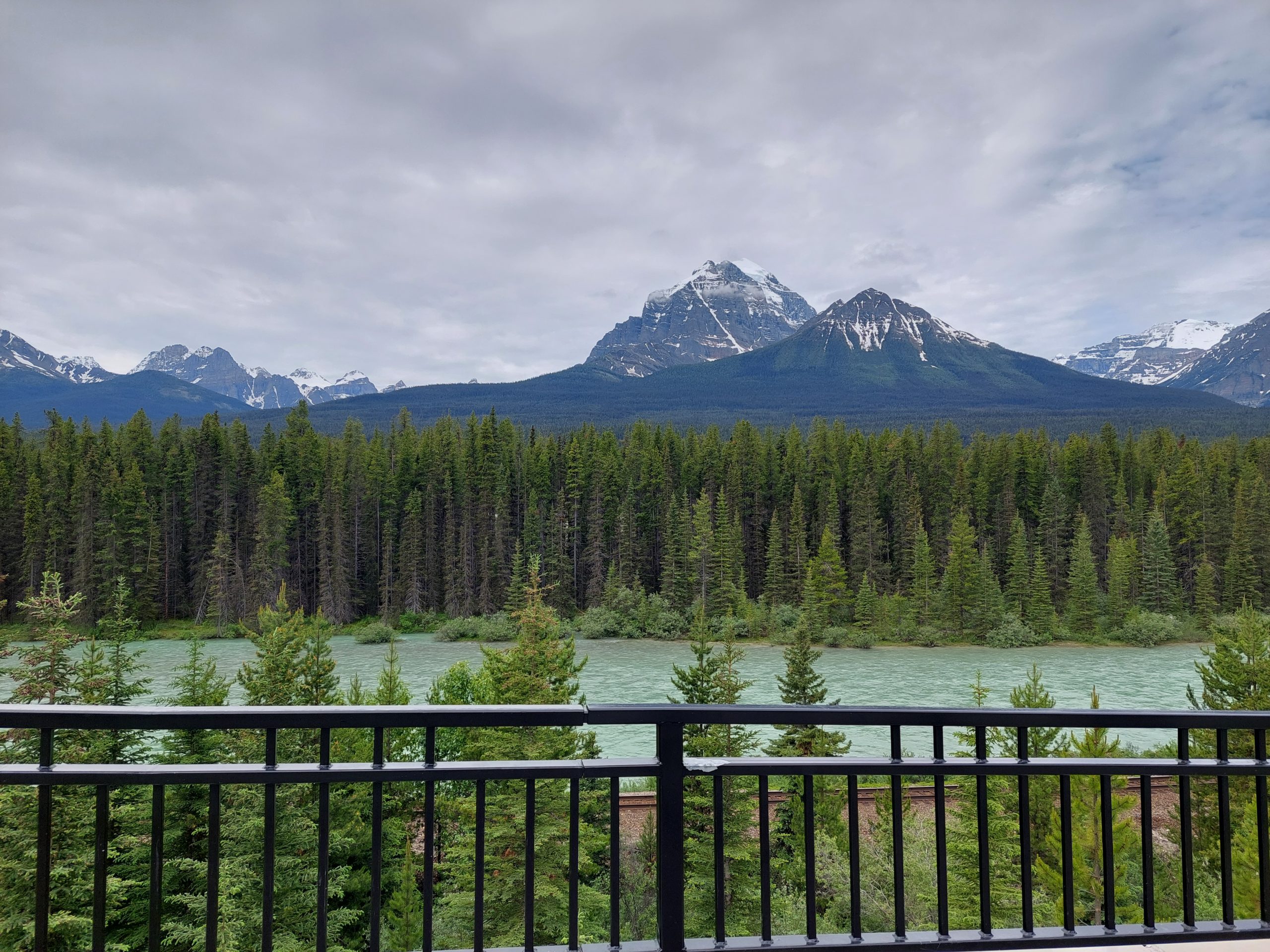
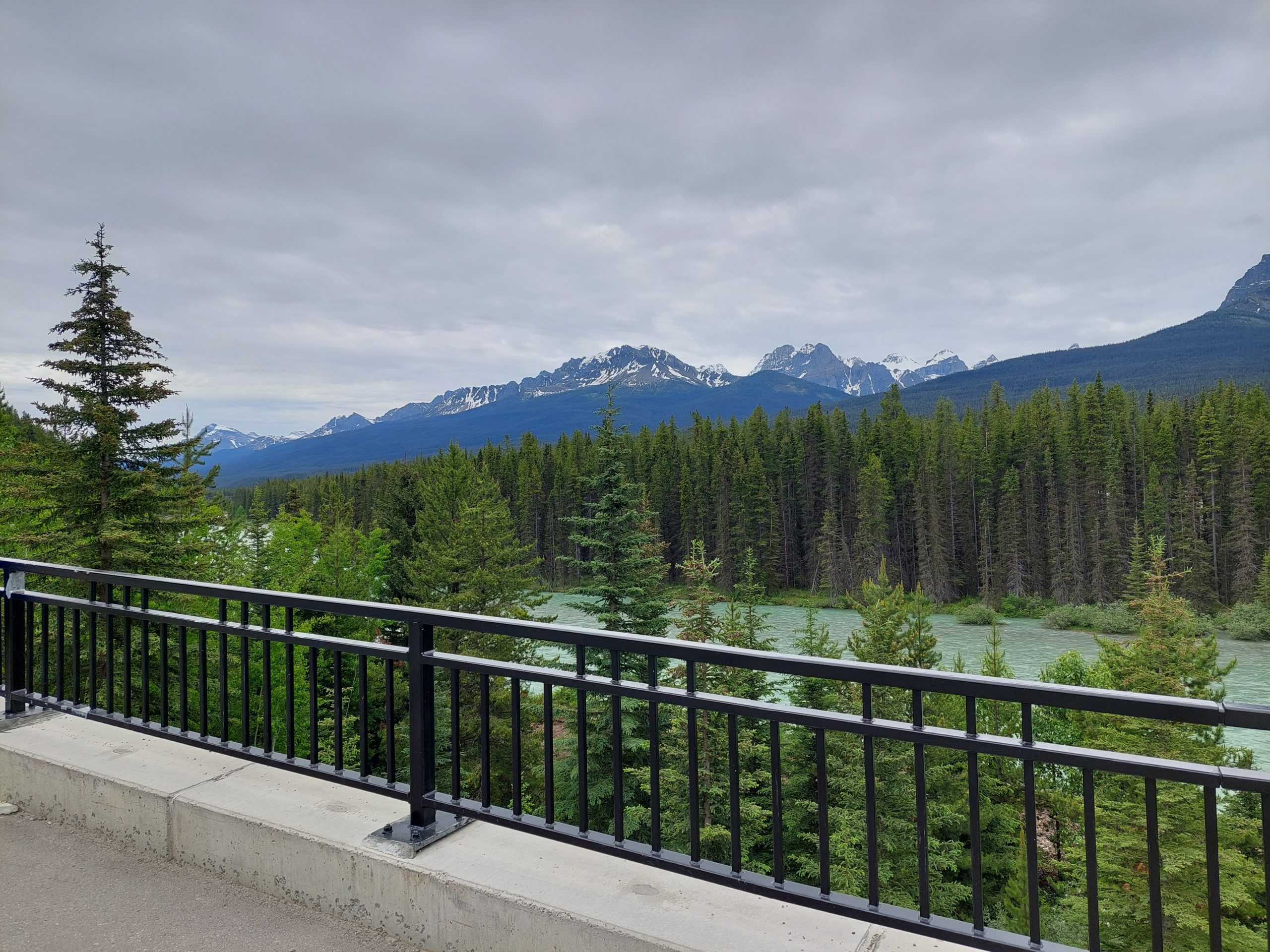
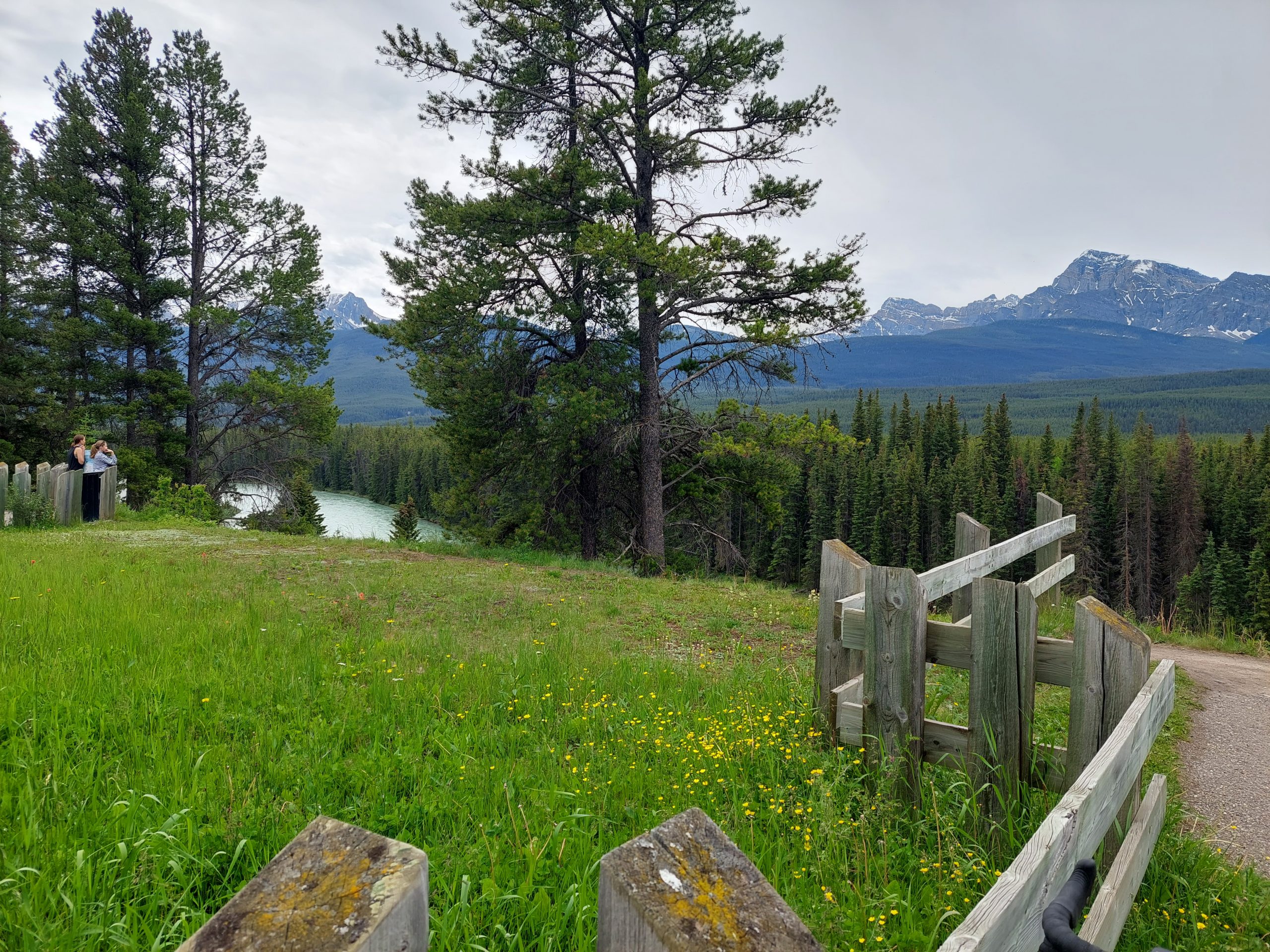
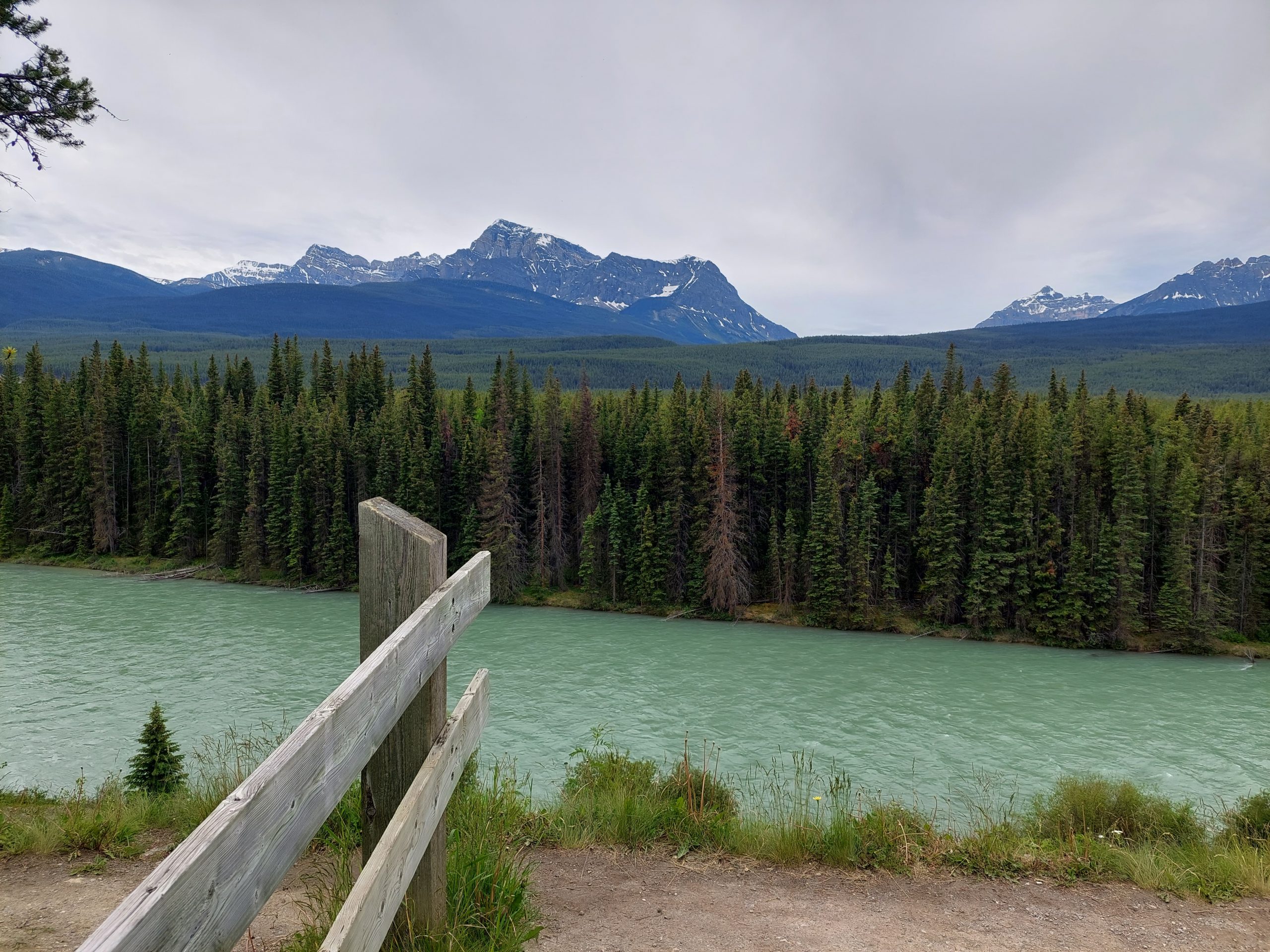
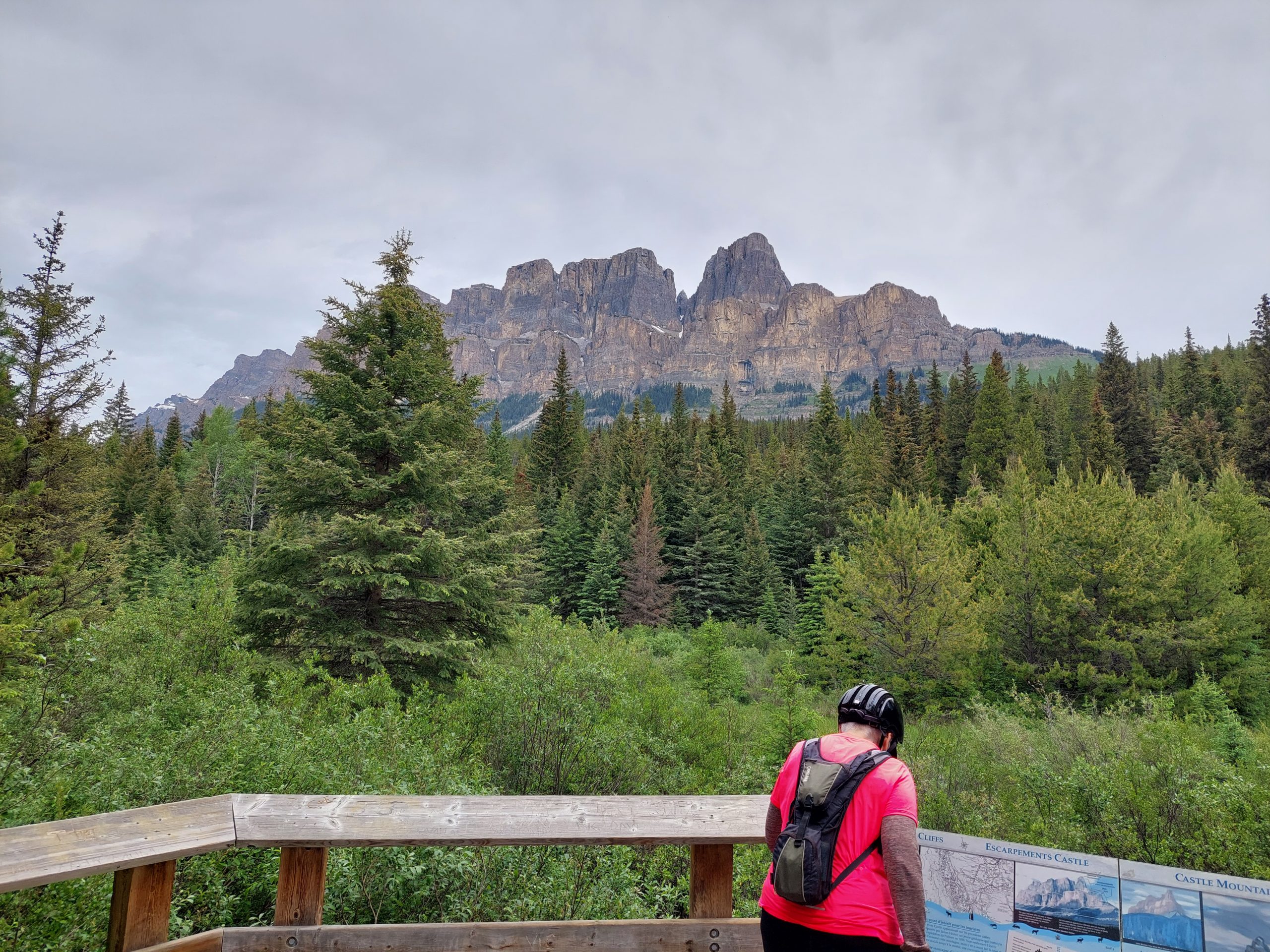
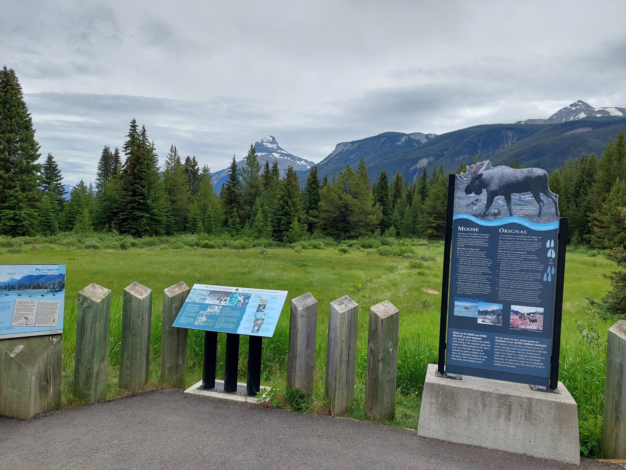
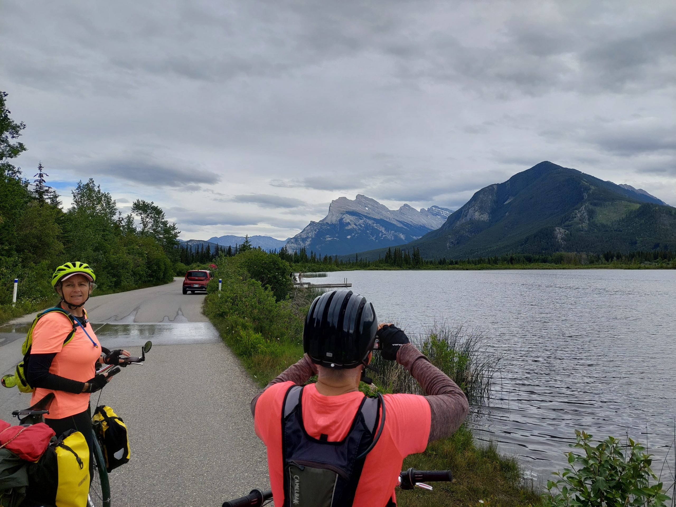
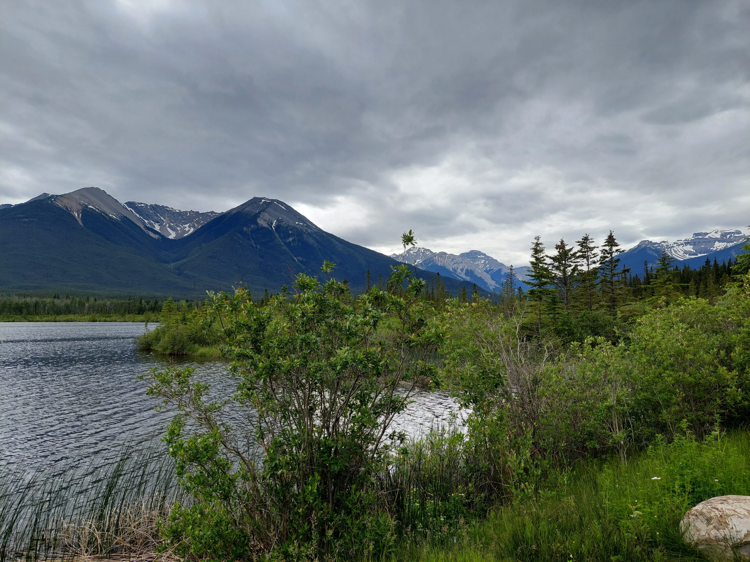
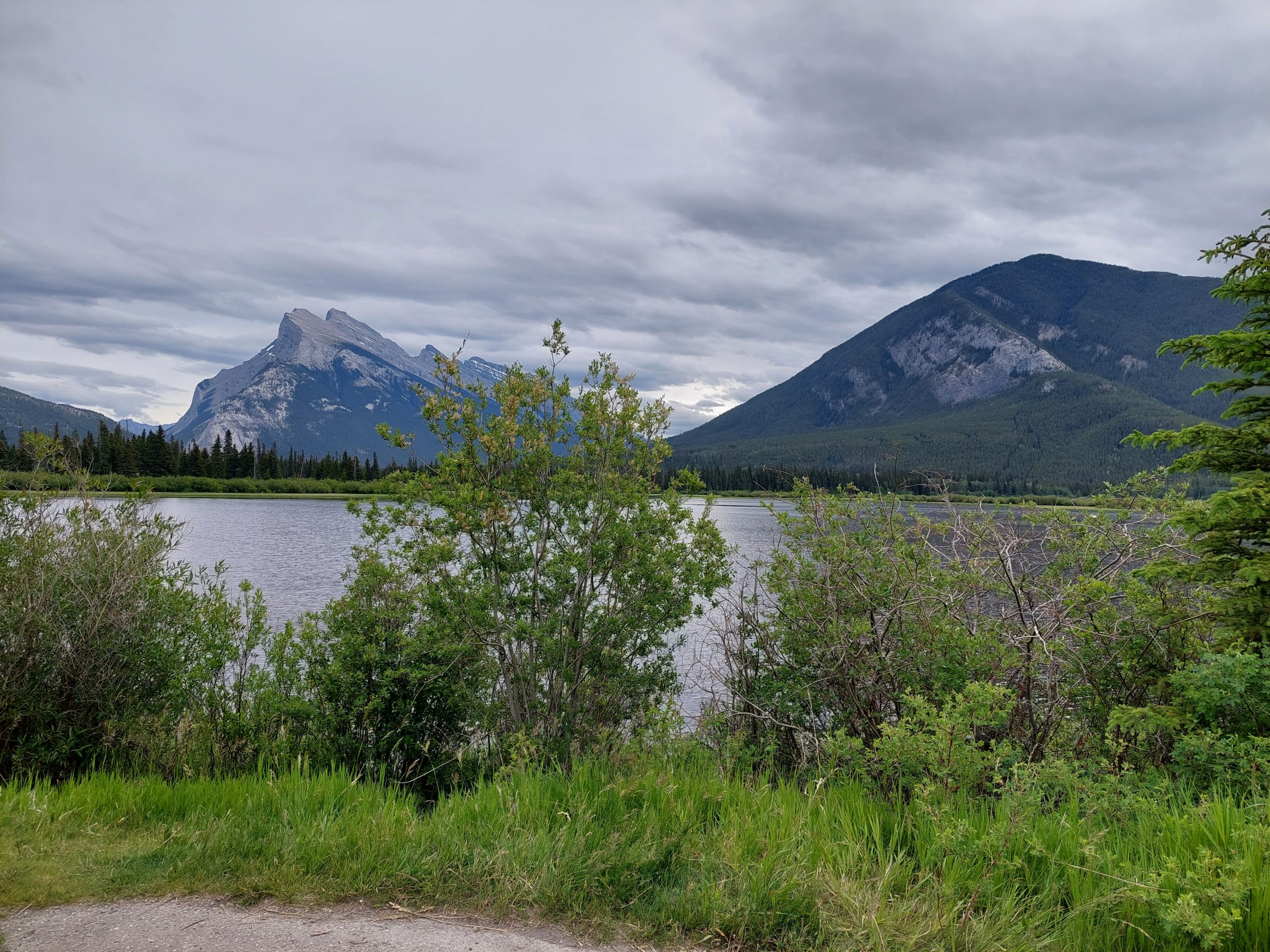
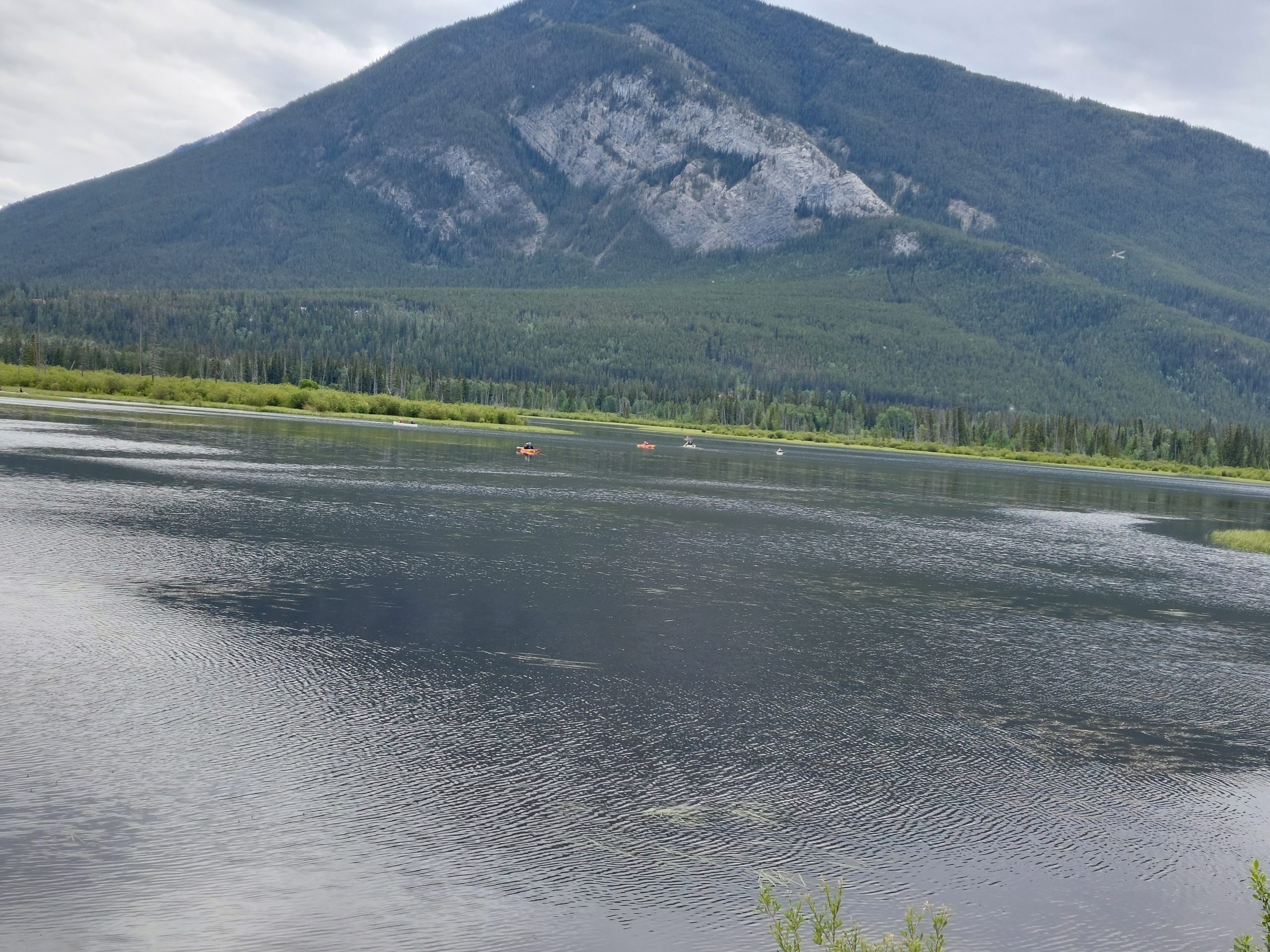
The Bow Valley Parkway was very pretty, as pretty as the Icefields Parkway, and it was obvious we were coming into more temperate ecosystems — the plants were a little more like home, and a bit thicker on the ground too. The ride was mostly uneventful, but we did have to stop to let a young bear cross the road at one point. We rode on, stopping at scenic places with names like Morant’s Curve, Castle Mountain, Moose Meadows, and Vermilion Lakes…
On Our Way!Iconic Morant’s CurveBow RiverMorant’s CurveBus Stopped For BearBow Valley ParkwayAnneScenic Bow ValleyBow RiverCastle MountainMoose MeadowJust Outside BanffVermilion LakeVermilion LakeKayaks
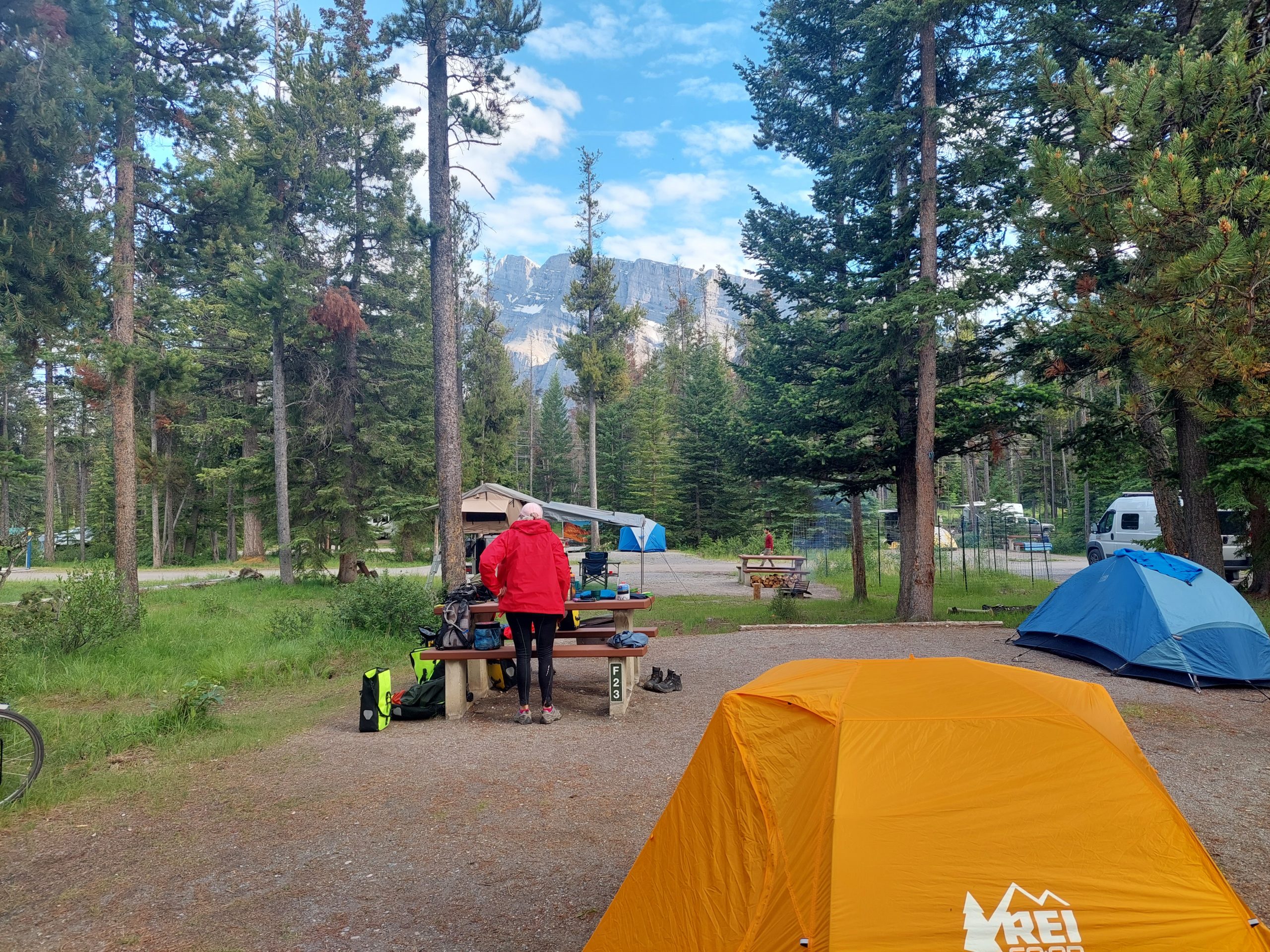
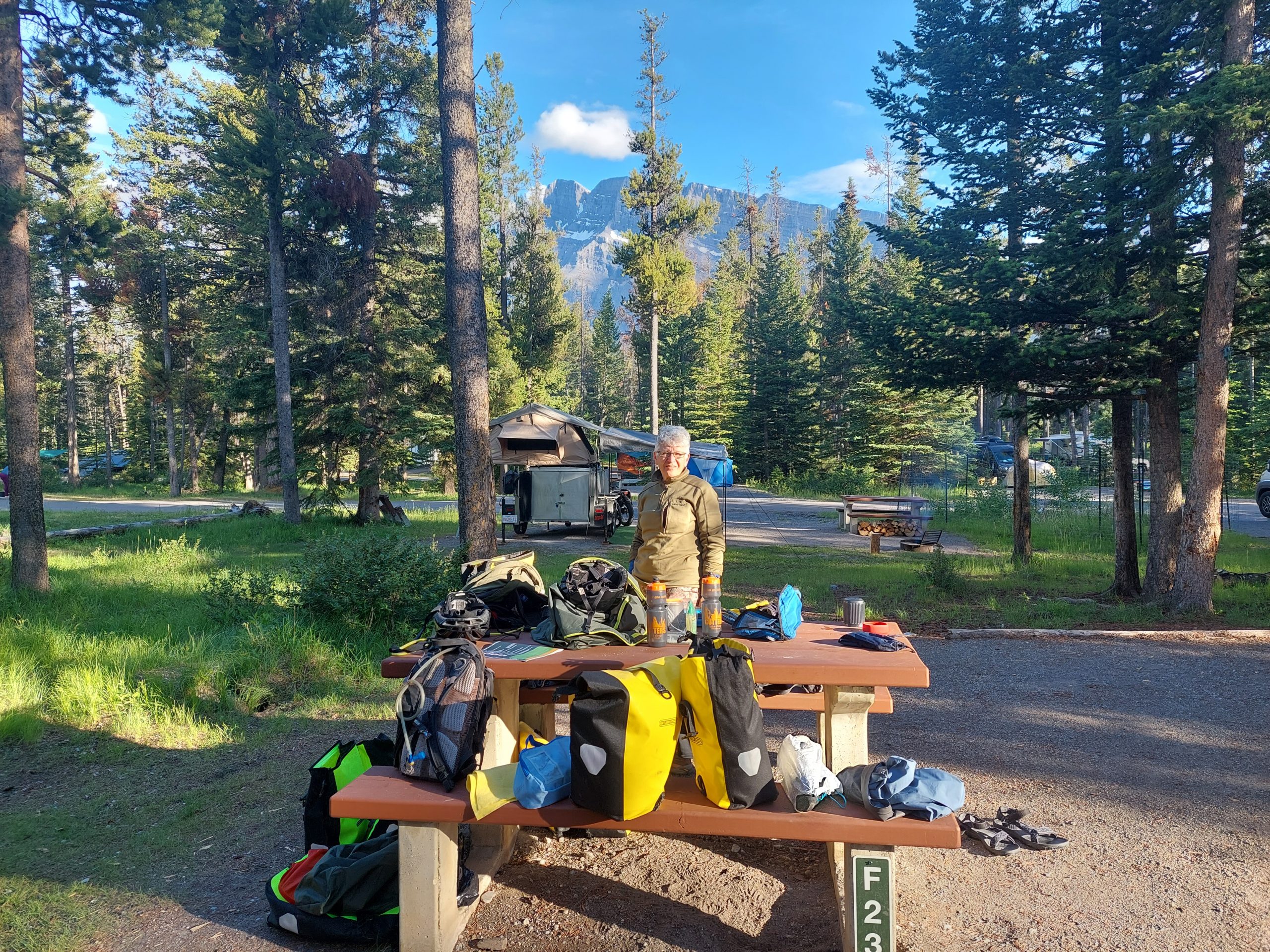
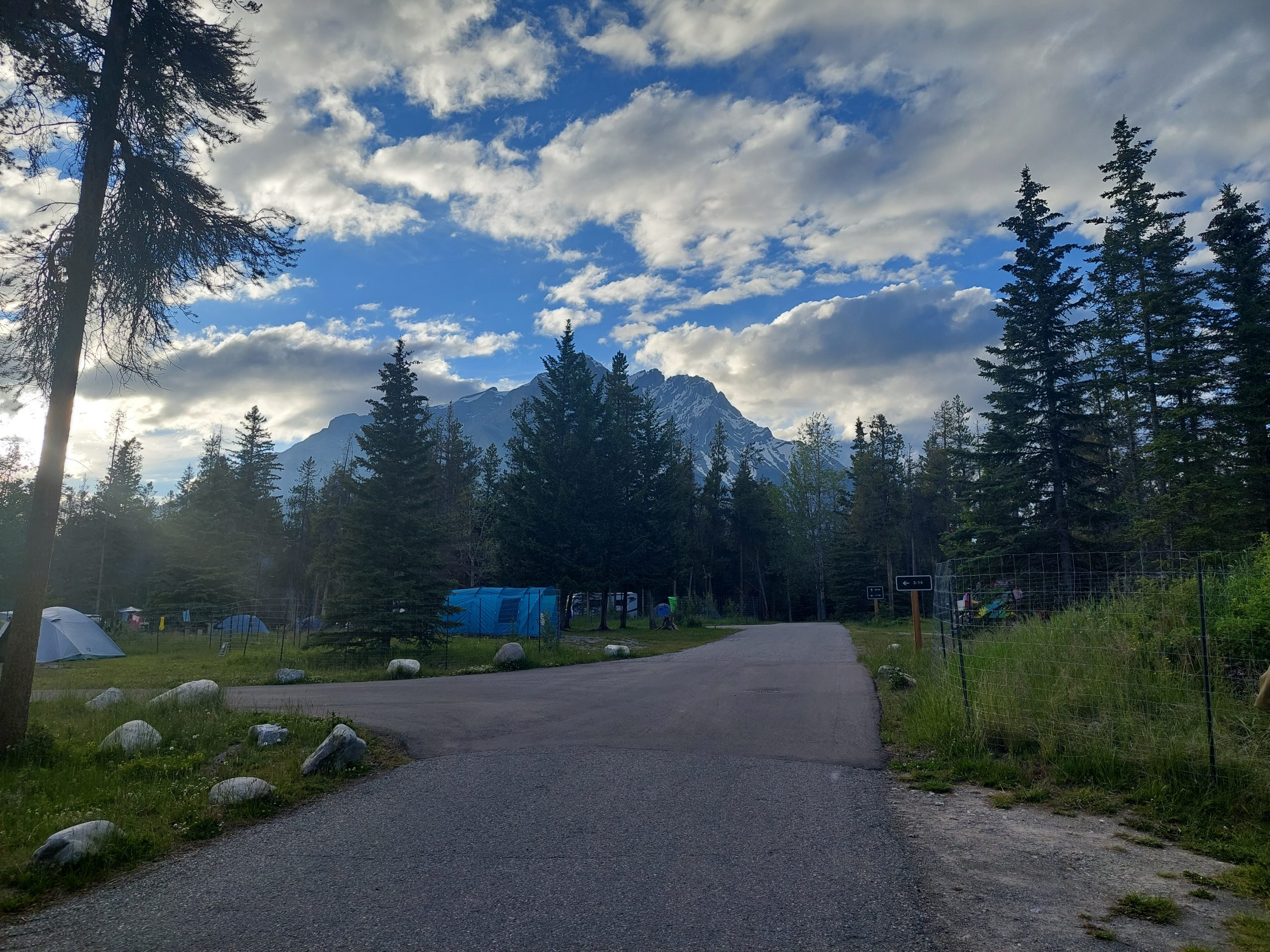
Banff, the town itself, was considerably less idyllic and more hectic than the ride there. We stopped at the first place we saw (mistake), a Tim Horton’s (big mistake), and when we parked the bikes I saw a woman painting her be-stickered and graffiti-covered car with a paintbrush and gray house paint. I said hello (huge mistake) and she bombarded me with a torrent of pressured speech about the car and bad decisions, etc; we retreated into the Tim Horton’s, but it was a mob scene so we hopped back on our bikes and rode straight to our campsite, another mile or so up the road.
JulieAnneMountain ViewFlowers
This was Tunnel Mountain Village I, and it was awesome: a really big place but spacious and comfortable, with running water and showers and beautiful views everywhere. We showered, ate, took a walk around our new neighborhood, and fell back into our tents.