In my database of towpath-accessible amenities, my original definition of “accessible” was simply “within a half mile, by paths available to a cyclist, of an access point.” This seemed pretty reasonable — people don’t really want to travel more than a few hundred yards off the trail to get a bite or whatever, and beyond that point an amenity isn’t really part of the trail ecosystem anymore. This break-off point is more or less arbitrary, so I chose a half mile as a nice, round and fairly inclusive distance.
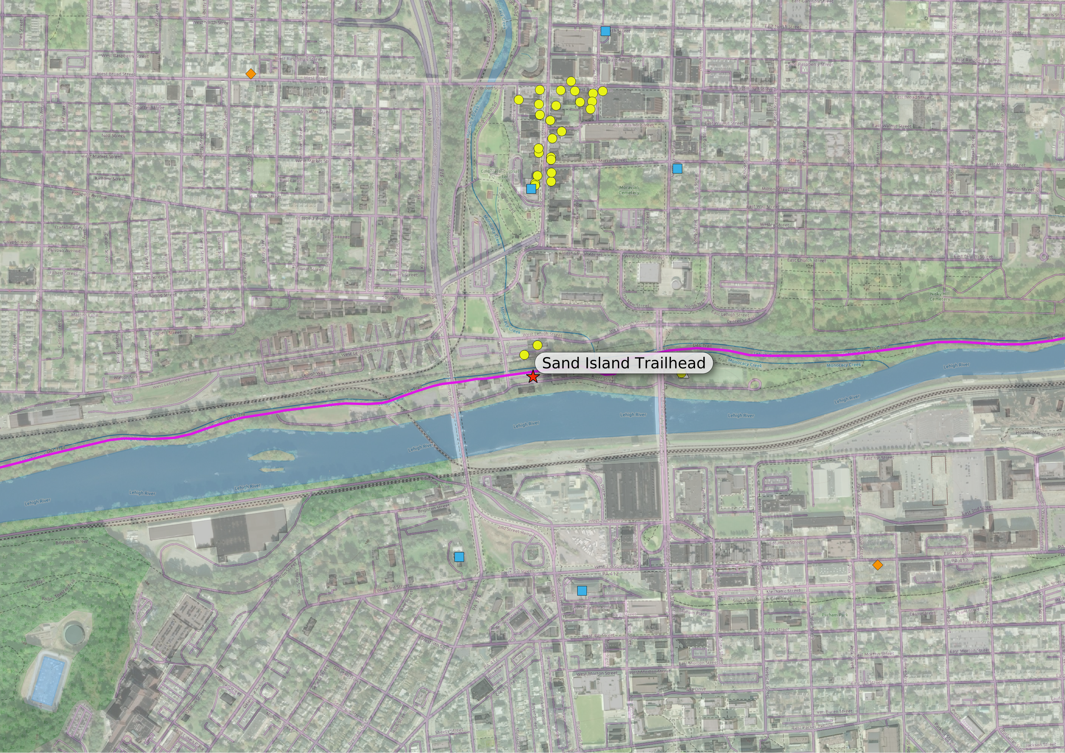
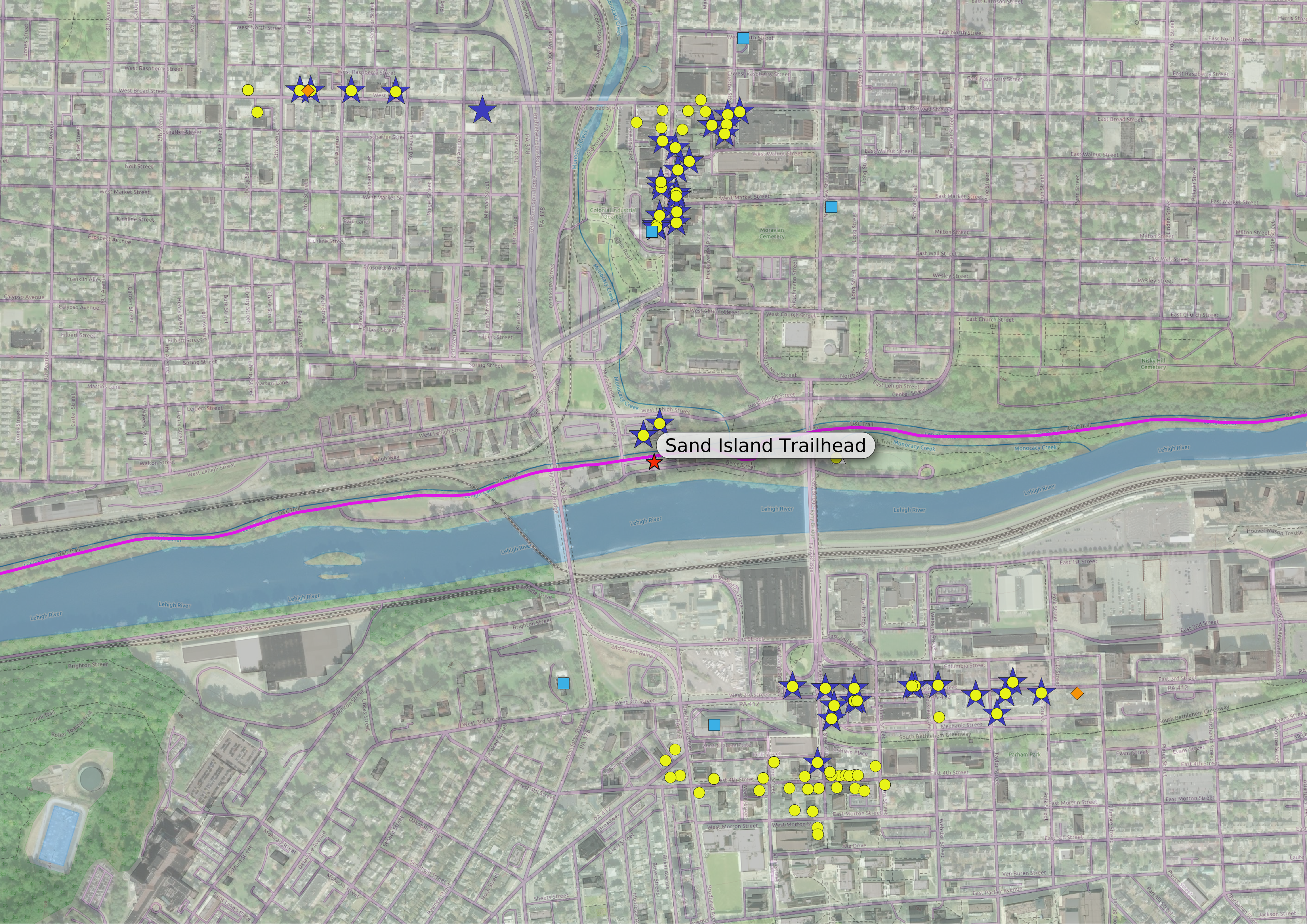
As an example of what this might look like, here is a view of the Sand Island trailhead, with accessible amenities selected using this simple definition:

You can see that there is not much available immediately near the trailhead, and then further north there’s a hotel (blue square) and a bunch of food/drink amenities (yellow circles) on Main Street’s “restaurant row.”
I saw two issues with this. One is that people will probably be willing to go a bit further from the trail to get to lodging or a bike store, but these places are not shown, and the other issue is that the arbitrary break-off point comes in the middle of a dense clump of amenities — this is the case with “restaurant row” — and it seems silly to include one restaurant just under the half-mile cutoff while excluding the four next door, just beyond it.
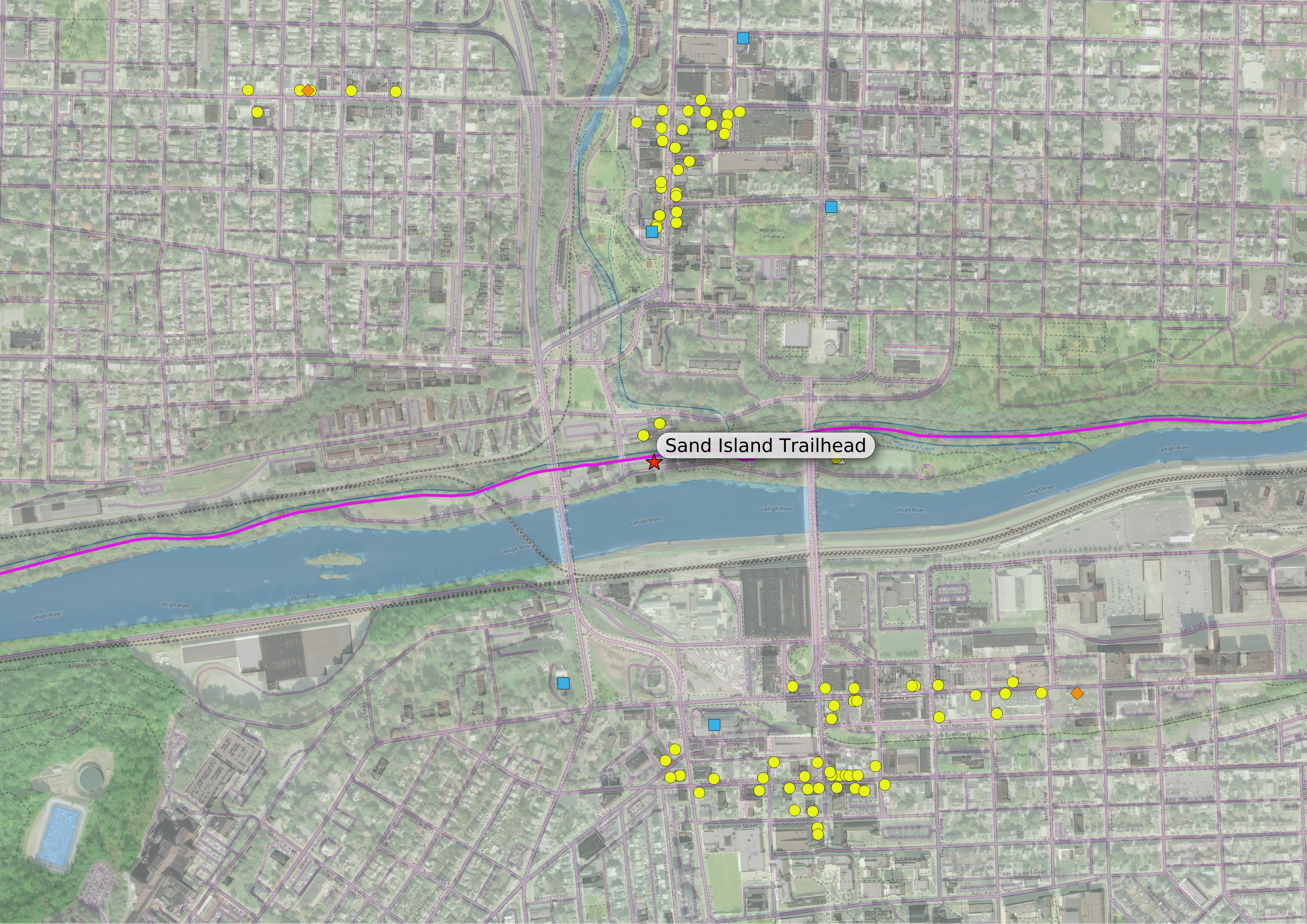
So (to address the second issue) I expanded my definition to include clusters: if there is a dense group of amenities, and at least one of the amenities in the group is within a half mile of the trailhead, all of them in the group are considered accessible.
I also included any lodging or bike store within a full mile of the trailhead (to deal with the first issue), and now the map looks like this:
The map now includes the rest of the tourist/nightlife area near Broad and Main Streets, as well as several more hotels and two bike stores (the orange diamonds). This is the version of “accessible” my amenities map uses.
But should I be even more expansive in my definition? What if someone wants to find a restaurant near their hotel, or near a bike shop, and the hotel or bike shop is one of the outliers, nowhere near the other “accessible amenities” even if there might be places nearby? (This actually happens in Bethlehem, where there is a separate business district on the south side of the river.) I decided to explore this possibility.
My first approach to a more expansive definition of accessibility was to expand my definition of an accessible cluster: if a group of amenities contains anything considered accessible, like an amenity within a half mile of the trailhead, or a hotel or bike shop within a mile of the trailhead, then all amenities in the group are accessible. The new amenities can be seen in this map:
This was easy to implement, it just meant a tweak or two to the function I used for the original cluster definition. Now the Southside downtown is pretty well represented. By the way, here is the same map, but with clusters (accessible and inaccessible) shown:
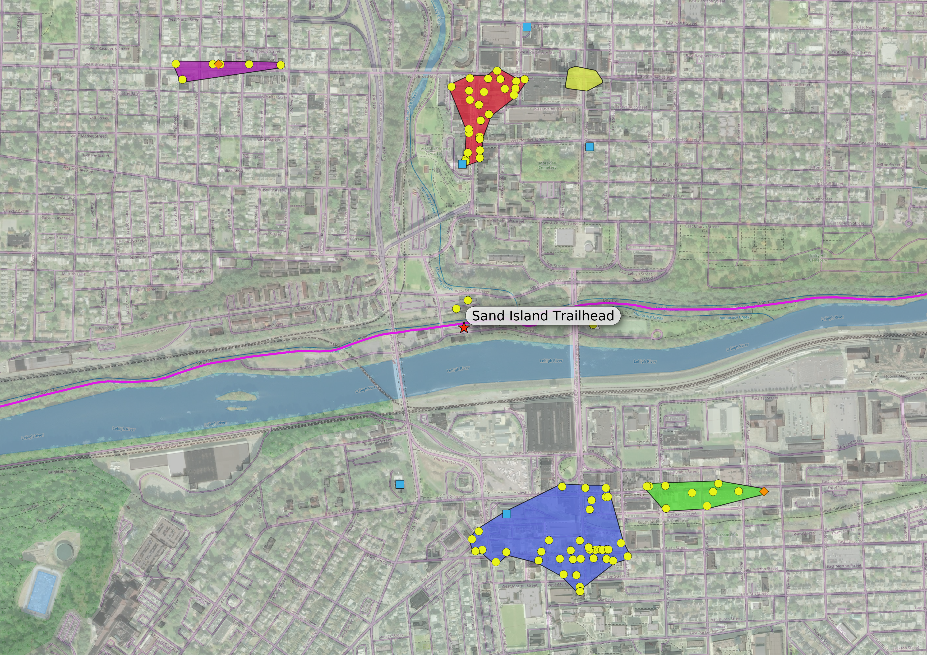
The colored polygons in this map are the regions where clusters of amenities can be found. (Note the yellow polygon in the northeast corner. That represents a cluster where no amenity met any of my criteria, and no amenities are shown.)
I worked out this definition of accessibility about the same time as the original clustered version, but didn’t use this definition for my map because it seemed a bit too expansive, with these second-order amenities — accessible not to the trailhead per se, but to other places that someone may want to visit — making the whole map too busy without adding much more value. After all, if someone wants dinner recommendations near their hotel, they can always ask at the front desk…
But lately I’ve been thinking about a different approach to expanding my definition: what about the routes from the trailhead to the hotel (or bike shop), would it be useful to show the amenities along the way? Here is a map, just of the amenities that are within 50 yards of the shortest path to the accessible hotels and bike shops:
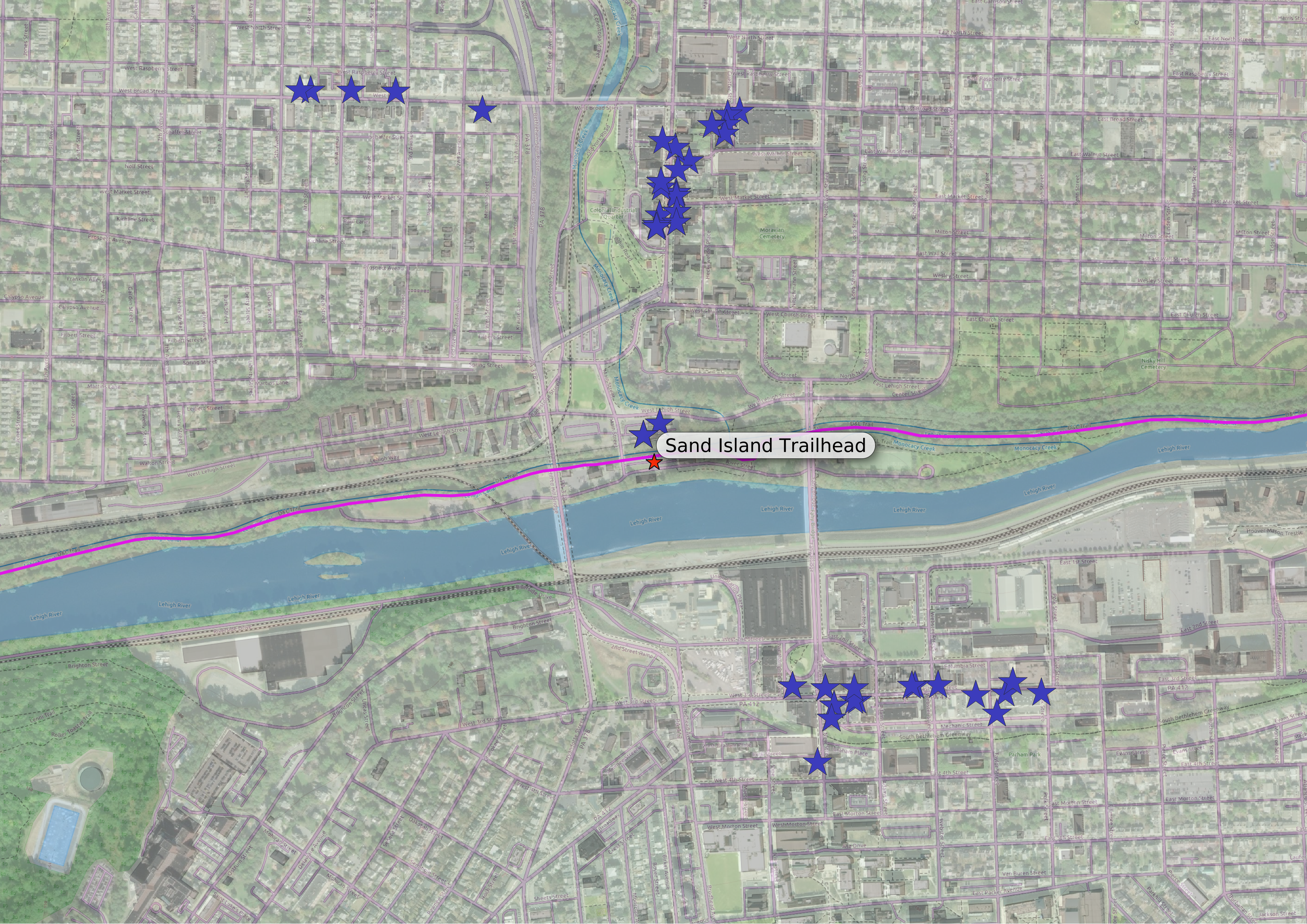
This seems to strike a happy medium, inclusive but not too inclusive. Here are those amenities along the hotel/bike shop routes, with the more expansive version of the clustered amenities superimposed:
I kind of like this approach, though I wonder if it’s more a CYA reflex: I don’t want hungry people to pass restaurants on the way to the bike shop, and not see them on my map. After all, this is still a second-order set of amenities, and even if it’s not quite as busy as my first attempt at a more expansive definition, there is a lot of overlap. I’ll be thinking about this a bit more…
