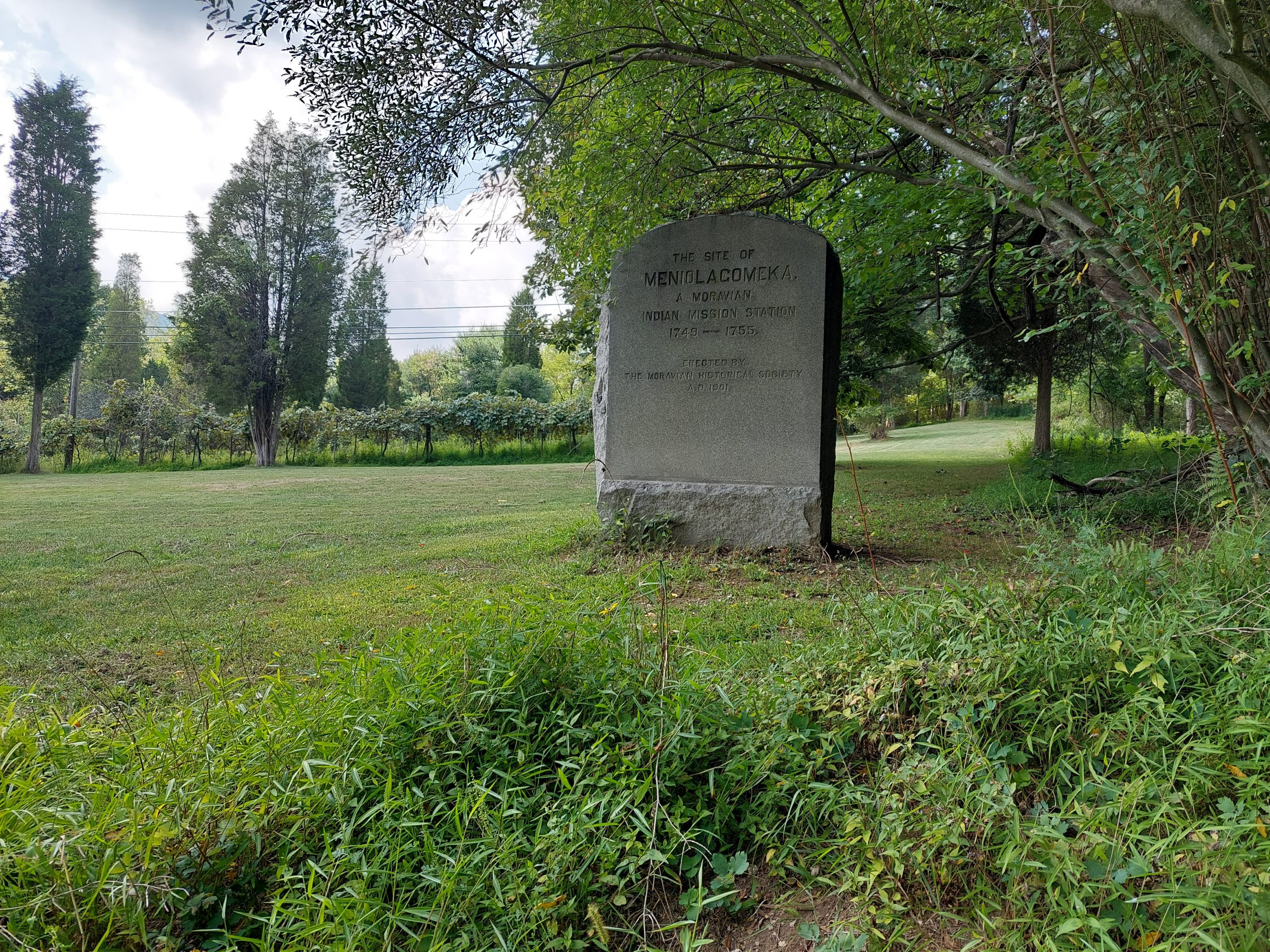
Meniolagomeka (“fat land in the midst of scarcity”) was a small Lenape village near what is now Kunkletown, on the banks of the Aquashikola Creek just north of Blue Mountain at Smith’s Gap. The Moravians had converted many in the village, and eventually founded a mission station there, but some time after the Walking Purchase the natives were evicted by the colonial authorities, and the Moravians relocated them to Gnadenhuetten (Lehighton). The actual location was pretty much forgotten for a century, until the Moravian Historical Society rediscovered it and put up this memorial marker.
The village is not far off the route of one of the more iconic local bike rides — among my crowd anyway; it’s part of the old Gap Gallop century ride, crossing Blue Mountain at Little Gap and returning via Wind Gap a dozen or so miles further down the ridge — but I had no idea anything like this was here until recently. After the week of kitchen disasters we just had, Anne and I both needed a big ride, so even though the Blue Mountain route doesn’t really follow many native paths, and the Meniolagomeka site does not figure prominently in my Native Paths project, I thought it would be neat to do the ride, and make an effort to find the old memorial stone.
So that was the ride we did on Friday, with our friend Dwight H.
Our ride took us up Township Line Road, through Bath and Moore Township, and out to Danielsville via the little roads that run south of the mountain. Blue Mountain Drive was being repaved and was down to one lane the whole way to the top, but the construction guys gave us some traffic assistance (and an audience) for the climb. We regrouped at the top, then bombed down the hill, past the ski resort and made the right onto Smith Gap Road.
The memorial is on a road called Chestnut Ridge Road, a turn off Smith Gap Road (and pretty much at Smith Gap). We turned off our route, spent some time admiring Aquashikola Creek, and then rode a few hundred yards up the hill and found the stone — it was at the edge of a field, on what looked like private property but close to and easily visible from the road. We stopped, took some pictures and paid our respects, and then continued on our way. (We heard thunder so we weren’t sticking around.)
The rest of the ride was pretty uneventful, though we did get caught in a storm cell (a little cold rain actually felt good), and we also stopped at the “Snoopy Barn,” where Dwight took a few selfies. All told, we got in about 67 miles in just over seven hours. (I took about a mile off the beginning and end of the ride on my map, to preserve some privacy.)
