We had an earthquake today. Anne and I were watching Iris, and hanging out in the living room when there was a sort of whump! against the house, and a low rumble. Anne thought it was a really crazy wind gust, while I thought it might have been a truck rolling by outside. I started suspecting something else when I looked out the window: no wind, no trucks, and the rumble continued for a few seconds longer…
I looked it up on the USGS site (no mean feat when Iris is around, and really into our electronic gadgets — we usually keep them hidden), and sure enough there was an earthquake, 4.8 on the Richter scale, out near Whitehouse Station NJ. Meanwhile, our phones lit up with messages: neighbors, friends, and Anne’s siblings too, from nearby and from as far away as Connecticut. (Her brother lives near the epicenter, and they had pictures fall off the walls.) We were listening to WXPN out of Philadelphia when it happened, and they played “Whole Lotta Shaking Going On” (and other songs like that), so I guess they felt it down there too.
So that makes five earthquakes I’ve experienced, all on the East coast:
- In high school, probably junior year, we had one during school hours. No one knew it at the time, I was in class and I remember glancing at the door — it sounded like one of those wheeled carts they used in school, rolling down the hall just outside.
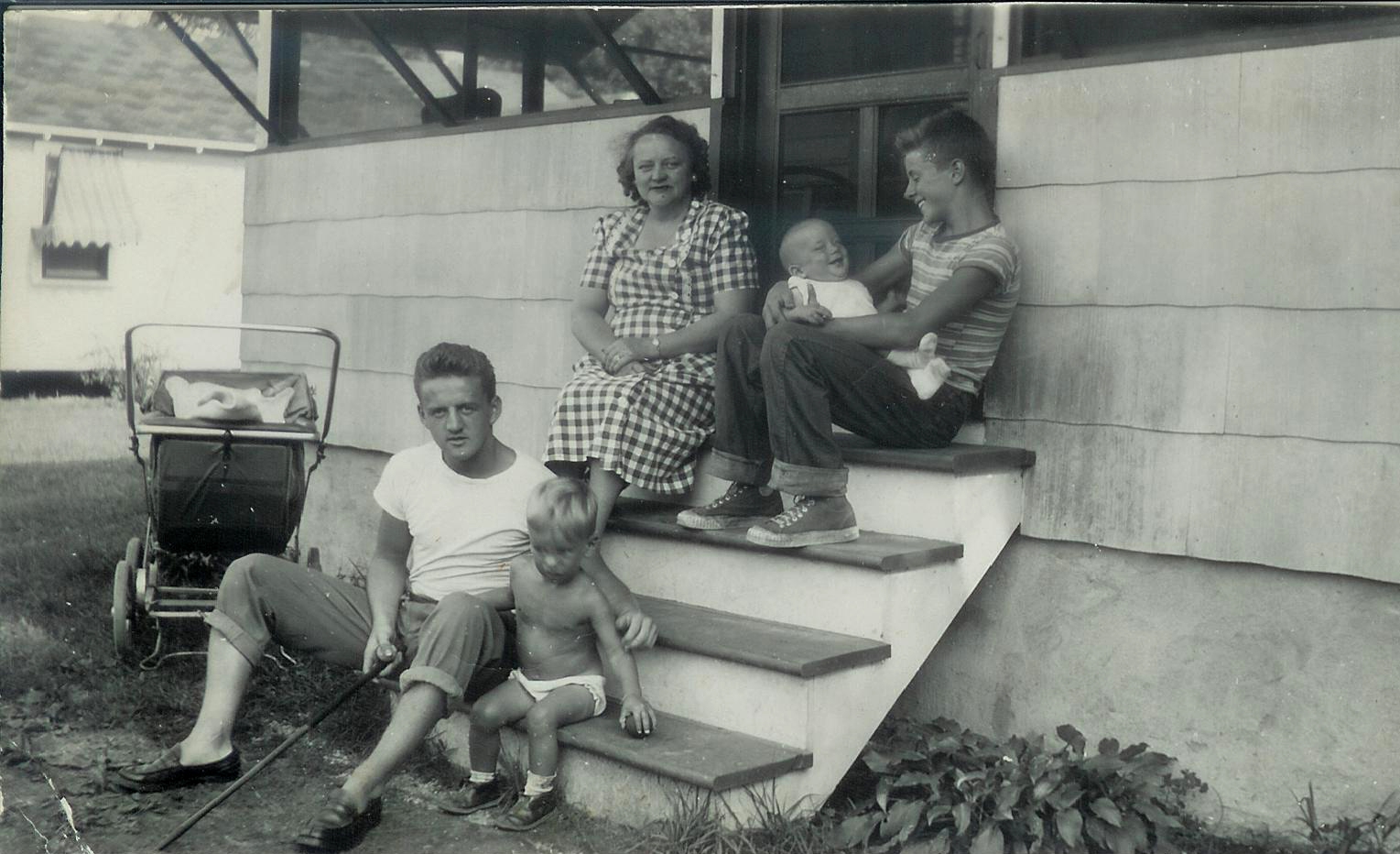
- Not long after high school, my brothers and I were hanging out in the front yard, and there came a weird groaning from the cement porch. I looked at the porch, and I must have looked like I thought I was losing my mind, because my brother said “yeah I heard it too.” It turned out to be another earthquake.
- Early Eighties, I was living in Boston and I was awakened in the middle of the night by what I thought was a passing subway (Boston has subways, but I didn’t live anywhere near one). The next day it was all over the newspapers — we’d had an earthquake.
- We had one while I was at work maybe twenty years ago, the first of the bunch that was recognizable as an earthquake while it was happening. It was small and pretty close to my office, which was close to the epicenter of today’s.
Anyway, we just finished a pizza dinner with Emmi & Kyle (and Iris). Tomorrow is a ride to the farmer’s market in Easton.
UPDATE: WE had an aftershock about 6:00 last night, but I didn’t notice it. Also, there was another earthquake here, maybe 2010, strong enough to require repairs to the Fahy Bridge (which TBH may have already needed repairs).