It is interesting to contemplate an entangled bank, clothed with many plants of many kinds, with birds singing on the bushes, with various insects flitting about, and with worms crawling through the damp earth, and to reflect that these elaborately constructed forms, so different from each other, and dependent on each other in so complex a manner, have all been produced by laws acting around us. These laws, taken in the largest sense, being Growth with Reproduction; Inheritance which is almost implied by reproduction; Variability from the indirect and direct action of the external conditions of life, and from use and disuse; a Ratio of Increase so high as to lead to a Struggle for Life, and as a consequence to Natural Selection, entailing Divergence of Character and the Extinction of less-improved forms. Thus, from the war of nature, from famine and death, the most exalted object which we are capable of conceiving, namely, the production of the higher animals, directly follows. There is grandeur in this view of life, with its several powers, having been originally breathed into a few forms or into one; and that, whilst this planet has gone cycling on according to the fixed law of gravity, from so simple a beginning endless forms most beautiful and most wonderful have been, and are being, evolved.
Charles Darwin, “The Origin of Species”
I saw that quote when I was looking at what I wrote ten years ago — no idea why I quoted it back then, Darwin Day is in February. Meanwhile, this is what I wrote twenty years ago. Strange to think that the two main characters (other than myself) in that long-ago Thanksgiving are no longer with us.
Speaking of Sals and maps, this is what I wrote fifteen years ago. Also, this is what I wrote twenty years ago.
RIP Debbie
I got the sad news the other day that my cousin Debbie passed away late last week. (Her obituary is here.) Her brother Eddie called and told me; he was (understandably) pretty broken up about it. It’s a tough blow for my Mom too, she and Debbie had become close in recent years. We’ll be going to the wake on Wednesday.
I haven’t been diligent about it, exactly, but I have been progressing on my Native Paths project, slowly but surely, and just yesterday I finished — I digitized my last path.
(This was part two of my project, the second pass through the book. I have pretty much followed through on my workflow: for each path I’d photograph the map in the book, clean the photo using GIMP, georeference it in QGIS, and finally digitize the foot paths (and any native villages or other notable places I’d find) by tracing them from the map. I’d also check the description for any cross-references between paths, which I’d also add to the database.)
A friend asked the other day what I would do with the project, as in how I would present it to the world, and I really didn’t have an answer. My original motivation (at least, as I remember it now) was not to produce something for other people to see, but to gain an understanding of the book Indian Paths of Pennsylvania for myself. I guess it’s time to take stock of what I’ve learned on this journey…
I think I accomplished what I set out to do, which was to gain a better understanding of Wallace’s book, its scope and its limitations; I also have a better understanding of the world the Pennsylvania natives lived in. And in the end, I also improved my GIMP and QGIS skills — I got a lot of practice cleaning, georeferencing and tracing those trail map photos!
I still have a few GIS projects I can play with — I can use the native paths project to plan some bike tours, and I also have a few “ground-truthing” things I want to do with my Sals maps — but the truth is, I have reached the end of a long, engaging, and sometimes onerous process, and I am feeling a bit of post-accomplishment blues. Oh well, something will come along, GIS or something else.
I wrote this post in January of last year, but never published it. Some additions and light editing, and here it is:
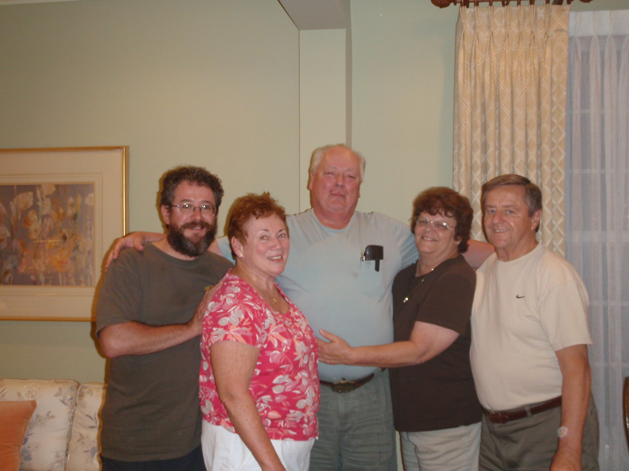
My Uncle Frank passed away a year ago last summer. I really couldn’t write much about it at the time, but here’s a post to at least mark and remember his passing.
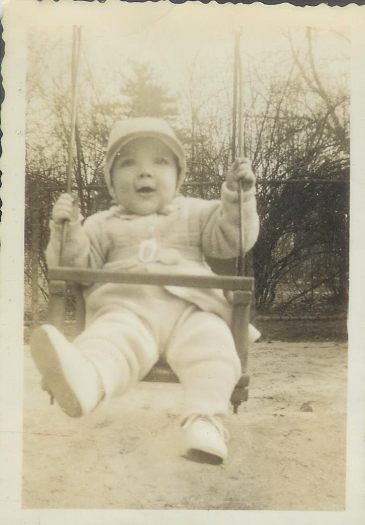
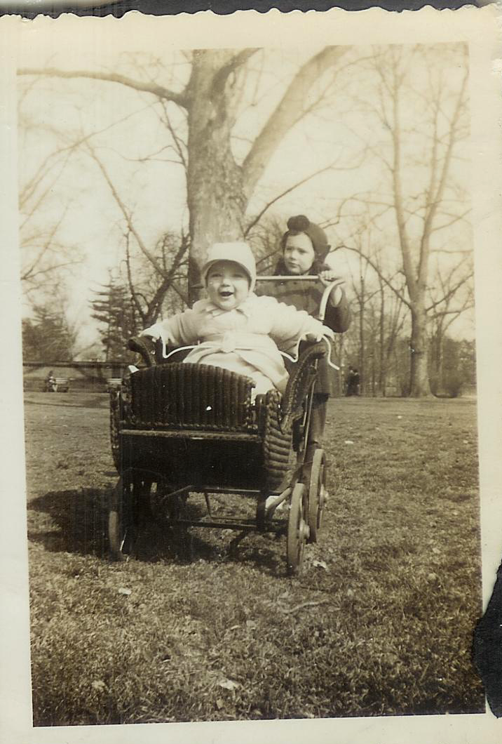
Frank was my mom’s younger brother, the middle of three; he was just a few years younger than my mom. Here are a few photos I have from my mom’s photo book. These were taken at a park in Brooklyn, maybe Prospect Park.
Uncle Frank, 1942Uncle Frank with Mom, 1942
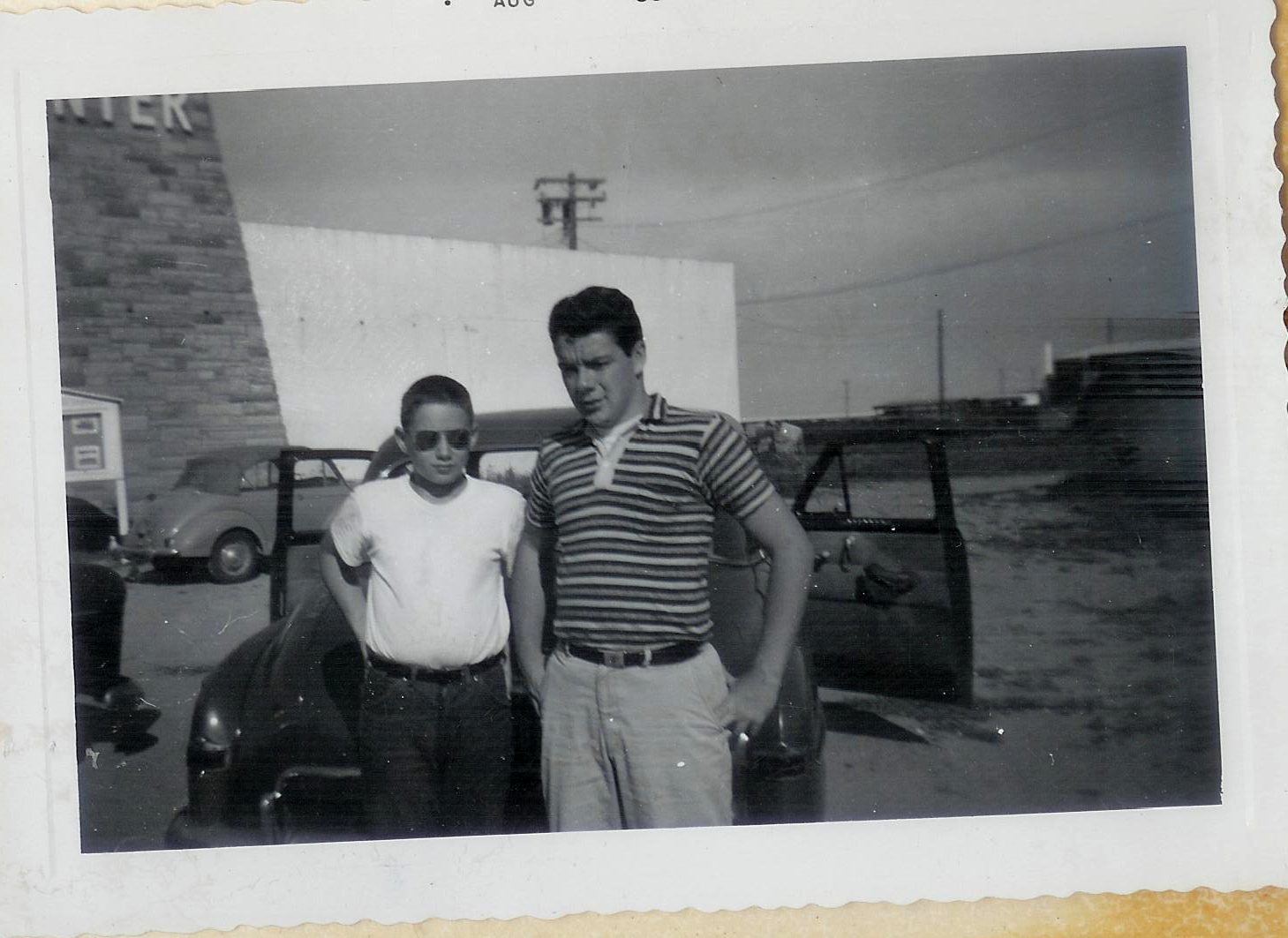
I have another photo from before my time, what looks like a vacation photo of my Uncles Pat and Frank as teenagers:
Pat and Frank, ca 1958
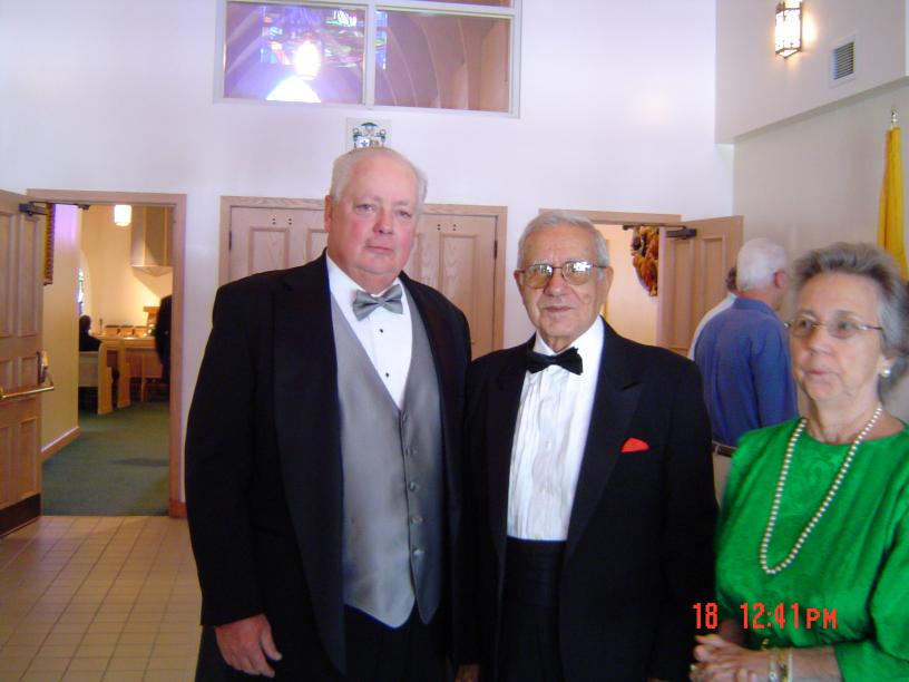
Here are some of my own photos, taken many years ago (and years apart):
Uncle Frank With Christine’s ParentsMe, Mom, Uncle Frank, Aunt Pat, And Dad
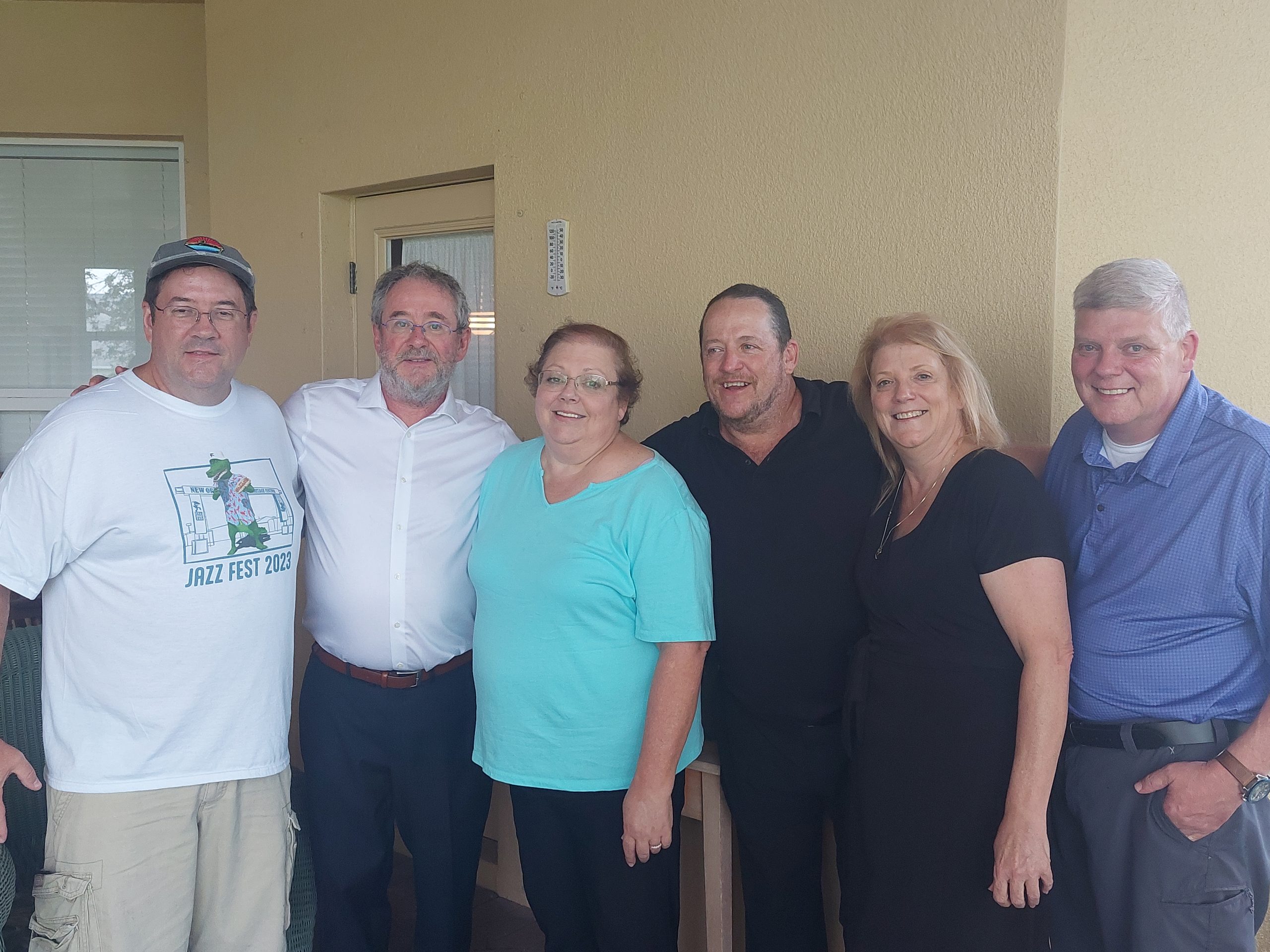
The first was at my cousin Frank’s wedding circa 2003, and the second is when My uncle Frank an Aunt Pat visited my parents in maybe 2011 or so. This might have been the last time I’d seen either of them alive and in person: they lived in Florida, Aunt Pat had health issues and passed just at the start of COVID, and Uncle Frank followed her not all that long after.
Uncle Frank and Aunt Pat had three kids (Patricia, Eileen and Frank), our families were about the same age and we spent a lot of our holidays together, but I hadn’t seen them in years; Uncle Frank’s funeral was a bittersweet reunion. Here we are together, my cousins, brothers and me at the post-funeral luncheon:
I saw recently that FreeCAD, the engineering program I played with once or twice in the past (it wasn’t ready for prime time), well it finally just reached its first official release version. I thought I’d give the new version a try, so I installed it (using Flatpak — probably a mistake, but it was the easiest choice in the moment) and got it running pretty quickly. The program looks the same, maybe a bit more polished, but it definitely works much better. That got me thinking…
There was a work project I automated years ago, then extended the automation; and then (after I retired) I decided to re-do the whole thing using FreeCAD and Python. Looking back, the actual project was a little bit boring, but playing with the programming was fun, and so I found my old programs, re-worked them a bit, and it worked great.
I won’t bore you with new pictures.
One difficulty I did run across was that FlatPak builds apps isolated in their own little sandboxes, with their own version of everything they might need in the sandbox with them, and the version of Python shipped with FreeCAD did not have some of the library moduless my original script needed. And I couldn’t for the life of me figure out how to install a library module in the sandboxed version of Python.
All I needed from the library module was a root-finding function, and in the end it was actually easier to just write my own function than continue messing with the libraries. Strangely enough, my script now runs slightly faster despite my function being less efficient (bisection in Python vs Brent’s Method in C++ or whatever), probably because I got rid of the of the slowdown of having to load that library. Once again, for small problems, small brute-force solutions have their (small) advantages.
(I don’t remember where I got the idea, all those years ago — I may have pulled it out of my ass made it up myself — but back in school I always thought that the magic number was 3000: when dealing with less than 3000 items, just use the brute-force approach.)
I also went looking for some of the models I made in my last go-around with FreeCAD. I found a few and moved them from my old laptop to my new one — backing up the old laptop along the way, I don’t think it’s long for this world anymore — but the one I wanted to find, a model of a forged tee I made, was nowhere to be found. Oh well, I guess I can re-litigate that one too, if I really want.
Right now I’m home alone. Anne’s sister Lorraine came down from Tamaqua last night (they were expecting snow), and they took off early this morning, picking up Laura on their way to a “sisters weekend” in Massachussetts. I might visit my Mom tomorrow, if I hear back from her, but otherwise I’m on my own… I am currently wearing a nice heavy wool sweater and eating fish chowder, and I will probably go for a walk in the drizzling “wintry mix” soon, to drop off some overdue library books. Thank goodness the weather has finally become more seasonable, though it is less fun outside now, and we still have a long way to go before the drought conditions are over.
One other thing: I just signed up for Bluesky. I never subscribed to Twitter, and I’ve been on Mastodon for years but it’s kind of boring (though this might be down to how I use it); we will see about the new kid.
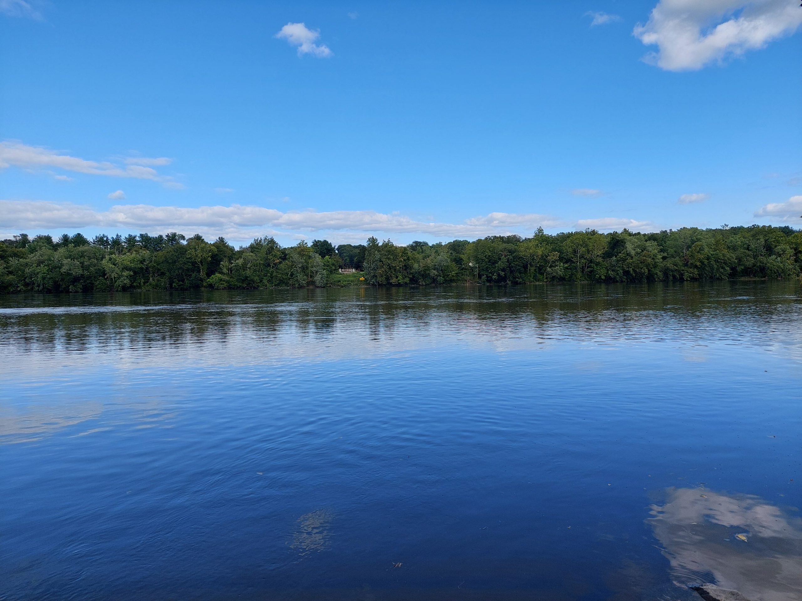
This was a short bike tour we took, a loop south along the Delaware, then west and back home by way of Vera Cruz. We took some liberties, but it was at least nominally meant to follow some of the old native paths in the area south of us.
Day One
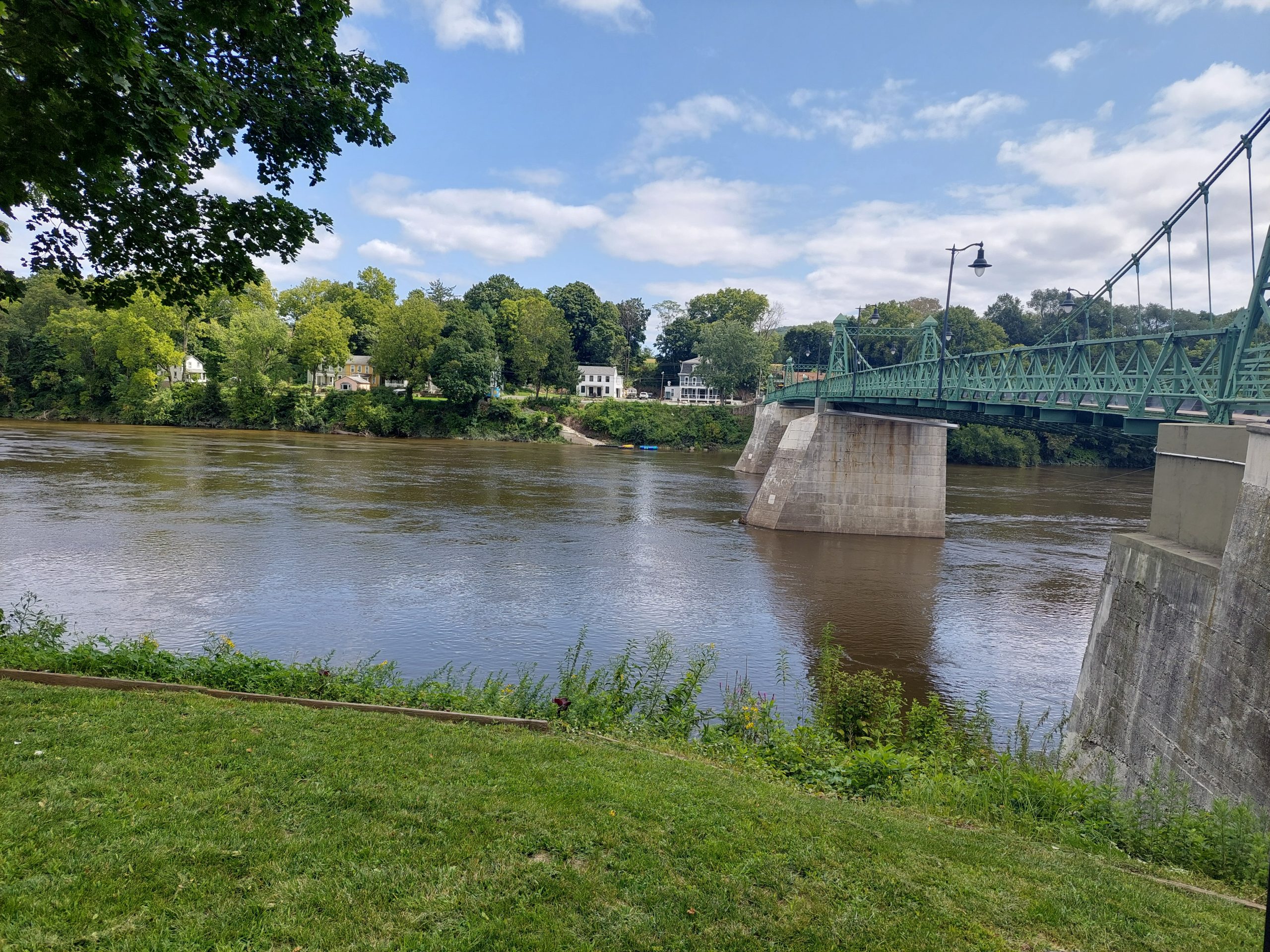
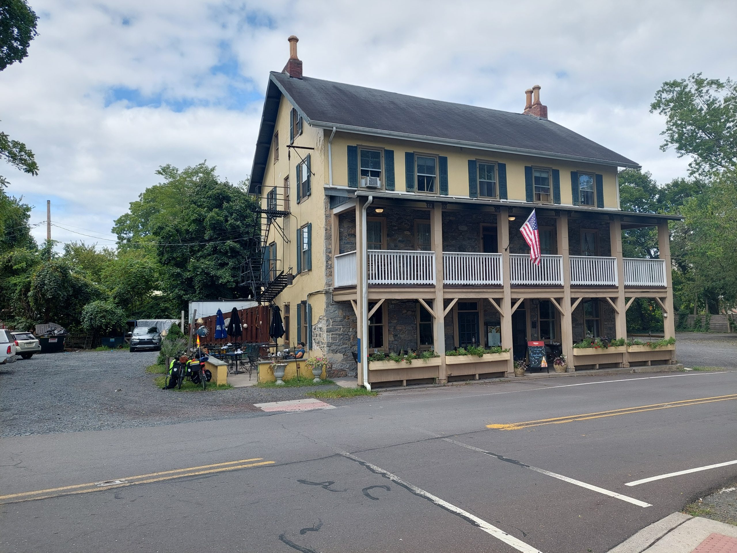
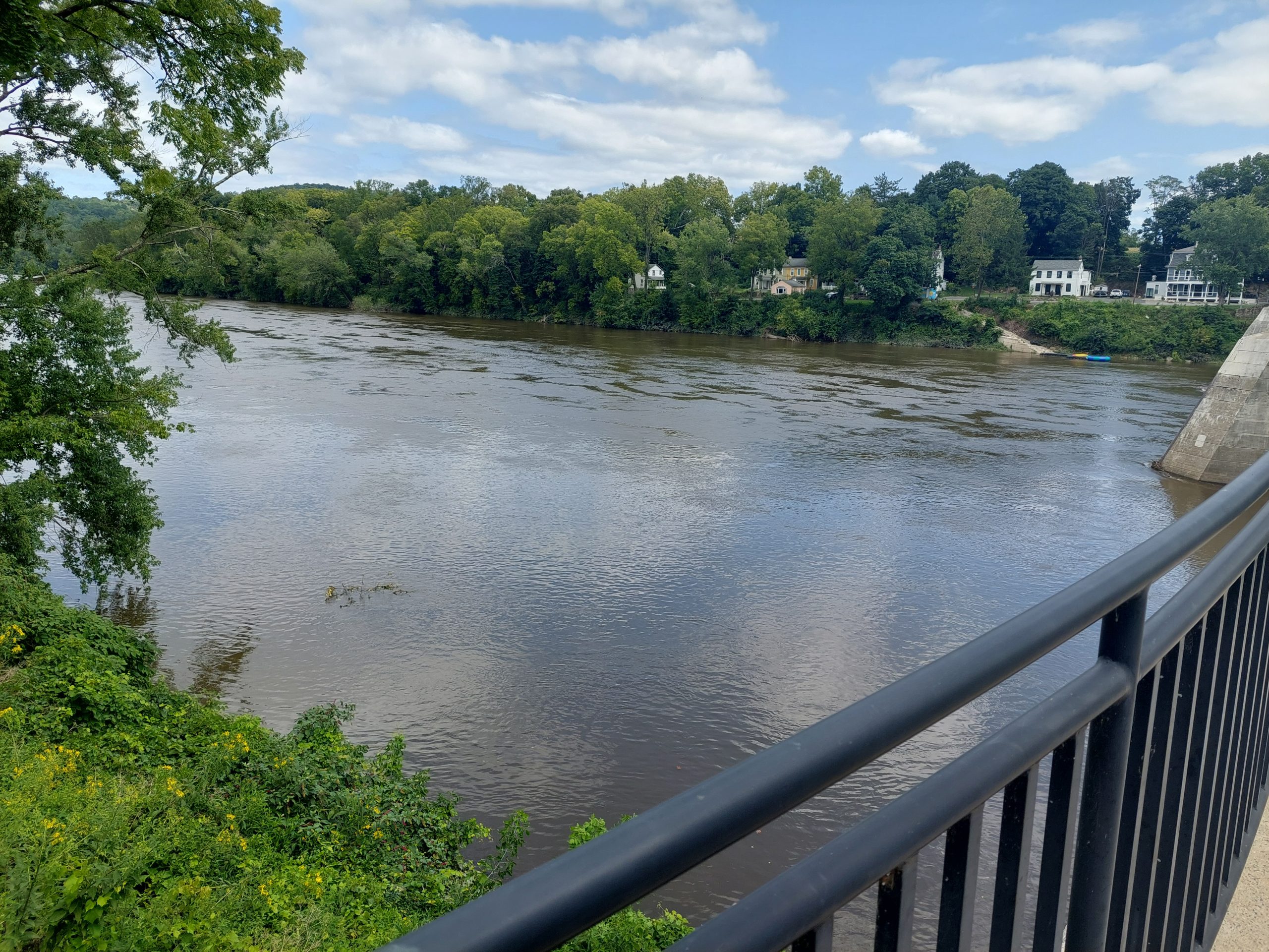
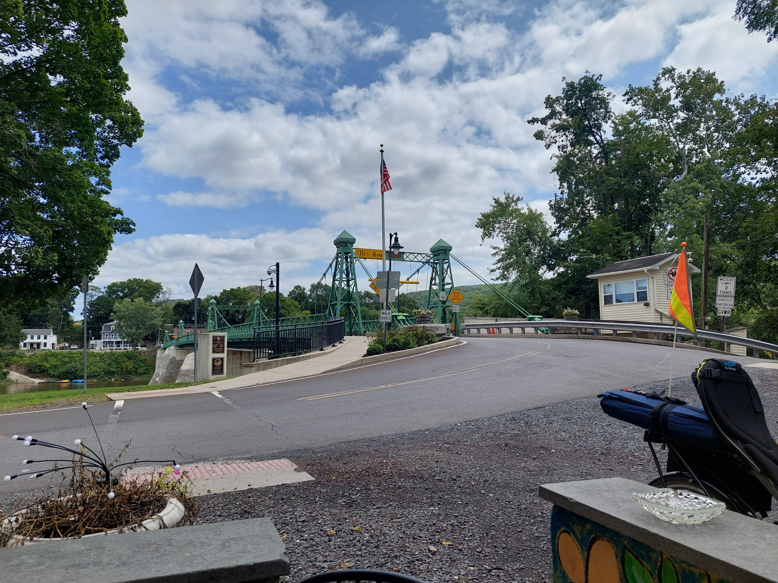
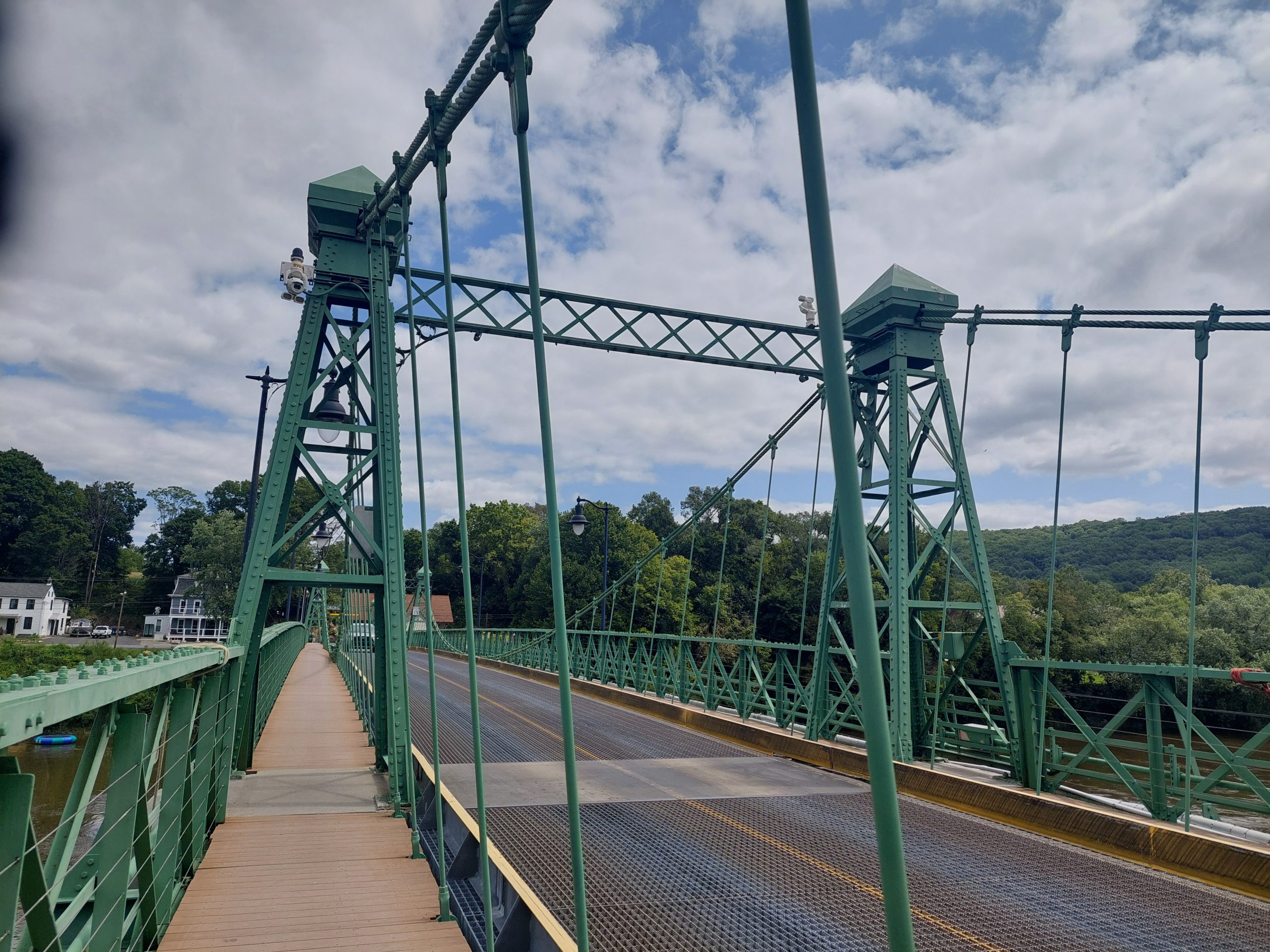
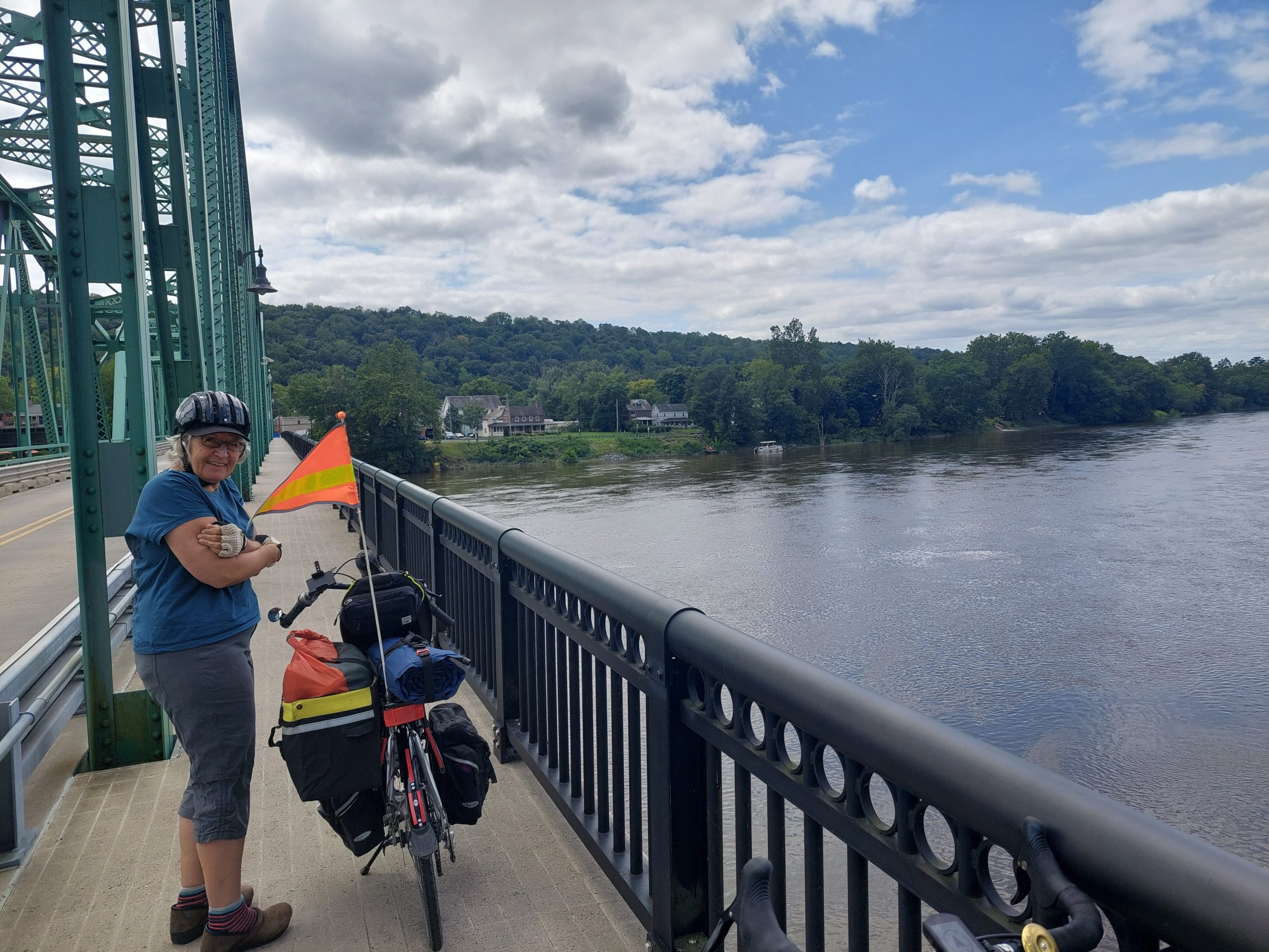
We left Bethlehem, heading cross-country over to Riegelsville, brunched at the Riegelsville Inn (we got there just as it opened), then we continued downriver on the New Jersey side, crossed back into Pennsylvania at Milford, and rode down the towpath to Tinicum Park, our stop for the night.
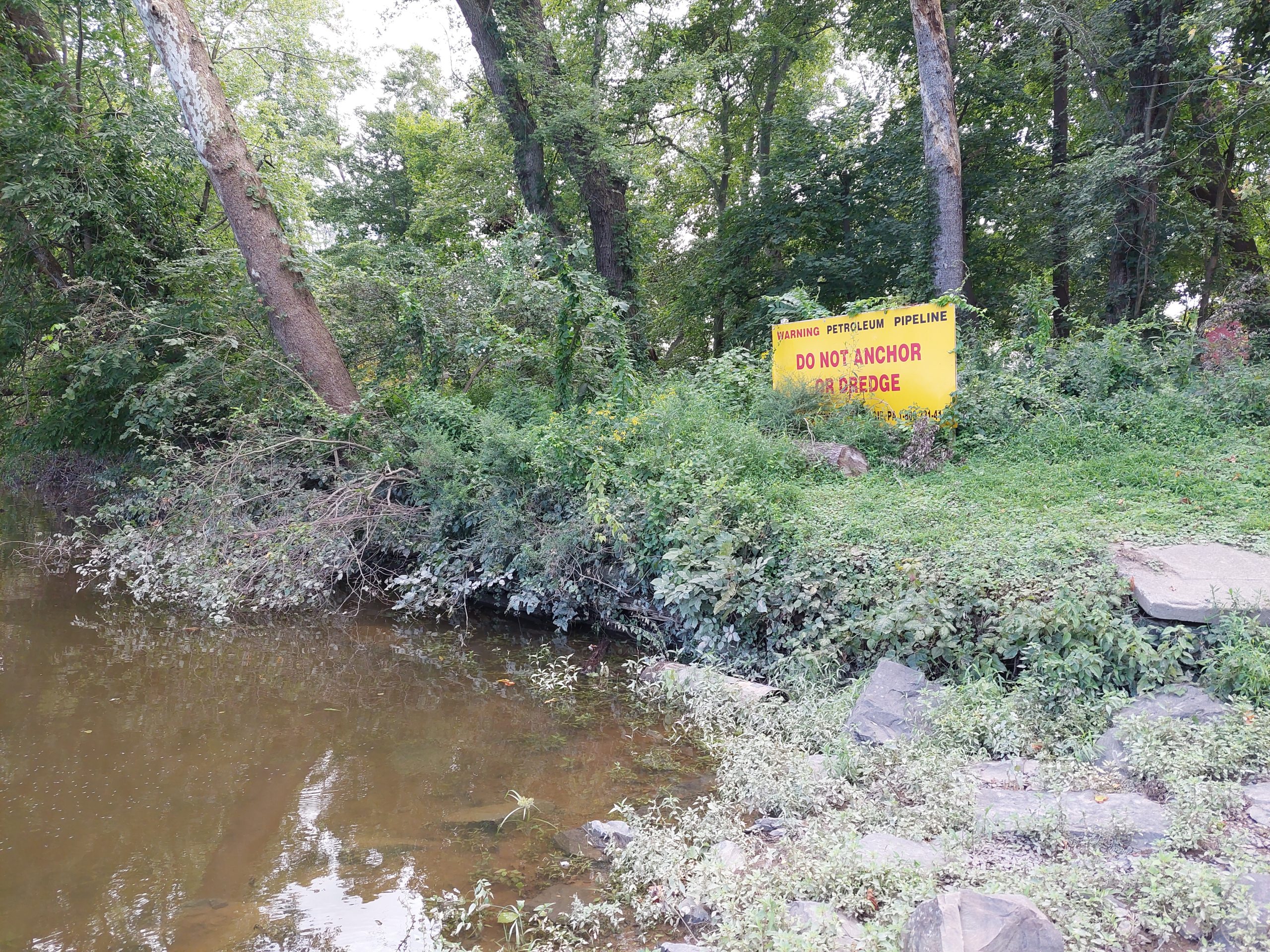
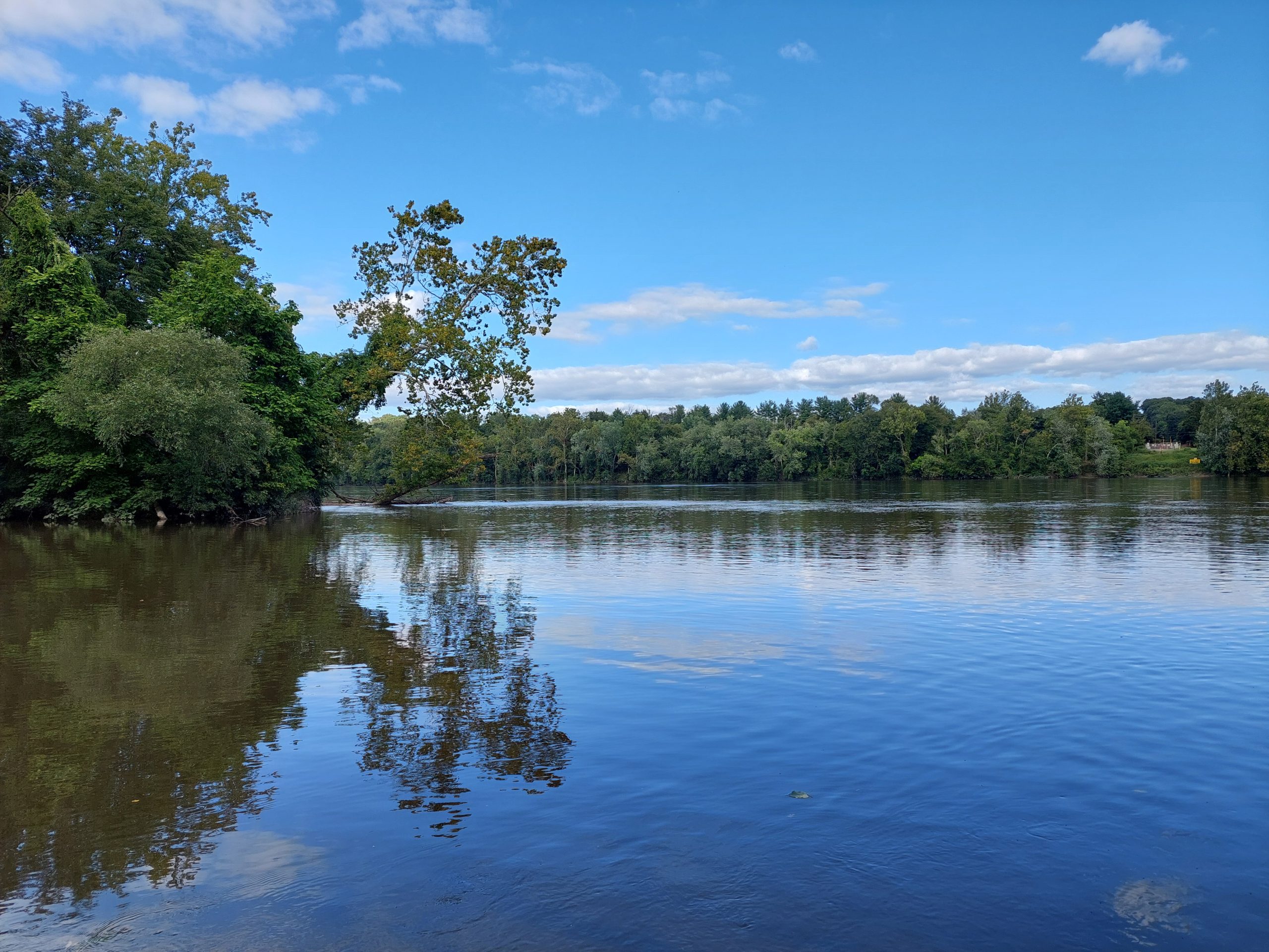
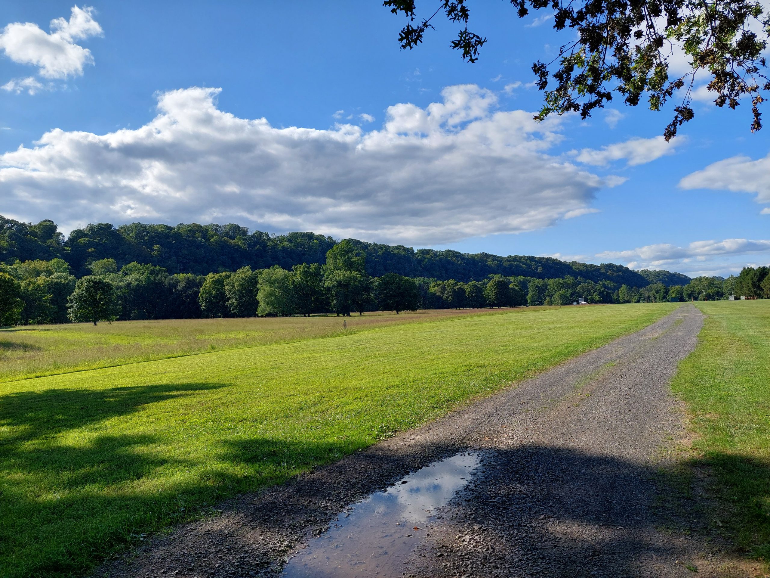
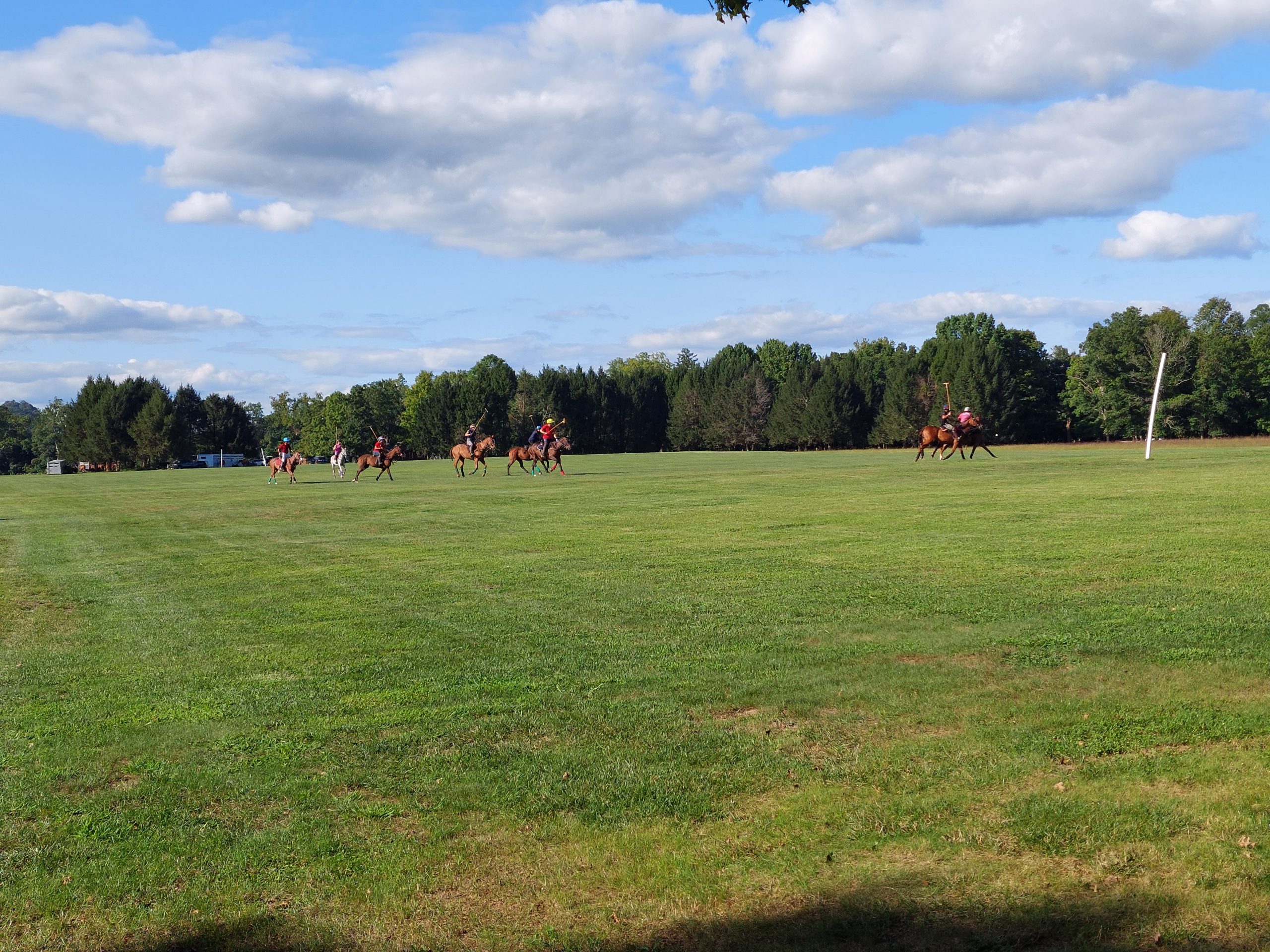
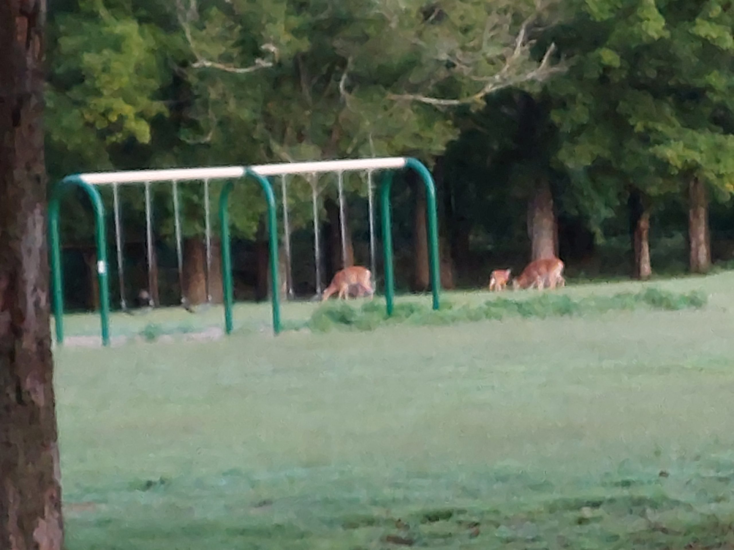
Riegelsville BridgeRiegelsville InnThe Delaware At RiegelsvilleRiegelsville BridgeRiegelsville BridgeAnne On The Milford BridgeDelaware RiverTinicum: Delaware RiverTinicum: Delaware RiverTinicum ParkTinicum: Polo PlayersTinicum: Morning Deer
Tinicum was fairly primitive as far as campgrounds go, but it was very pleasant, and we got to watch some local equestrians play polo for a while before we crashed for the night.
Day Two
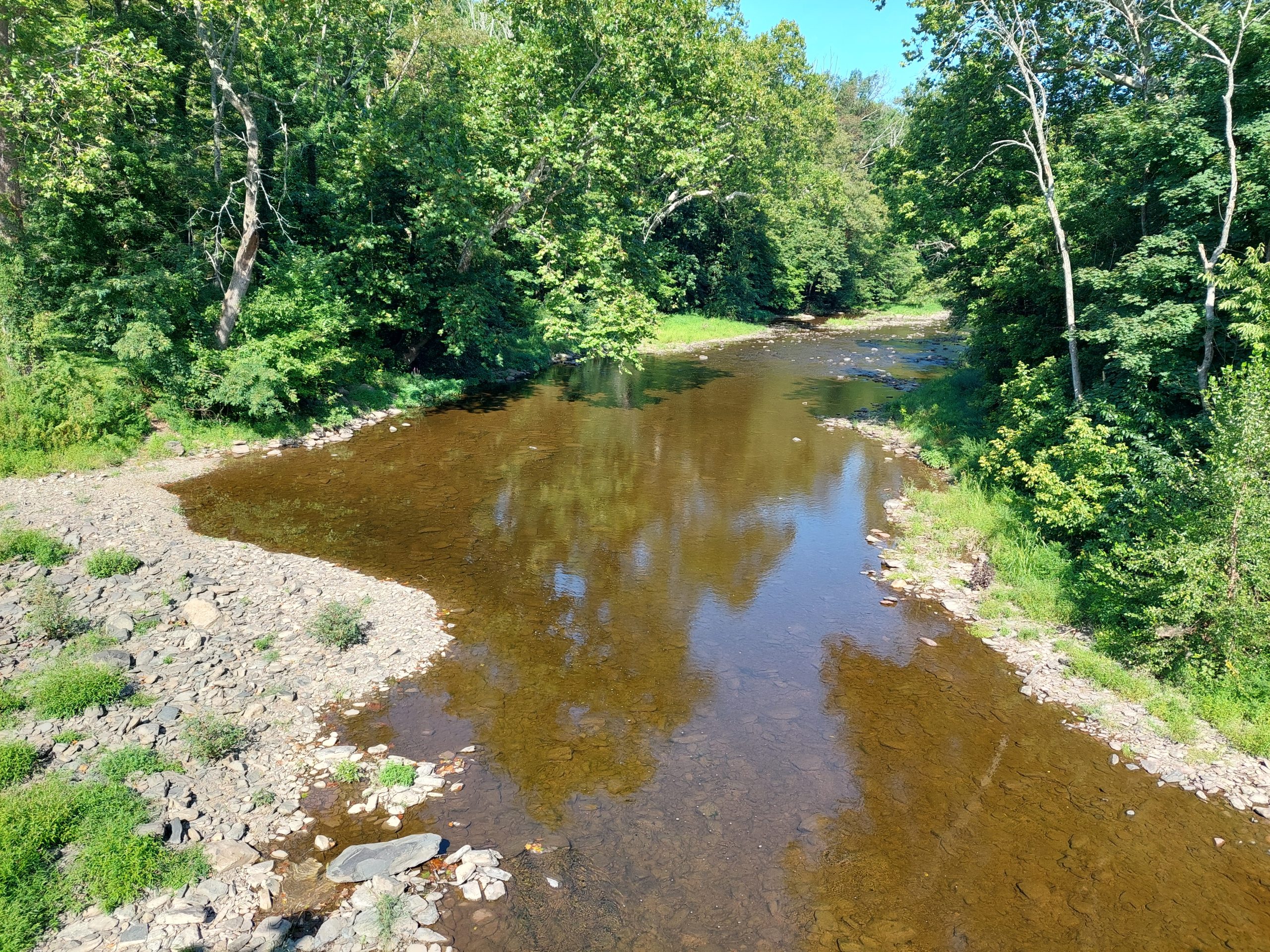
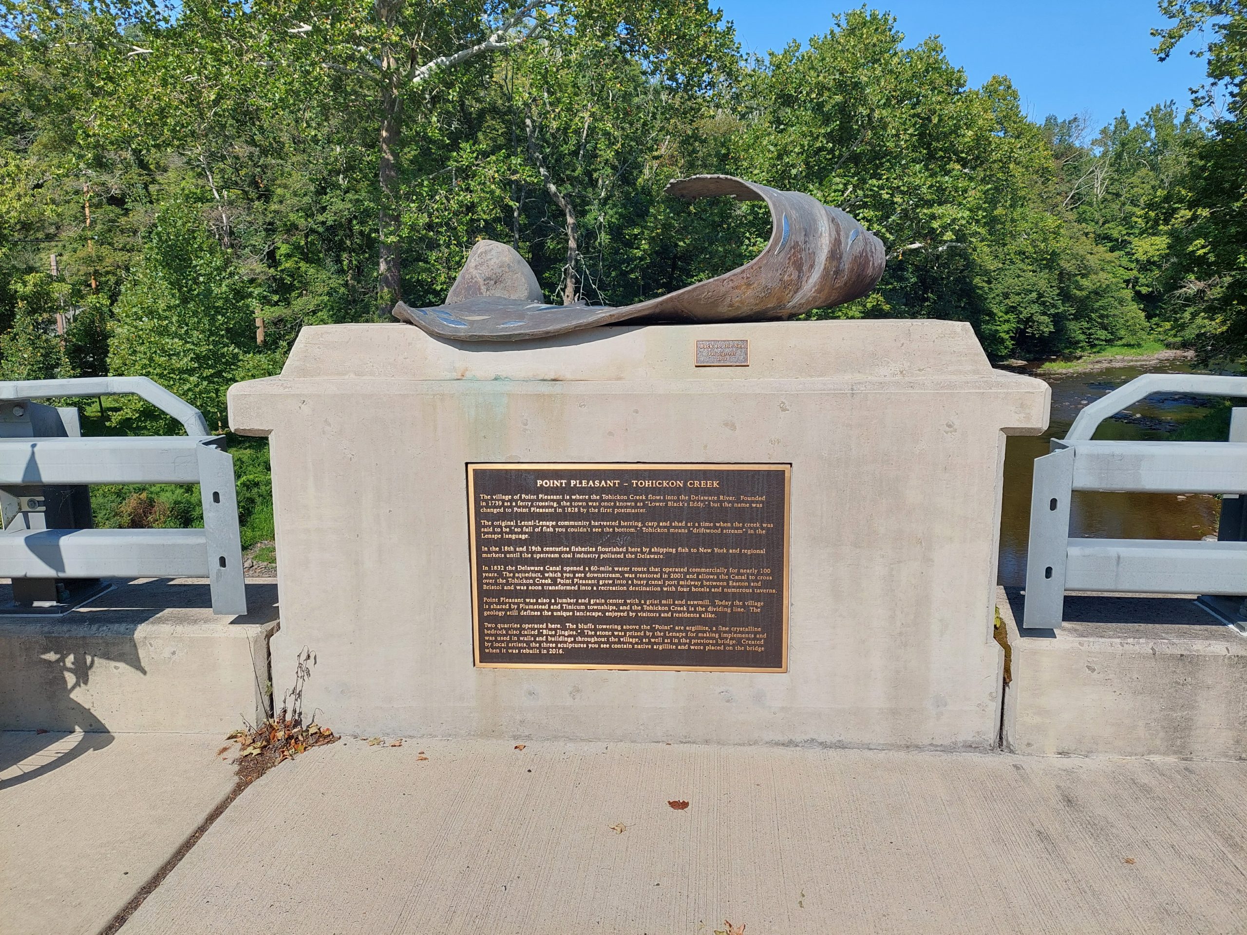
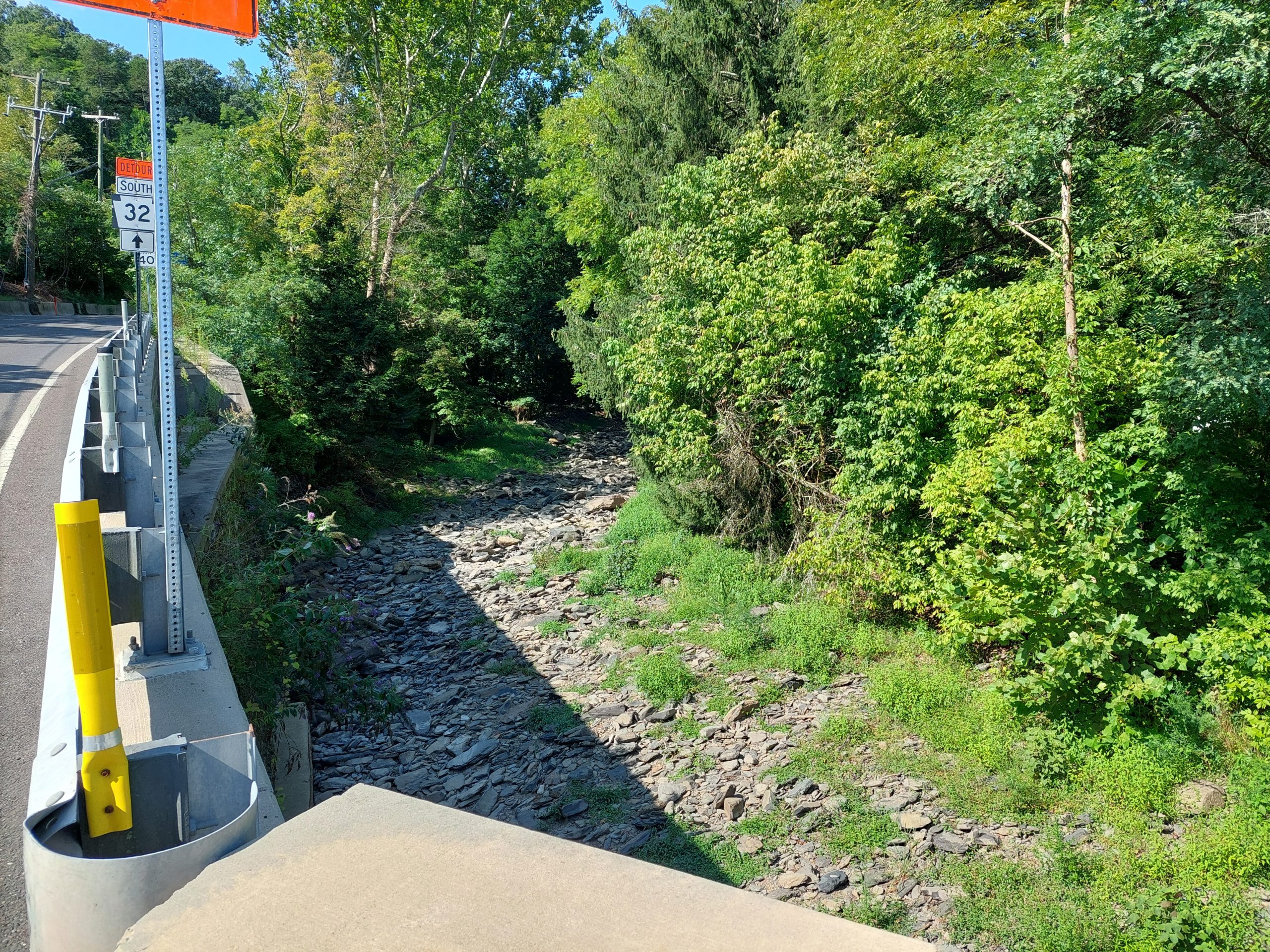
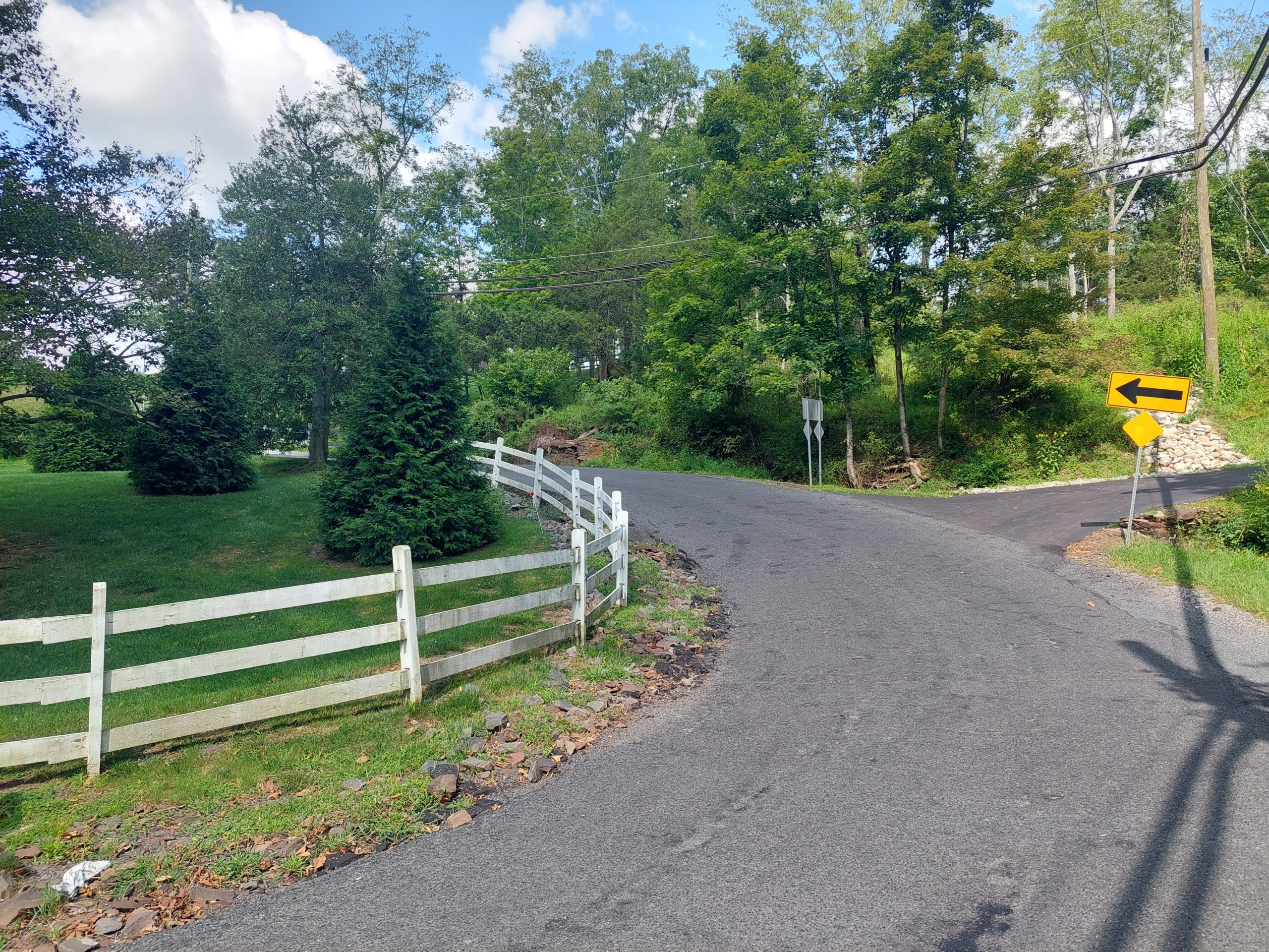
This was another beautiful day. We got up and out early, got breakfast at a diner not far from the campsite (again arriving just as it opened), then rode down the towpath and Rt 32 to Point Pleasant.
Point Pleasant is where Tohicon Creek meets the Delaware, and just above that is where Geddes Run enters Tohicon Creek. This area had a substantial native population once, and the mouth of Geddes Run was once a place where Native Americans worked a local stone called argillite (aka “mudstone,” or “blue jingles” as the local quarries later called it). The actual native quarry site is now on private land, but we could get a view of the general area from the road.
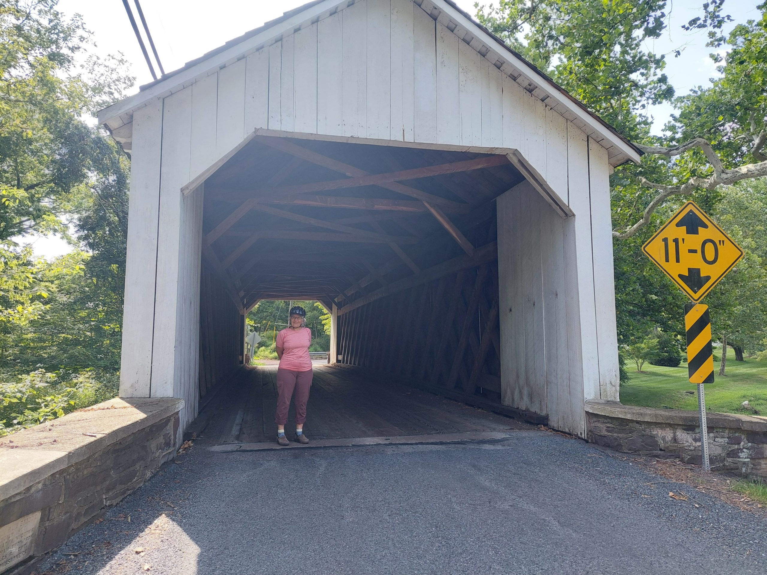
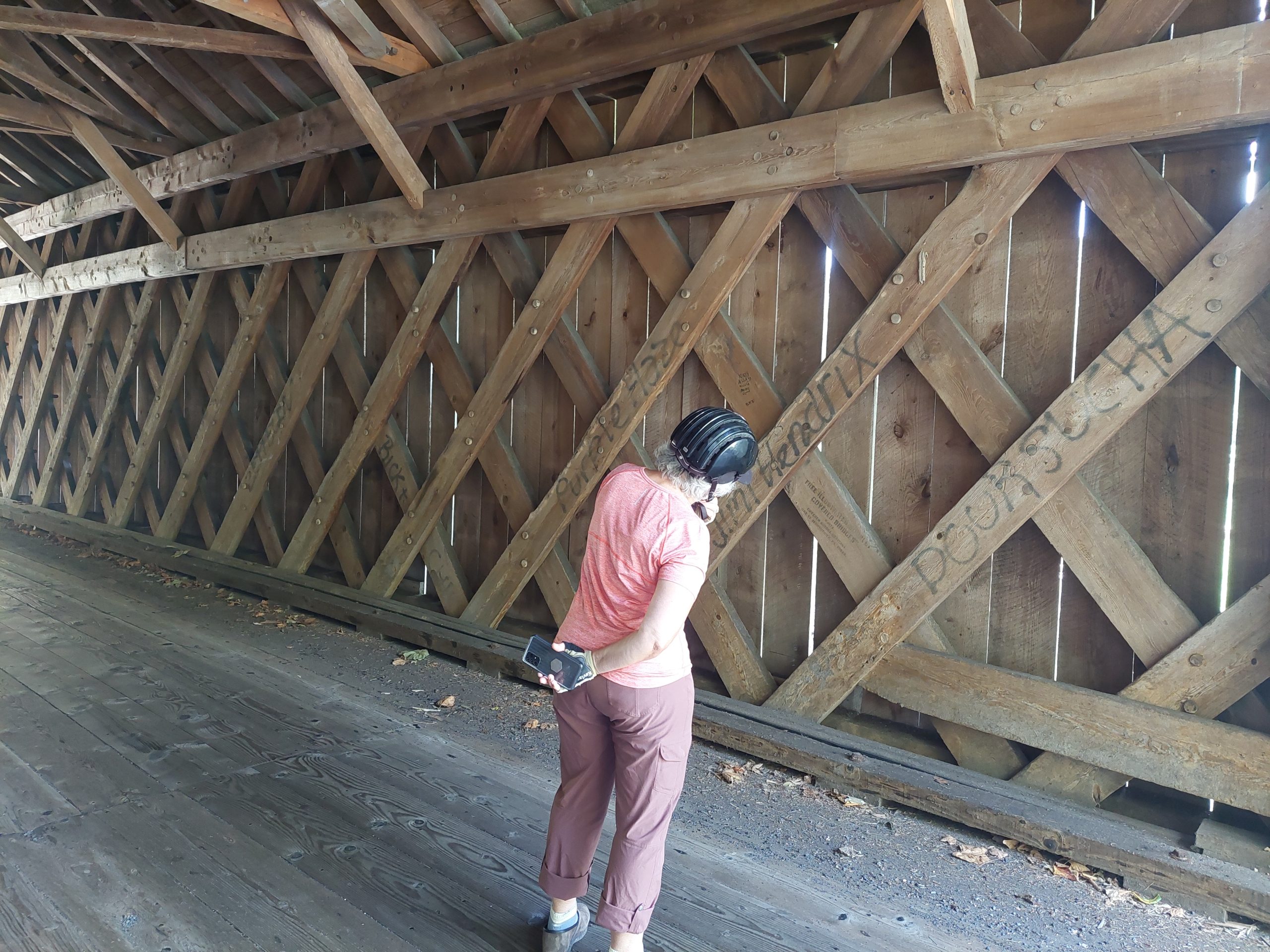
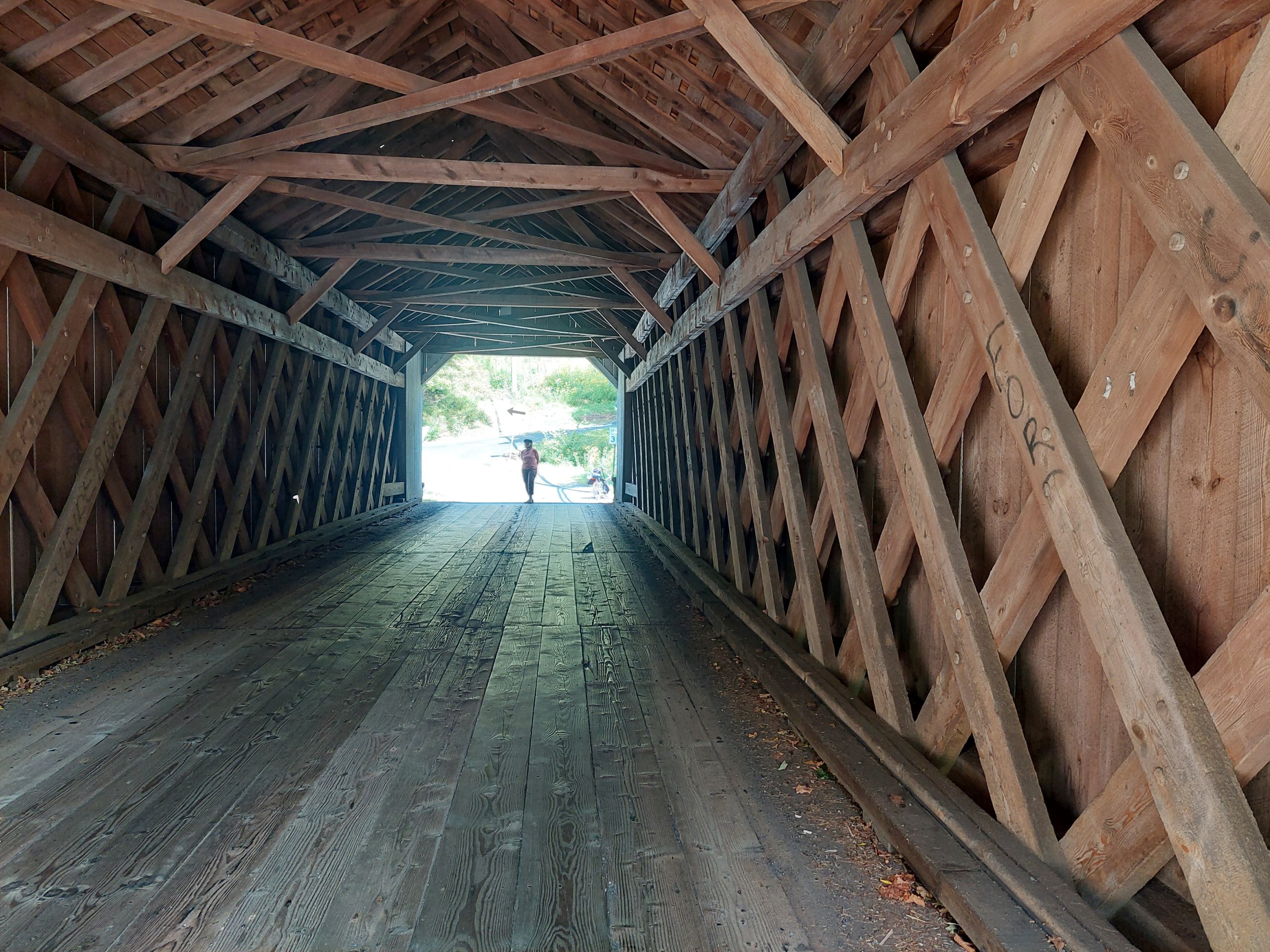
Tohicon CreekTohicon CreekGeddes RunWismer Road At The BridgeAnne At The Covered BridgeAnne In The Covered BridgeIn The Covered Bridge
Our route from there took us west on the Point Pleasant Pike, generally following an old native path to Schwenksville, through scenic little roads, and into more built-up and heavily trafficked areas, until we finally made it to Green Lane Park, our second night’s lodgings.
Day Three
From Green Lane we went north, again following the general outline of a native path — this was the path from the Phoenixville area to the jasper quarries at Vera Cruz. The route was a bit of a surprise; I expected it to be fairly flat (something I’d heard was a hallmark of native paths) but it was actually fairly hilly and rolling.
We got into Vera Cruz, stopped to explore Jasper Park (sorry, no pictures this time), and then we went into Emmaus to get lunch. We came home on our usual route from Emmaus, which was once also a native path. And that was our little holiday!
I sometimes get myself into Native-Path-adjacent GIS enthusiasms (other than my original projects), two of them in particular being the original path of the Walking Purchase, and the Mason-Dixon Line.
There was very little information I could find about the actual path of the Walking Purchase “walk” — certainly no publicly available GIS data, just a few scanned maps here and there, along with many depressing accounts of the whole sordid incident and its aftermath. This shouldn’t be too surprising; it seems that the perpetrators took steps after the fact to obscure what exactly happened. This information is probably not lost to history, but it is probably well buried, and it seems that not many people like to dig for and play with shameful data from the past.
By contrast, the Mason-Dixon Line is pretty well established online, but then the line itself has been a part of state (and colonial) legal boundaries for more than 250 years, and a cultural boundary (and touchstone) for almost as long. It was a large and highly scientific project for its time, and well marked at the time with massive milestones and a great deal of documentation, and it has had multiple restorations over the centuries. In other words: not shameful, but a point of historic pride. It has received a great deal of attention in recent years, as surveyors and others have been documenting the GPS locations of the original (and replacement) milestones. More info from the Mason & Dixon Line Preservation Partnership can be found here.
Anyway, just some things I’ve been thinking about.
We had an earthquake today. Anne and I were watching Iris, and hanging out in the living room when there was a sort of whump! against the house, and a low rumble. Anne thought it was a really crazy wind gust, while I thought it might have been a truck rolling by outside. I started suspecting something else when I looked out the window: no wind, no trucks, and the rumble continued for a few seconds longer…
I looked it up on the USGS site (no mean feat when Iris is around, and really into our electronic gadgets — we usually keep them hidden), and sure enough there was an earthquake, 4.8 on the Richter scale, out near Whitehouse Station NJ. Meanwhile, our phones lit up with messages: neighbors, friends, and Anne’s siblings too, from nearby and from as far away as Connecticut. (Her brother lives near the epicenter, and they had pictures fall off the walls.) We were listening to WXPN out of Philadelphia when it happened, and they played “Whole Lotta Shaking Going On” (and other songs like that), so I guess they felt it down there too.
So that makes five earthquakes I’ve experienced, all on the East coast:
In high school, probably junior year, we had one during school hours. No one knew it at the time, I was in class and I remember glancing at the door — it sounded like one of those wheeled carts they used in school, rolling down the hall just outside.
Not long after high school, my brothers and I were hanging out in the front yard, and there came a weird groaning from the cement porch. I looked at the porch, and I must have looked like I thought I was losing my mind, because my brother said “yeah I heard it too.” It turned out to be another earthquake.
Early Eighties, I was living in Boston and I was awakened in the middle of the night by what I thought was a passing subway (Boston has subways, but I didn’t live anywhere near one). The next day it was all over the newspapers — we’d had an earthquake.
We had one while I was at work maybe twenty years ago, the first of the bunch that was recognizable as an earthquake while it was happening. It was small and pretty close to my office, which was close to the epicenter of today’s.
Anyway, we just finished a pizza dinner with Emmi & Kyle (and Iris). Tomorrow is a ride to the farmer’s market in Easton.
UPDATE: WE had an aftershock about 6:00 last night, but I didn’t notice it. Also, there was another earthquake here, maybe 2010, strong enough to require repairs to the Fahy Bridge (which TBH may have already needed repairs).
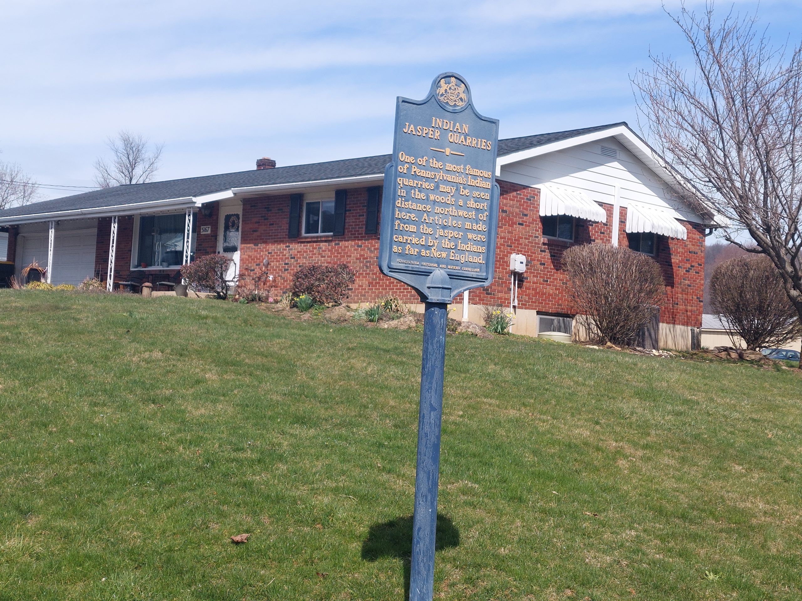
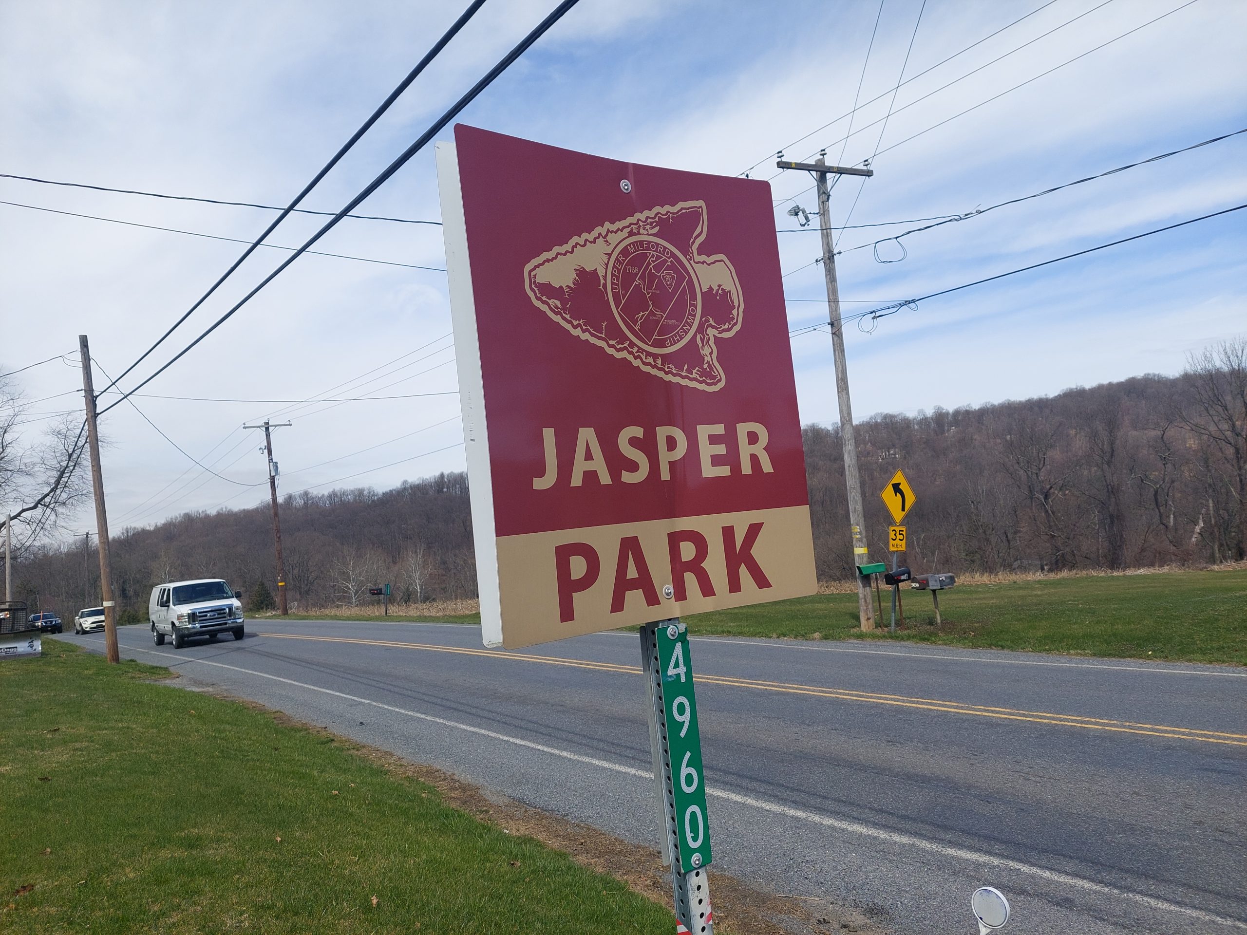
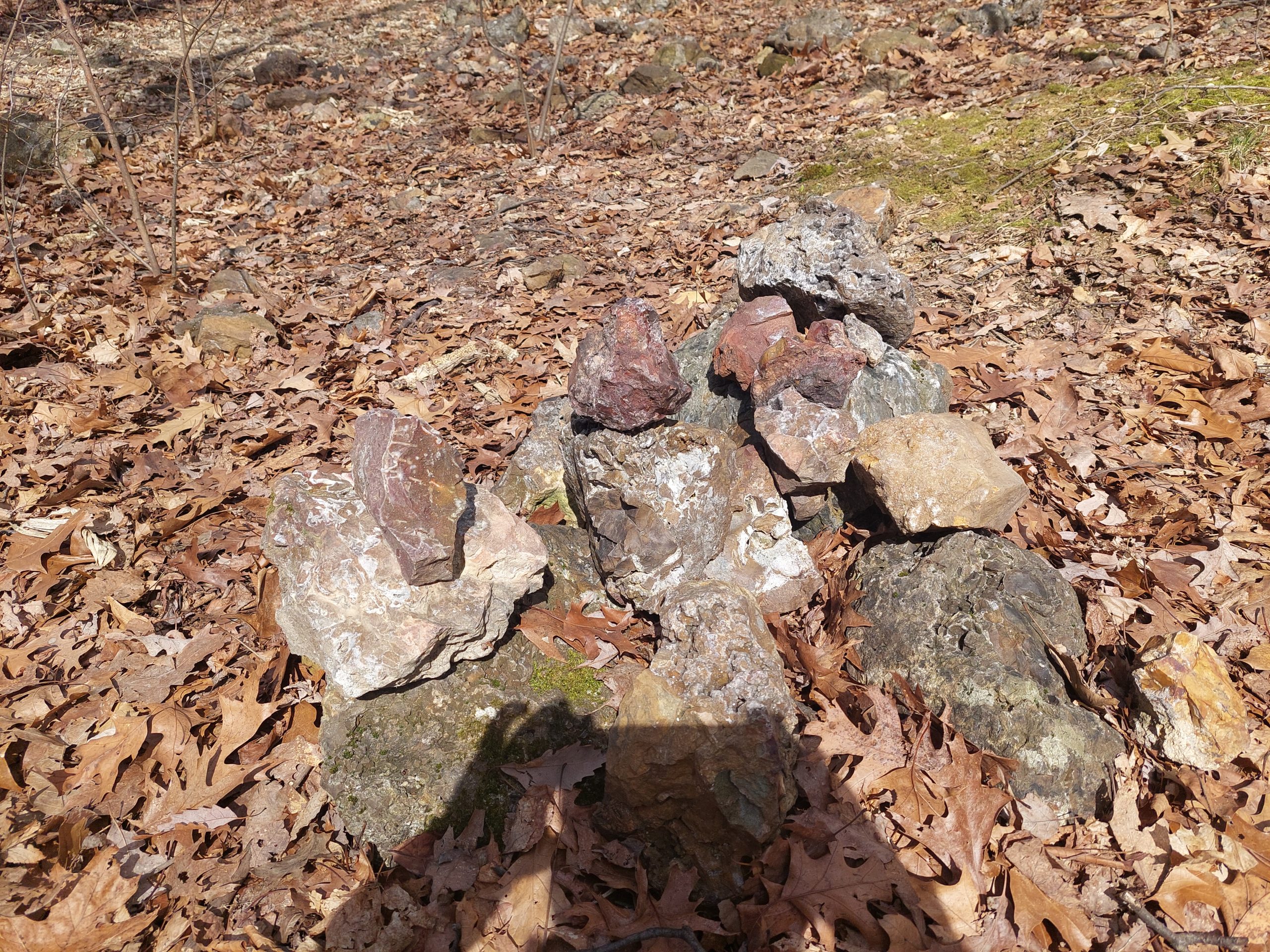
Jasper is a type of stone, sort of like an agglomeration of quartz-like minerals. It’s very pretty when polished and has been used for millennia for ornamentation, and it’s also very good for high quality stone tools like axe heads, arrowheads, and stone knives. There is a seam of jasper going through Lehigh and Berks Counties, and there are small sites all along the seam where natives once dug it up, but the biggest and most important site was an actual jasper quarry just south of Emmaus, at a place now called Jasper Park in Vera Cruz.
This quarry was worked for thousands of years, making it one of the oldest industrial sites in North America, and it really only shut down with the coming of European traders and their more competitive iron wares in the 1600’s. The site was studied by Henry Mercer in the late 1800’s, and was included as the destination for one of the native paths in Wallace’s Indian Paths of Pennsylvania; Wallace also noted that several other paths came together nearby, which was likely how the jasper made its way into the native trade networks — the jasper from here has been found as far away as New England.
As part of my native paths project, I’d put together a bunch of bike rides that more or less follow the old paths, and I have two — one a short ride, and one a multi-day trip — which visit Jasper Park. I have been meaning to go out on the shorter ride for a while now…
The Canal Museum is currently putting together an exhibit about Pennsylvania’s native paths, and just posted something on Facebook about Jasper Park. That, along with the recent nice weather, was enough inspiration to get me off my duff and out on my ride.
I started with some climbing, crossing the Lehigh and cutting across the college campus over South Mountain, then I picked up a few sections of the now-fragmented Old Philadelphia Pike/Old Bethlehem Pike (which name depends on where you are and where you’re heading), which I suspect followed the “Delaware River Path.” From there I headed southwest, skirting the southern flank of South Mountain out to Vera Cruz, and picked up the “Perkiomen-Lehigh Path” which led to Jasper Park, were I stopped to explore on foot.
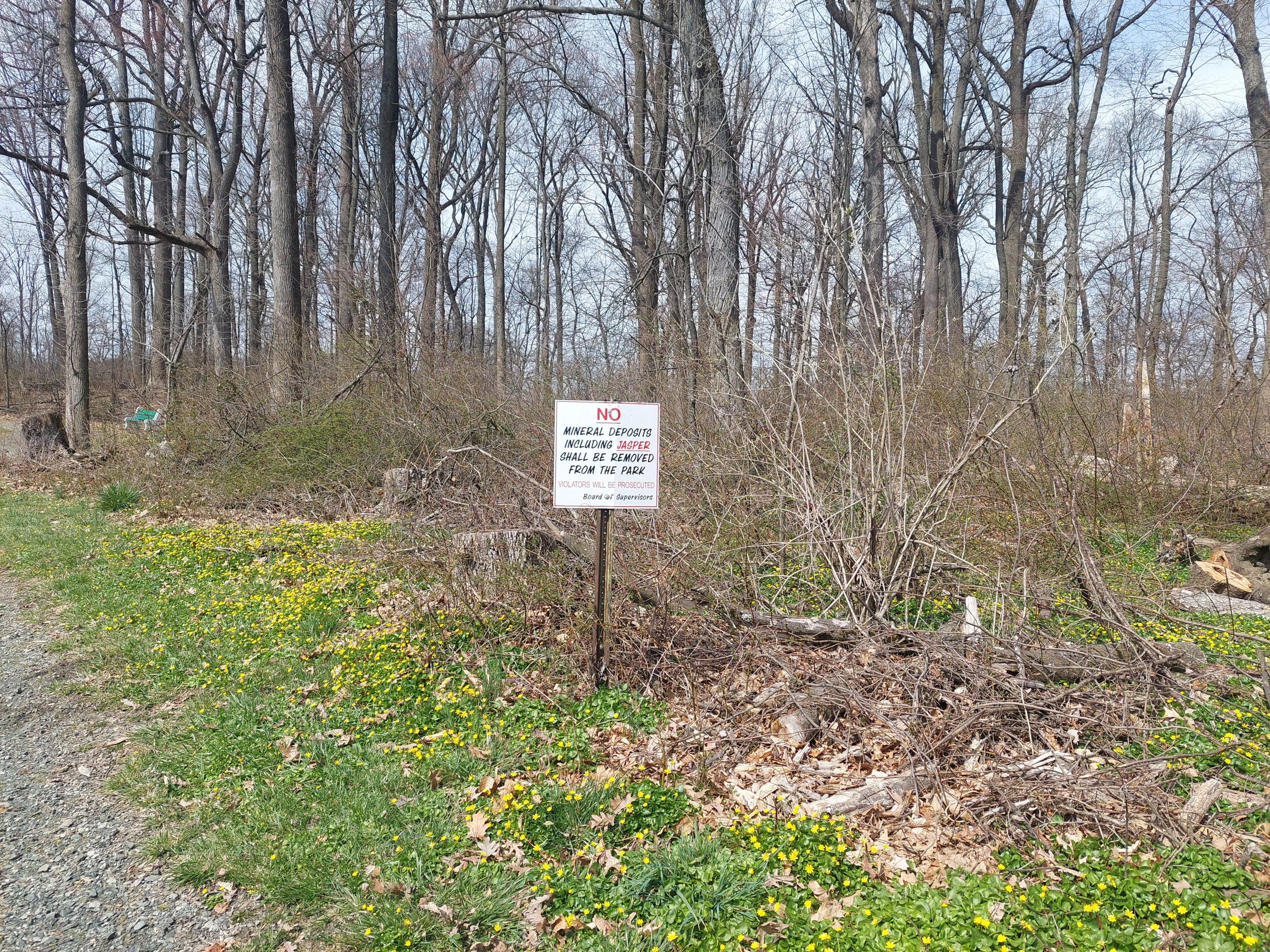
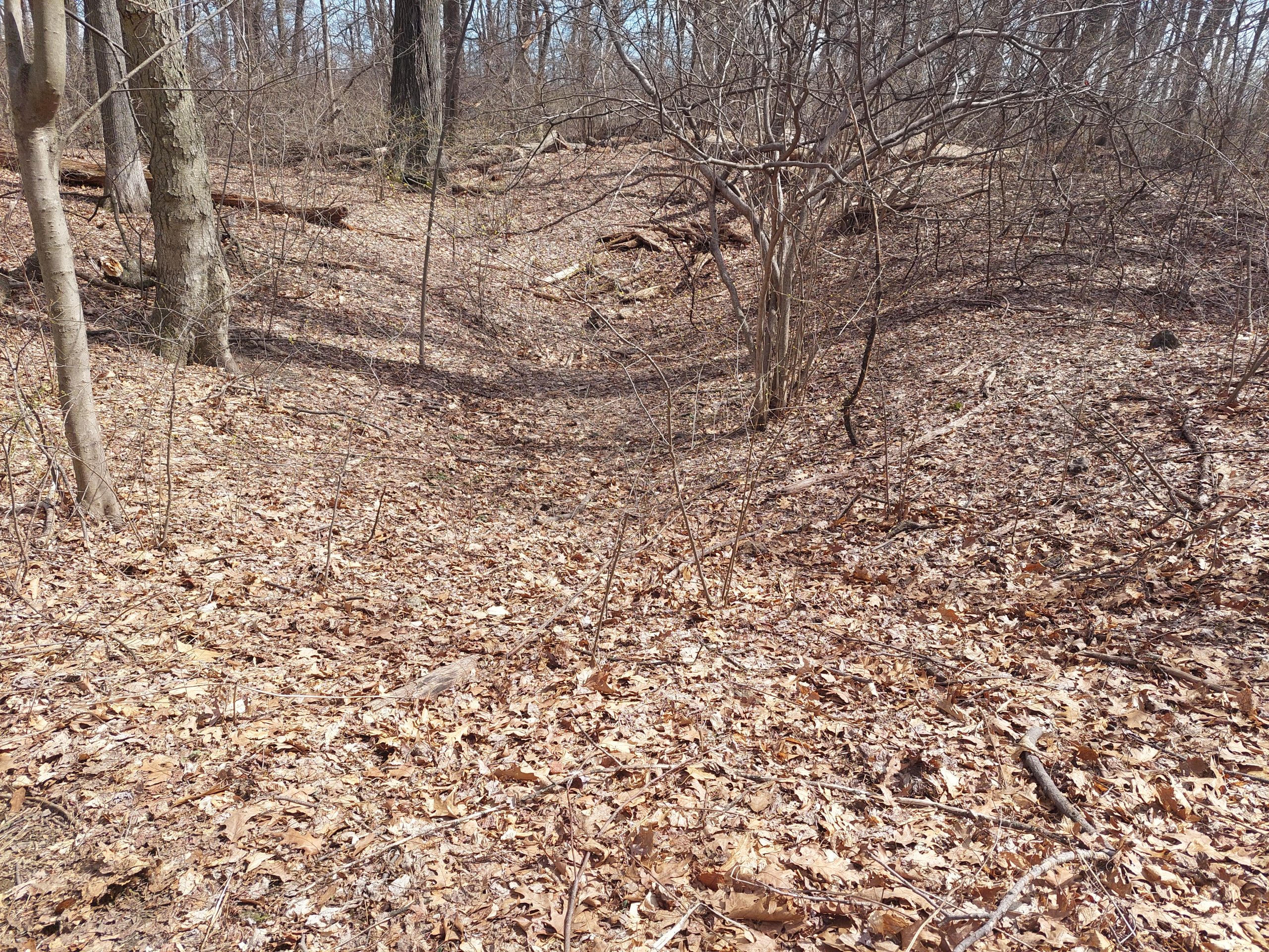
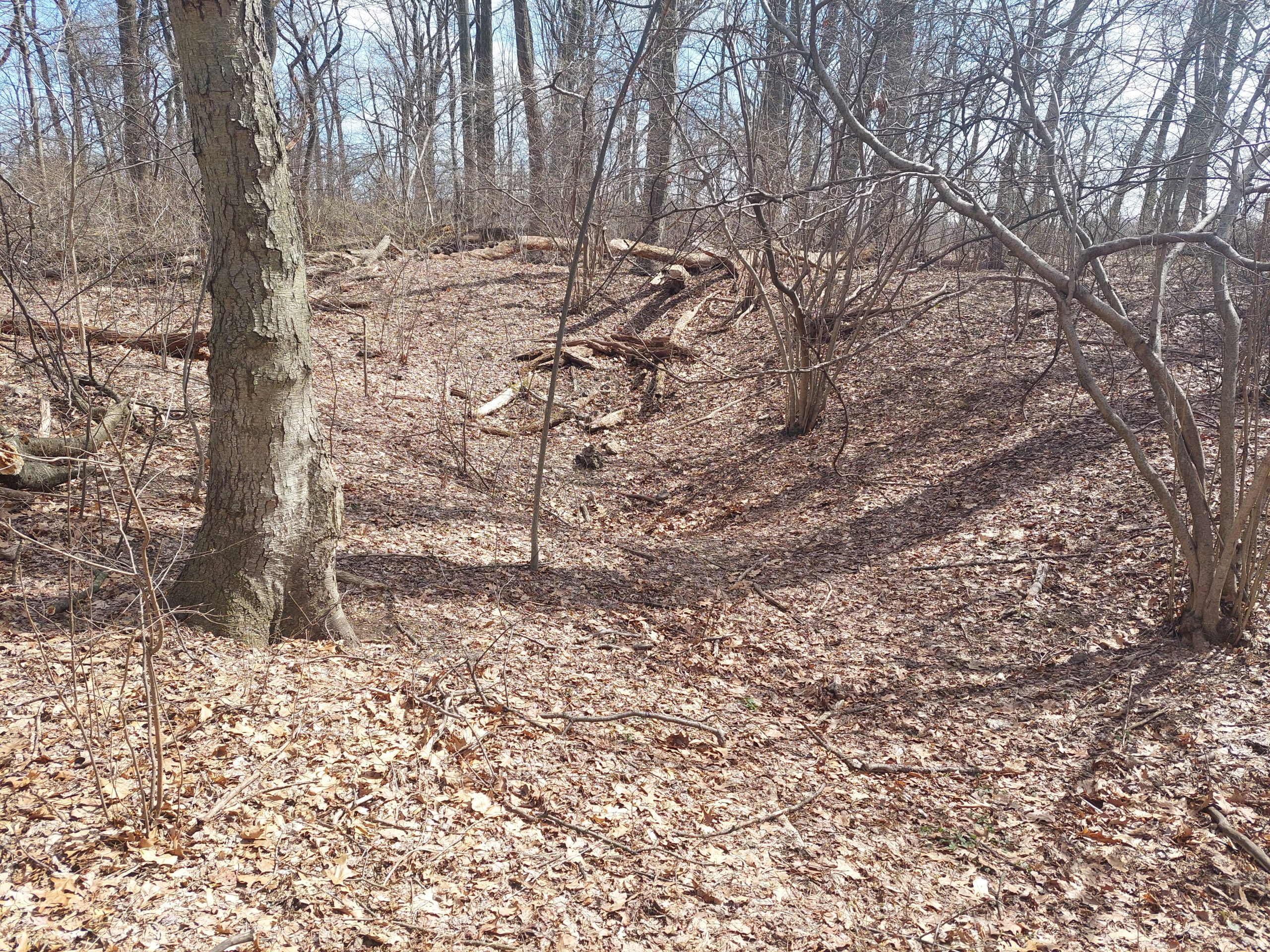
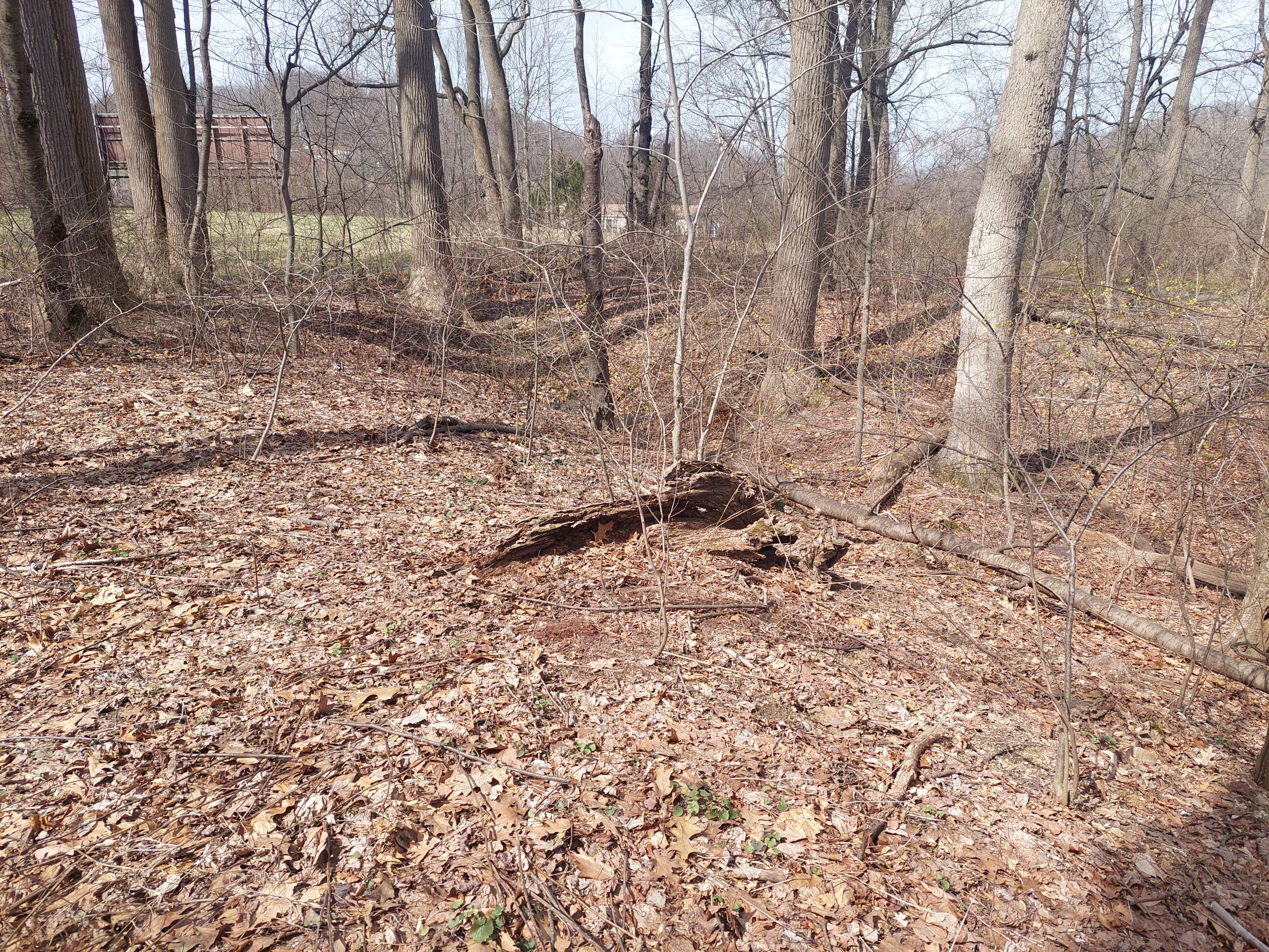
Jasper Park is a Little League baseball field, some pavillions, and a small fitness trail; the quarries are off the fitness trail, in the woods behind the ball field, and tucked up against the Turnpike Northeast Extension right-of-way.
There wasn’t really much to see, no spooky vibes or anything, though it was cool that the ground still showed the indentations after almost 400 years. The top stone in the pile might have been what’s called a “turtleback:” these were once considered a very primitive form of stone tool, but are now thought to be stones that were partially dressed for trade, which would be shaped to their final form (arrowheads etc) by their end users.
After my expedition I got back on the bike and came home via Emmaus. I was essentially following the “Perkiomen-Lehigh Path” to the “Oley Path,” and it was pretty obvious that I was following the native paths more closely on the way home: the route was much flatter, and traffic was heavier — native and modern routes both preferred to avoid the hills.
In the end, the hilly parts were not historical, and the historical parts weren’t hilly…