• The Searchers All Say We Made Whitefish Bay

    We didn’t quite make it to Whitefish Point, but our first night on the Upper Peninsula was spent pretty close to the bay, at a campsite in Tahquamenon Falls State Park, right where the Tahquamenon River enters Lake Superior. It was pretty serendipitous, actually: the campground was supposed to be full, but I took a chance and called, and we got a reservation for one night — in the RV section. (We got a good look at RV camping here and at our next campsite, and it’s a really weird, alien world.)

    Anyway, we made it to our site in the middle of Thursday afternoon, set up camp and took a short walk down to the river mouth and lake shore, and saw a bunch of pileated woodpeckers, all hopping around on the ground eating bugs. The sunset was pretty; we watched from the riverbank as the sky grew dark, then crashed for the night in the hammock. We’d been warned about serious mosquito nastiness, but the bugs were not too bad, and it was also mush warmer than we were expecting, mid-eighties during the day and maybe 70 at night.

    Friday we packed up, then we did a road ride out to the Lower Falls on the river, about 30 miles round trip. This area is so flat that we were doing a good 17 mph  with almost no effort — it was a bit of a surprise  that there could even be waterfalls here, when we actually found ourselves at the falls they were really big (though not tall), and beautiful. It was another hot day and people were swimming;,and some teens were even playing behind the falling water.

    It was mid-afternoon when we got back to the campsite. We showered and changed, and then hit the road for Manistique.


  • Greetings From Ann Arbor!

    Well, we made it! The eight hour (and change) travel time turned out to actually be more like ten-plus, what with construction delays, rest breaks, and breakfast/lunch stops, but the trip was uneventful. We got to our bed-and-breakfast — the Baxter House, which by the way is really awesome: I’ll take photos — around 6:00.

    We didn’t do too much last night — Nicole Atkins was playing in town, but we blew it off and just grabbed dinner and drinks, outdoors at an Irish pub on Main Street; we wandered around afterward, did some people watching, and then we just walked back to our place. We tried to do a bit of reading but were both probably fully asleep by 10:00. It’s actually much warmer here than we expected, and a lot like home: highs in the upper eighties, lows around 70, though not nearly as much rain (or flooding). We brought tons of warm clothes, which will probably come into play once we’re sleeping outdoors in the Upper Peninsula.

    Today is our only full day in town. We’ll be meeting Ben’s old friend Jason, who’s getting his PhD here, so he can show us around a bit. There are many cool bookstores and coffee shops, and I have a list of great brew pubs to check out, but I have a feeling we’re only going to scratch the surface of what’s on offer here.


  • Just A Test

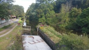
    This is a shot of VolksPlatz and other Musikfest shenanegans, from the Broad Street bridge over the Monocacy and colonial industrial quarter. I took it on our way home the other day, and I’m posting it here as a test, to see about blogging from my phone.


  • The Party’s Over!

    Musikfest 2018 has now come and gone. I’d guess that between the heat and the rain (and flooding), this one’s going to be a bit of a disappointment when they finally tally up the money and attendance — we certainly didn’t go as much, and when we did we noticed the crowds were kind of small.

    For our part, we were a bit spoiled by the early evening concert series at the Moravian church & chapel, and also the new beer garden at the Sun Inn: we saw two shows a night, Tuesday through Friday, and did not even go down once to the main VolksPlatz/FestPlatz areas. Nor, for the umpteenth year, did we get anything to eat or drink from any vendors. We pay for our Musikfest experience by putting up with it in our neighborhood…


  • Goddard and Montpelier

    Here are some photos from Ben’s graduation, which was the last part of our vacation trip. I don’t have much to say except that we had a really nice time with Ben and his girlfriend, Goddard College (and nearby Montpelier) were awesome places, and the commencement ceremony itself was very moving. Anyway, here are the photos:


  • To The Bat Cave!

    Posted on by Don

    I did an exploratory ride today with my friend Renee E, at Wildcat Ridge Wildlife Management Area (basically Splitrock, near Rockaway NJ). Neither of us had ever been there before, but Renee had heard good things from some friends, so off we went…


    It was a great place: a whole lot of technical riding (some of it above my pay grade, leaving me walking the tougher sections), along with some really sweet singletrack. One highlight was going up a trail to what was called “the bat cave,” an old mine with some seriously cold air coming out of it. This was early in the ride and we were still both pretty spry, so we took a few selfies before moving on.

    Renee had a bit of an itinerary, some trails she’d heard we should ride, and even though we didn’t really have a grip on where we were much of the time we managed to hit most of them. Later, after my GPS died, and her phone (with trail maps) died, and we started getting lost and eaten by bugs, we’d had enough — we found our way through a nearby suburban development to the road back to our parking lot. We were out about six hours, maybe four of them riding. What an awesome day!


  • Odds & Ends

    Posted on by Don

    I have a bunch more photos to put up about the final leg of our vacation (Ben’s graduation), but before I get to that I have a few other items, and a few other vacation photos, I want to post that really don’t go anywhere else.

    Vacation Miscellany

    Just a few photos of things around the cabin. Our place apparently was a camp once, having multiple primitive cabins, etc, and had been refurbished — and had the main house added — after years of downward fashionableness and possible abandonment; three cabins were still standing, one converted into a sort of detached den or game room, and the other two converted into separate sleeping quarters. Behind the cabins, as things were now arranged, was a small pond with a dam at one end. I’m not sure how important the pond had been in the past — it had the look of a kiddie fishing area — but now it was brown and scummy, and working its way back to being a meadow. (The lake was a lot better, but the muck at the bottom made for unpleasant swimming. Only Alex and I tried, and we only tried once.)  There were other camp amenities, including a fire pit which we made use of on the chilly nights.

    Shapes and Clusters

    The clustering experiments were a success, but what I really want is to show the regions or neighborhoods where my cycling amenities are clustered. I’ve been trying several different ways to build a shape around a group of points:

    • Convex Hull: this one is pretty nice, it’s the shape you’d get if a rubber band were stretched around the points. It’s also built into both QGIS and PostGIS. Unfortunately, if the point cluster has concavities the convex hull won’t show them — an L-shaped cluster would get a triangular region.
    • Concave Hull: this one is also available in both QGIS and PostGIS, but I don’t trust it — I can’t find too much about how it really works, its very name doesn’t make all that much sense, and it requires parameters that are not as well documented as I’d like.
    • Alpha Shape: the most promising of the bunch, defined pretty rigorously in “the literature,” and I like the l looks of the shapes it makes. Unfortunately, it doesn’t exist in either QGIS or PostGIS; it is available as a package in R, so I’ve spent some time this week getting R to run correctly after much neglect, then installing the “alphahull” package and trying it out. I managed to import my data and  create alpha shapes; now I have to find how to convert and export the shapes back into my database.

    There is one other method I just thought of, and pretty simple compared to these approaches: I could just make a heat map from the clustered amenities, then use a “contour line” function on the heat map raster. If the others don’t give satisfaction I may try this.

    Around Here

    Today was a brief respite from days of heavy, almost continuous rain — more is coming, starting tomorrow. I took the opportunity to attack the jungle that once was our back yard, managed to use up all the weed-whacker twine, and ran over a yellow jacket’s nest (no stings, but a fairly hasty retreat into the house for a while), and the yard looks much better if not quite 100% yet.

    We’ve also had a Warm Showers guest: a young Brit named Arron who landed in New York and is cycling across the US. He’s early in his ride, not quite acclimated to cycling, and he’s getting a real baptism by fire, or at least by rain and hills and poor road choice, but he was a trooper. He stayed for two nights before heading for Coopersburg.


  • Kayak Day

    Posted on by Don

    Anne and I took the canoe out for a short paddle the first day we arrived, but later in the week we went out on the lake “for real,” in kayaks with Laura also in a kayak, and Joe & Alex in the canoe. We had a good time exploring the pond and the lake, but I really don’t have much to say about it so here are a bunch of pictures.


  • A Sojourn* Into Clustering

    Posted on by Don

    I was looking at the towpath amenities project in the week before we went on vacation, mainly to play with database reporting software, and I noticed that my amenities all were pretty closely grouped together. This stands to reason, since the data is a ready-made cluster — it’s composed of amenities within a kilometer of Sand Island, so the clustering may just be an artifact of that search criterium — but also because the data set encompasses the compact  Main Street restaurant district. Continuing on with my reporting experiments, I looked at all amenities within a mile of Sand Island, and now found myself looking at two distinct groups of amenities, the one around Main Street, and another on the south side of the Lehigh. This also stands to reason — Chamber-of-Commerce types like to joke that we’re the city with two downtowns — but again I wondered if it was some artifact of the analysis, or even if I was seeing patterns that didn’t really exist, and that got me thinking of what I actually thought I meant by “cluster.”

    Turns out, it’s a fairly big subject, with different ways of describing what “cluster” might mean — usually (and intuitively), it’s a subset of similar items within a larger data set, but then what does “similar” mean, and how similar do the members of a cluster have to be, especially compared to the rest of the set? For each way of understanding what a cluster is, there are various ways of finding the clusters within a data set. This whole subject is apparently a big deal, a subject of ongoing research, and an important tool in the fields of machine learning and big data.

    My problem was spatial, so for me “similar” meant “close together in terms of location.” Some Googling found that there were plenty of GIS solutions to clustering problems, and in fact PostGIS contains several functions implementing the more common and important clustering algorithms, including DBSCAN, the algorithm that comes closest to what I think “clustering” should mean for my situation.

    And here is where things became complicated…

    The clustering functions are not available in the version of PostGIS that I had installed. So I decided to upgrade PostGIS, did a bit of research and found many articles with titles like “How to Brick Your Database By Updating PostGIS.” The process itself is not difficult, it uses old-school “make” rather than a package manager, and the pitfalls are easily avoided, but now I was scared and I thought I’d better back up my whole database system before continuing. What this meant though, was that first I had to make room on my hard drive, which has one (small, overcrowded) main partition and a (large, empty) secondary area. First thing would be to back up the secondary partition to the NAS drive — something I’ve been remiss on ever since I installed Mint — then I’d move both my music (35 GB) and my photos (12 GB) over to the secondary drive, and then update the music and photo software so it knew where all the files went — it was starting to sound like that song about the hole in the bucket…

    I got through the first part, backing up the drive (which took hours), before we went on vacation. There was no Internet at our cabin, and I didn’t bring my computer anyway, so the rest had to await my return. The remainder of the hard drive cleanup (music and photos) also took some time but went smoothly enough, and I did a full backup of my databases.

    From here the process was a bit anticlimactic: I downloaded the new version, ran make and typed a few things into the database, and I was done without bricking a damn thing. I needed to lay on my fainting couch and rest for a day after that, but when I finally got around to using the new functions they were a breeze.

    I found some clusters and drew polygons around them — the subjects of another post —  but I have more to do to figure out what these things are actually telling me.

    *Hat tip to Achewood, still my favorite Internet thing ever.


  • Adirondacks: Two Rides

    Posted on by Don

    We brought four bikes on vacation: my road bike, my mountain bike, Anne’s road bike, and Anne’s mountain bike in case Holly wanted to go for a ride. Anne and I did a road ride together, and I also got in a mountain bike ride.

    On the Road

    The Adirondacks have some pretty big hills, but there is also a lot of flat ground — there are a lot of lakes and swamps and slow meandering rivers — and the roads, the paved main roads at least, mostly traverse the flatter areas. We found a really nice loop that was paved the whole way, had very few cars, and (for the most part) had the most gentle of rolling grades. Some areas were pretty remote — on one road, for a few hot seconds, we even had a bear running along with us, just a few yards away in the woods — and all of it was really scenic, with rivers, and waterfalls, and vistas everywhere you looked.


    In the Woods

    This area is a bit of a singletrack desert, which may just mean that no one posts their rides online, but there are a lot of dirt roads and ATV trails, and I found what looked like a promising area a little south, near where we hiked. I drove down to a place called Mountain Pond Road, parked at an “equestrian/snowmobile staging area” (aka “dirt parking lot in the woods”), and rode towards something called Slush Pond Road, another dirt road across the main street from Mountain Pond Road, which seemed like my most likely chance to find a trail.


    So far so good, but about a mile into the woods I ran into a roadblock: two Park Rangers standing in front of their vehicle told me that there was a search  going on and I had to turn around. Search and Rescue? Manhunt? I didn’t ask, but we’d been seeing Park Ranger vehicles and rescue teams on the roads, and saw a few “missing person” flyers here and there… I looked it up when I got back to our cabin: a sad situation, and I was basically trying to ride into Ground Zero for the search.

    The Rangers told me the Mountain Pond side was OK, so I went back over there and eventually found some really pleasant, though not particularly challenging, singletrack leading to an equestrian campsite, and I took a bunch of photos of this side.